


Temperatures are soaring and will peak early next week. Highs near 100° are expected in some valley locations by Monday. On Tuesday, there is a decent chance we will break the high temperature record of 97° Fahrenheit, which was set back in 1949.
RELATED: State of the Stream: Boise River flowing fast, frigid at 1,220 cfs
In the central mountains, temperatures will be warm, and water sports will be popular for those seeking a reprieve from the hot sun! Our next threat of storms will follow a cooldown into the 80s for the valley on Wednesday.
Tonight
Mostly clear, with a low around 62. Light wind.
Sunday
Sunny and hotter, with a high near 95. Light wind.
Monday
Sunny and continued hot, with a high near 97. Light wind.

Tuesday
Mostly sunny and continued hot, with a high near 98.
Wednesday
A slight chance of showers, then a chance of showers and thunderstorms after noon. Mostly sunny, with a high near 89. Chance of precipitation is 30%
Thursday
Sunny, with a high near 89.
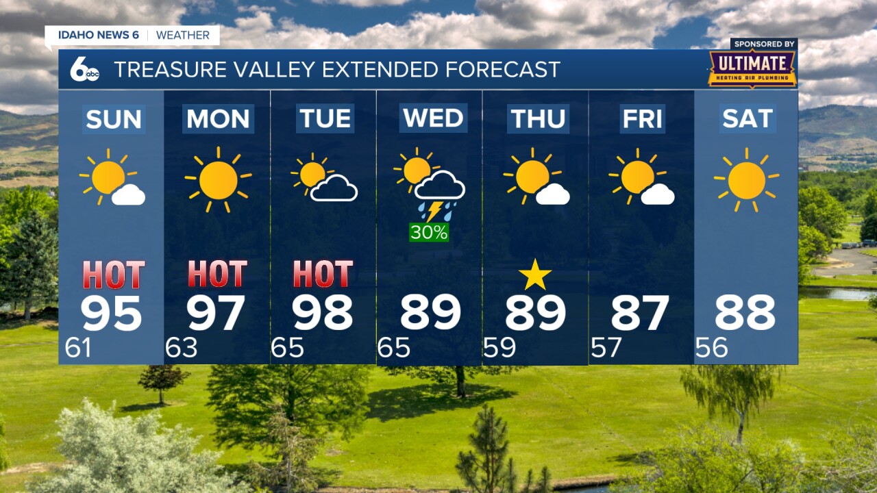
Friday
Sunny, with a high near 87.
Friday Night
Mostly clear, with a low around 56.
Saturday
Sunny, with a high near 88.
Stay connected right here for updates to my extended forecast all the way through next weekend!