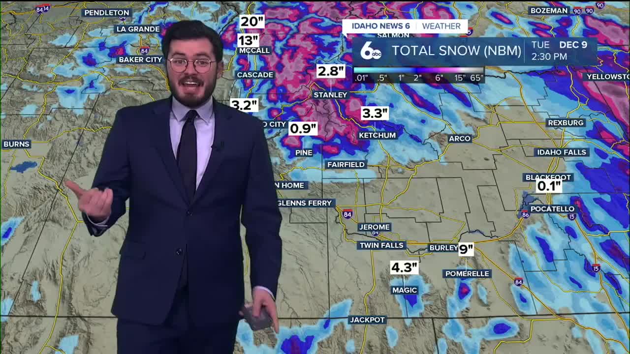


The rain continues today in the Treasure Valley, and snow continues to fall in the mountains. However, the weekend could bring a change after all of the wet weather we've experienced lately.
Heading into Friday night, Idaho will see a second wave of showers move into the Treasure Valley. More snow is forecast for the mountains as well.
RELATED | McCall's Brundage Mountain Resort announces sneak peek weekend
That means Winter Weather Advisories lasting until tomorrow morning for the mountainous areas of central Idaho. Please be safe if you plan on travelling through the mountainous regions north of Boise on Friday and Saturday.
Conditions start to turn going into the weekend with lesser chances of showers passing through. That lull appears will likely be short-lived as the Treasure Valley is set to see additional precipitation going into the work week.
The Magic Valley should stay a bit drier, and the lower elevations throughout Idaho are expected to see warmer temperatures, with some areas reaching the mid-50s by Wednesday.
Stay dry and warm out there as the wet weather rolls on!
WINTER WEATHER ADVISORY [NWS]
...WINTER WEATHER ADVISORY REMAINS IN EFFECT UNTIL 11 PM MST THIS EVENING...
* WHAT...Snow accumulations up to 2 inches in mountain valleys before mixing with or changing to rain this afternoon. An additional 4 to 8 inches in the mountains above 6000 feet, including high elevation passes. Wind gusts of 30 to 40 mph develop later this evening over the mountains.
* WHERE...Boise Mountains and West Central Mountains.
* WHEN...Until 11 PM MST this evening.
* IMPACTS...Travel could be difficult, especially over higher elevation passes. Locally heavy snowfall will limit visibility.