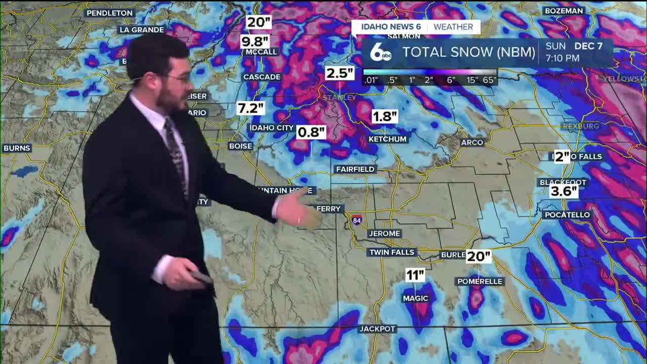


We close out the work week with wetter weather moving into Idaho with showers forecasted for the valley floors and snow blanketing the higher elevations.
This evening, a system of wet weather will arrive in an initial wave, followed by additional precipitation on Friday.
Starting at 5 P.M. MST on Thursday, multiple counties north of Boise will be under a Winter weather advisory. That advisory should last until 11 P.M. Friday.
The weekend is set to bring diminished chances of rain through southern Idaho. Further north, those chances increase, especially on Saturday. Temperatures should also climb a bit from the 40s over the next few days to the 50s at the start of next work week.
RELATED | Bogus Basin plans to open Coach Chairlift and all conveyor lifts this weekend
Stay dry out there as rain and snow continue over the next few days.
WINTER WEATHER ADVISORY [NWS]
...WINTER WEATHER ADVISORY IN EFFECT UNTIL 5 AM MST SATURDAY...
* WHAT... Snow expected. Total snow accumulations between 2 and 6 inches with higher snow totals expected at and above pass level with 7 to 10 inches of snow for Galena Summit. Very gusty winds developing late Friday into Friday night.
* WHERE... Sawtooth/Stanley Basin and Sun Valley Region.
* WHEN... Until 5 AM MST Saturday.
* IMPACTS... Plan on slippery road conditions. The hazardous conditions could impact the Thursday evening and Friday commutes.