


A ridge of high pressure will deliver a hot and dry Memorial Day weekend with temperatures 10 to 15 degrees above normal, before a cold front arrives Monday evening, bringing gusty winds, elevated fire weather conditions, and a significant cooldown.
Heating up into the holiday weekend but wind will arrive Monday afternoon
Temperatures will warm about 5 degrees on Friday, followed by another 5 to 10 degrees of warming on Saturday as the ridge moves overhead. This will place lower elevations in the mid to upper 80s through the weekend. Conditions will remain mostly dry, except for a 10 to 20 percent chance of showers and thunderstorms near the Nevada border as moisture lifts north with the building ridge. Winds will mostly be light, except for breezy conditions in the higher terrain Saturday afternoon.

Sunday and Monday will see temperatures 10 to 15 degrees above normal as high pressure sits over the area. Afternoon minimum relative humidity values will be very dry at 10 to 30 percent, increasing with elevation. Memorial Day will be the hottest day of the period, with highs reaching 90 degrees in the lower valleys.
The warm weather will cool down Monday evening as a cold front moves through, part of a larger upper-level low that will sit over the area for a few days. The cold front will bring wind gusts up to 45 mph Monday and Tuesday evenings. While Tuesday will be much cooler, the combination of gusty winds, dry conditions, and warm temperatures will support elevated fire weather risks Monday afternoon and evening.
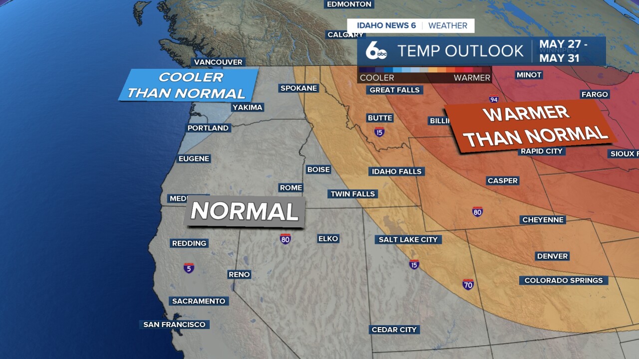
Each afternoon through the extended period will see a 20 to 30 percent chance of thunderstorms as the low-pressure system keeps conditions unsettled. The best storm chances will shift from the Nevada border Sunday and Monday to central Idaho Tuesday and most of southwest Idaho Wednesday and Thursday. Temperatures will gradually warm again after Tuesday.
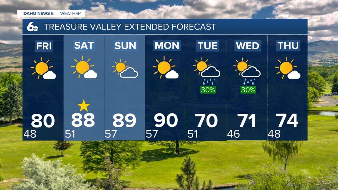
Tonight
Increasing clouds, with a low around 48. Diminishing NW wind.
Friday
Sunny & warmer, with a high near 80. Light wind.
Friday Night
Mostly clear, with a low around 50. Light wind.
Saturday
Sunny, with a high near 88. Light wind.
Saturday Night
Partly cloudy, with a low around 57. Light wind.
Sunday
Sunny & very warm, with a high near 88.
Sunday Night
Mostly clear, with a low around 57.
Memorial Day
Sunny and hot, with a high near 90. Light morning wind then becoming very breezy late in the day and evening.
Monday Night
Partly cloudy, with a low around 50.
Tuesday
A 20 percent chance of showers. Mostly sunny & much cooler. Very breezy, with a high near 70.
Tuesday Night
A 30 percent chance of showers. Mostly cloudy, with a low around 46.
Wednesday
A 30 percent chance of showers otherwise mostly sunny, breezy & mild, with a high near 71.
Wednesday Night
Mostly clear, with a low around 48.
Thursday
Sunny & seasonable, with a high near 74.