

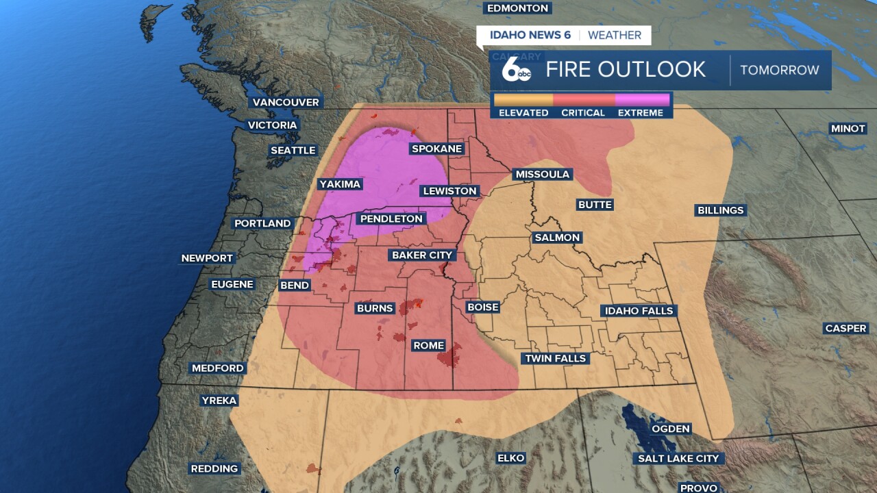


One more day of dangerous heat and widespread wildfire smoke is ahead Saturday before a dry cold front sweeps through Saturday evening, dropping Treasure Valley temperatures 10 to 15 degrees Sunday and potentially improving smoke conditions heading into next week.
Sizzling heat gives way to high fire danger and a cool down in Scott Dorval's video forecast
Saturday: Last Day of Dangerous Heat
The Treasure Valley will see temperatures touch 100 degrees Saturday under an upper high over the Desert Southwest. Locally hotter temperatures from Mountain Home to Hagerman could push above 100 degrees. Wildfire smoke will continue to impact the valley through Saturday, with patchy smoke most noticeable during the overnight and morning hours. Flow aloft will increase Saturday as an upper trough pushes into the Pacific Northwest, with winds gusting to 20 mph in the Treasure Valley by afternoon.
Cold Front Arrives Saturday Evening: Critical Fire Weather
The dry cold front will push into southwest Idaho Saturday evening, bringing a period of critical fire weather conditions. Wind gusts will reach 25 to 40 mph across the Snake River Plain and highlands of southwest Idaho through Saturday night. Combined with very low relative humidity values, these gusty winds will create dangerous fire conditions. Residents should be fire aware and avoid any potential ignition sources Saturday evening.
Sunday: Welcome Relief and Improving Smoke
Sunday will bring a dramatic change to the Treasure Valley. Temperatures will drop 10 to 15 degrees from Saturday, with highs near 87 degrees under mostly sunny skies. This will be a much more comfortable day after the prolonged stretch of dangerous heat. Notably, Sunday night temperatures will drop below 60 degrees across the Snake River Plain, which would be the first sub-60 degree reading in Boise since July 3rd.
Smoke conditions are also expected to improve Sunday as westerly flow in a well-mixed environment helps vent out the smoke that has pooled over the region. Forecast models are showing tighter smoke plumes and reduced coverage for Sunday, though some uncertainty remains depending on whether Saturday's wind event triggers new fire activity.

Central Idaho Mountains
The central Idaho mountains will also experience the cold frontal passage Saturday evening, with gusty winds and critical fire weather conditions developing. The mountains will see similar temperature moderation Sunday, with breezy westerly winds continuing through the day. Smoke impacts in the mountains will also improve Sunday as the pattern shifts.

Looking Ahead: Heat Returns Midweek
Monday will bring another comfortable day with highs near 87 degrees before temperatures begin climbing again. The upper trough will slide east Tuesday, allowing warm temperatures to return. By Wednesday, highs will be back in the mid to upper 90s across lower elevations. No precipitation is expected next week as monsoon moisture remains bottled up over the Four Corners. The hot and dry conditions will be favorable for fire growth, so smoke is likely to increase in coverage and density heading into next week.

Tonight
Patchy smoke between 11pm and 2am. Mostly clear, with a low around 67. Light wind.
Saturday
Patchy smoke. Increasing clouds and continued very hot, with a high near 100. Light and variable wind becoming WNW 5-10 mph in the afternoon with gusty evening winds as high as 25 mph.
Saturday Night
Patchy smoke. Partly cloudy, with a low around 62. WNW wind 10-15 mph, with gusts as high as 25 mph early then diminishing late.
Sunday
Areas of smoke before 7am. Sunny, breezy, and cooler, with a high near 87. WNW wind 10-15 mph.
Sunday Night
Clear, with a low around 56. West wind 5-15 mph.
Monday
Sunny & comfortably warm, with a high near 87.
Monday Night
Clear, with a low around 55.
Tuesday
Sunny and hotter, with a high near 92.
Tuesday Night
Clear, with a low around 58.
Wednesday
Sunny and hotter, with a high near 98.
Wednesday Night
Clear, with a low around 63.
Thursday
Sunny and hot, with a high near 99.
Thursday Night
Clear, with a low around 64.
Friday
Sunny and hot, with a high near 97.
