

A well-established upper-level high pressure system will remain centered over the Interior West through Thursday, maintaining dry and mild weather with afternoon temperatures reaching 10 degrees above normal before a significant pattern change arrives early next week.
Current Pattern: Ridge Dominance Continues
The sinking air aloft will keep dry and mild conditions in place across the region, with Wednesday and Thursday seeing temperatures climb to 10 degrees above normal. Surface winds will remain light during this period, and the resulting stagnant air mass will gradually reveal itself through increased fog and haze during the week.
The most notable fog and haze development will occur across the lower Snake Plain and basins and valleys of southeast Oregon. Through Thursday, fog formation in the Snake Plain will be limited to areas along the Snake River and more broadly to points west of the Canyon and Ada County line into the Weiser Basin.
Forecast adjustments have been made to increase fog coverage across lower valleys each morning as the stagnant pattern persists.
Valley Inversion Impacts: Expanding Fog Coverage
The persistent high pressure will continue creating temperature inversions that trap cold air and moisture in valley locations. The stagnant air mass will gradually worsen air quality conditions, particularly in areas prone to fog development.
Morning fog will become more widespread as the week progresses, with the Snake River corridor and western valleys experiencing the most significant impacts. Drivers should prepare for reduced visibility during morning commutes, particularly in areas west of the Canyon-Ada County line.
Weekend: Ridge Begins to Weaken
The upper-level ridge that dominates the short-term period will begin to break down and move east to end the week. While Friday and Saturday will remain dry, weather model clusters show good agreement on a pattern change early next week as a trough moves in off the coast.
Friday and Saturday will continue the mild, dry pattern with sunny skies and temperatures in the mid-50s, representing the final days of the current stable weather regime.
Pattern Change: Cold Front Approaches
Although exact timing cannot be pinned down yet, weather models all show a cold front crossing the area late Sunday into early Monday. This front will mix out the persistent inversion with increased winds and cooling aloft, finally breaking the stagnant pattern that has dominated recent weeks.
The front will also cool surface temperatures to more seasonable levels by Monday, ending the extended period of above-normal temperatures.
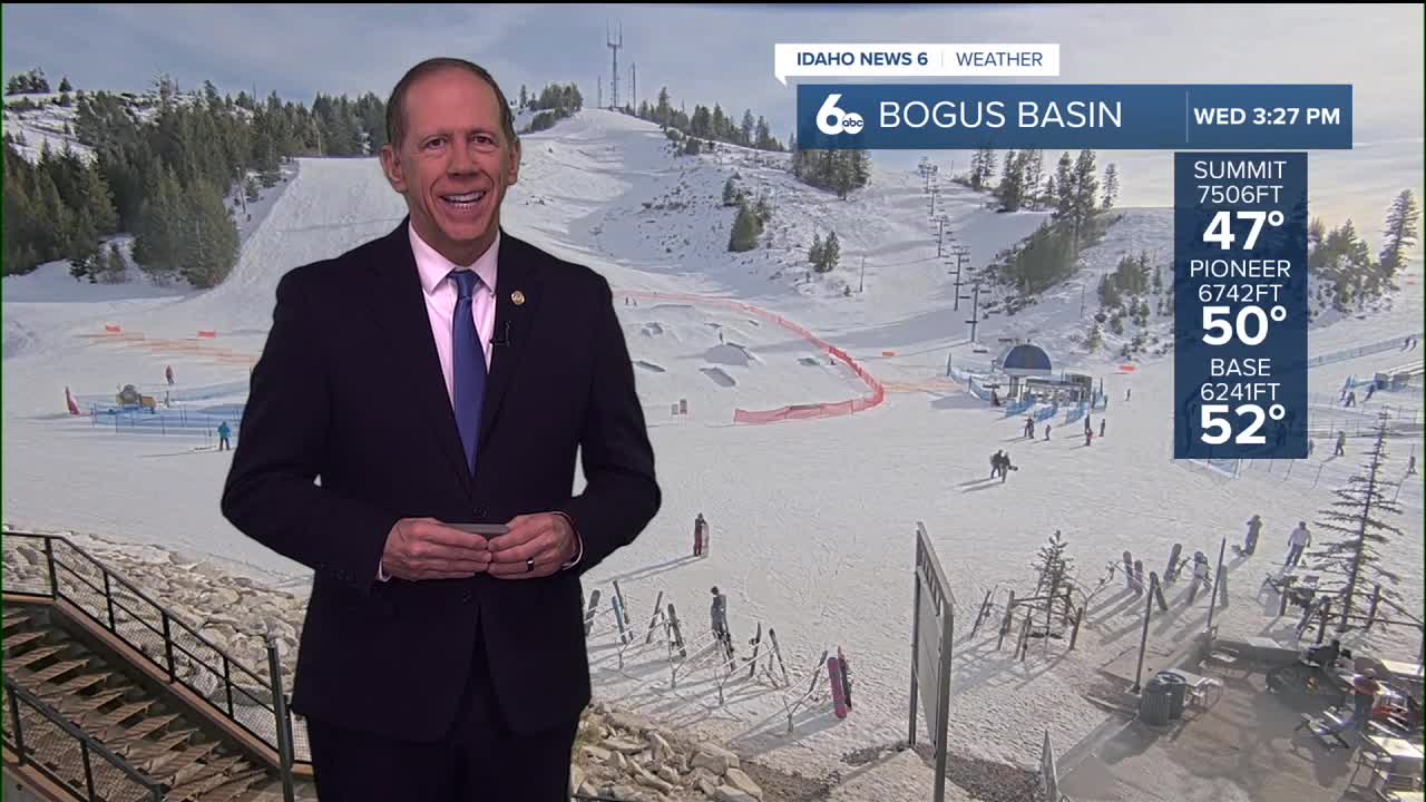
Mountain Snow Conditions for Ski Areas
The current ridge pattern will continue limiting new snowfall opportunities through the weekend. However, the approaching pattern change early next week will bring the first significant precipitation chances in an extended period.
Mountain areas will see the highest precipitation chances Monday morning, with 55 to 75% probability in the west-central mountains. This could bring much-needed fresh snowfall to ski areas, though snow levels will depend on the exact temperature profile as the system moves through.
Precipitation Returns: Monday Focus
Precipitation chances will increase through the day Sunday, before reaching maximum probability Monday morning. Current forecasts show 55 to 75% chances in the west-central mountains and 35 to 55% chances elsewhere.
These precipitation chances will likely increase in coming days as the exact timing becomes better resolved. Beyond Monday, precipitation chances will remain elevated as weather model clusters show good agreement on continued troughing over the area.
Extended Outlook: Active Pattern Potential
The pattern change represents a significant shift from the persistent ridge that has dominated much of the winter. The transition to troughing over the area suggests a more active weather pattern may develop, bringing regular precipitation chances and more variable temperatures.
This change will provide relief from the stagnant air quality conditions and persistent inversions that have characterized recent weeks.
Daily Forecast:
Tonight
Mostly clear, with a low around 30. Calm wind.
Thursday
Sunny & unseasonably mild, with a high near 57. Light and variable wind.
Thursday Night
Mostly clear, with a low around 34. Calm wind.
Friday
Increasing clouds but continued mild, with a high near 55. Calm wind.
Friday Night
Mostly cloudy, with a low around 33. Calm wind.
Saturday
Mostly sunny & very mild, with a high near 57.
Saturday Night
Mostly cloudy, with a low around 38.
Sunday
Mostly cloudy and continued mild, with a high near 59.
Sunday Night
A 50 percent chance of rain. Cloudy, with a low around 39.
Monday
A 40 percent chance of rain, mainly before 11am then partly sunny, with a high near 50.
Monday Night
A 20 percent chance of rain. Mostly cloudy, with a low around 32.
Tuesday
A slight chance of rain and snow. Mostly cloudy, with a high near 48. Chance of precipitation is 20%.
Tuesday Night
Mostly cloudy, with a low around 31.
Wednesday
A slight chance of rain and snow. Partly sunny, with a high near 47. Chance of precipitation is 20%.