

The warm and wet pattern continues and looks to stick around through at least mid-December.
A warm, moisture-rich storm system will keep periods of rain going through midweek, mainly across the northern parts of the region.

Snow levels stay very high (sorry snow lovers)—above 8,000 feet—so most locations see rain only.
Rivers may run higher, but are expected to stay below flood stage. Temperatures warm up each day, with many southern valleys near 60° by Wednesday.
By late Wednesday into Thursday, rain shifts north, and many areas begin to dry out. Overnight fog may develop in calmer valleys.
Temperatures continue to climb, with many valley floors expected to reach the 60s by Wednesday.

The Weekend:
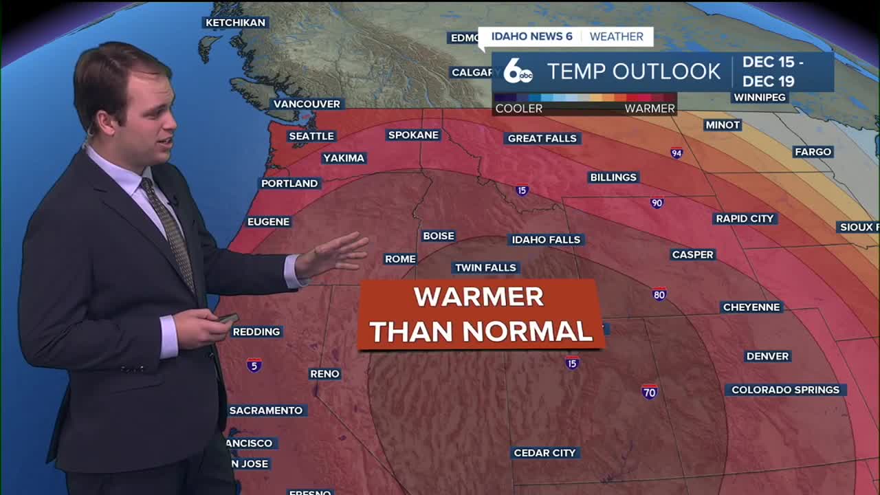
High pressure builds in, bringing dry and partly cloudy weather for the weekend. While it stays generally warm, valley inversions may trap cooler air and lead to fog and low clouds, especially in the mornings. Temperatures will run 10–15 degrees above normal overall, but some valley areas could feel cooler under the fog.
Early Next Week:
Active weather looks to return Monday into Tuesday as a new system moves in. Rain and mountain snow chances will increase, though the exact timing is still uncertain.
Stay up to date right here @SophiaCruzWX
