Idaho is into the last week of April and comfortable Spring conditions are moving in to close out the month.
The past few weeks saw plenty of showers pass over southern Idaho with 2026 seeing one of the wettest Aprils ever recorded. That trend comes to a halt as we get closer to May. This week, scattered showers surrounding the valley floors will fall but as for the main Boise and Twin Falls regions, not a lot of precipitation is expected. What is on the way is an uptick in heat.
Sixties to start the week quickly hit 70's by midweek and heading into the weekend, valley floors climb into the 80's. Skies stay clear outside of a few scattered clouds. The mostly sunshine forecast continues into the start of May as the first few weeks of the new month are leaning warmer than usual. Idaho's precipitation outlook during that time is sitting right at average as south of us is wetter and north of us is dryer. It will be interesting to see which of the two moves into our region over the coming months into Summer.
Enjoy the nice skies while they last and get ready for some warmer temperatures!
Forecast Outlook: Warmer weather coming soon
Treasure Valley Extended Forecast:

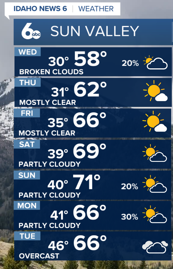
Sun Valley Forecast