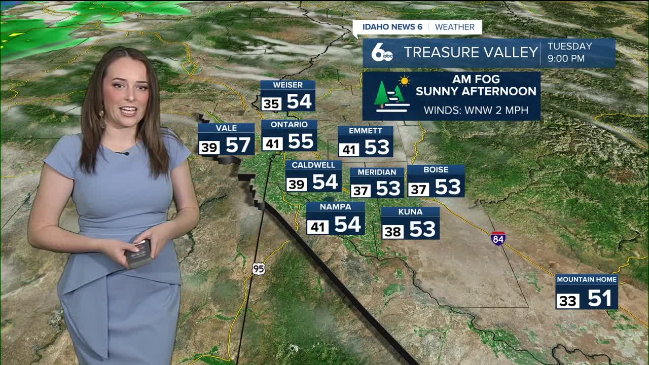


The low pressure system that hit Idaho yesterday has moved eastward and left behind foggy conditions in some of our valleys this morning. This includes the Treasure Valley - where people are waking up to slick roads, and Long Valley - where people are waking up to a dusting of snow.
☁️Yikes!! Thick fog over one of our @IdahoNews6 traffic cams - Garrity Blvd onto I-84.
— Geneva Zoltek TV 🌱🌦🌎 (@GenevaZoltek) October 25, 2022
Be careful driving this morning!
☀️Expect sunshine this afternoon once the fog clears up in the Treasure Valley. #IDwx #Boise #Idaho pic.twitter.com/IhwZo2IN9h
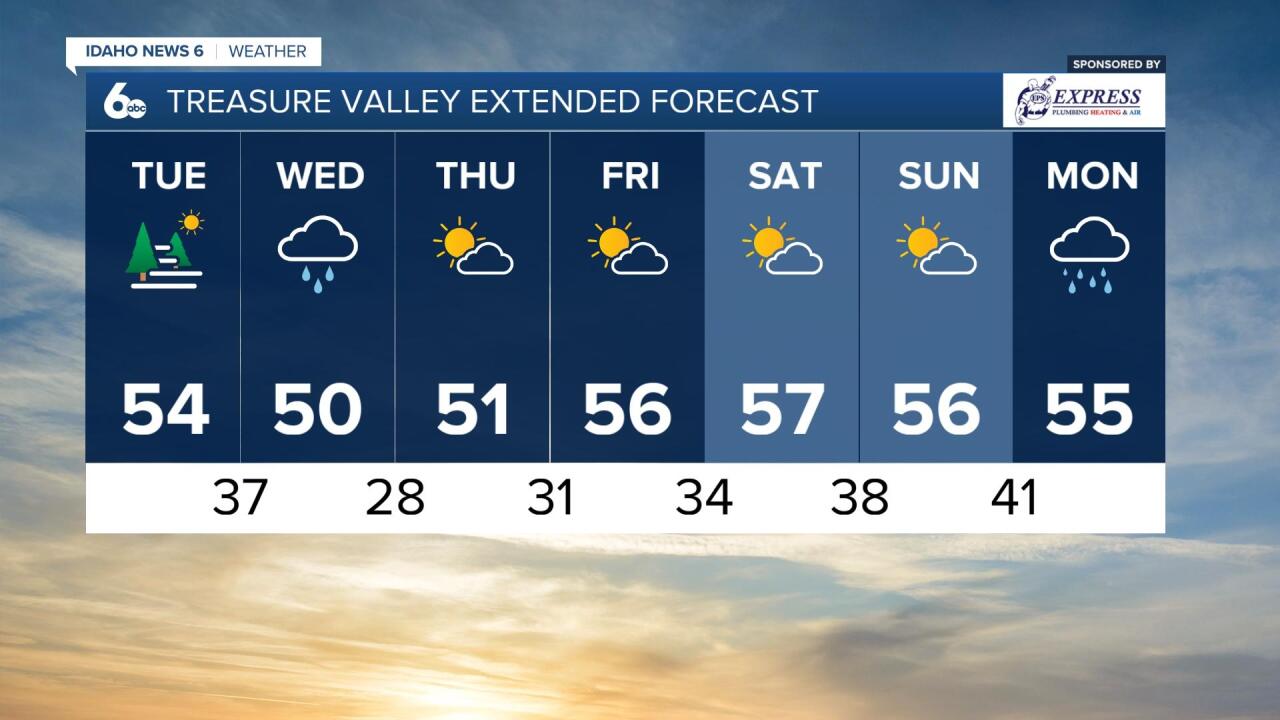
Look forward to a sunny afternoon today in southern and central Idaho! Cloud cover is set to dissipate through the day leaving behind clear skies for the afternoon.
Don't be fooled by the sunshine, it's going to be a chilly day today! Temperatures will only reach the upper 40s to mid 50s through the region at the hottest part of the day, so bundle up as you head out the door.
Another wave of active weather will hit Idaho tomorrow brining more rain and snow. That system will start to ramp up in the early hours of Wednesday morning and impact us throughout the day tomorrow.
👀👀 peep the dusting of SNOW in McCall this morning!! ☃️☃️Go make a snow angel and enjoy the brief break in active weather today 🌤we’ll see more action in Idaho tomorrow🌨#idwx pic.twitter.com/UaLrKtnIiF
— Geneva Zoltek TV 🌱🌦🌎 (@GenevaZoltek) October 25, 2022
Thursday will mirror Tuesday and be much more calm in the Gem State. Temperatures are set to reach the mid-50s at the warmest part of this upcoming week and we're expecting more moisture next week starting Monday.