

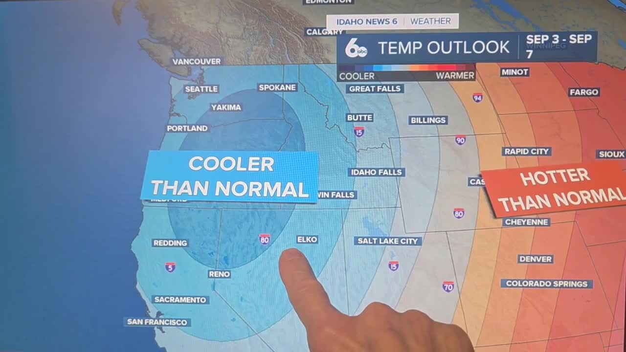


Remnant tropical moisture will fuel a thunderstorm threat for the Treasure Valley and central Idaho mountains tonight before a cold front sweeps through Saturday evening, ushering in a much cooler and drier Sunday. An active pattern will then develop through next week as a strong closed low-pressure system approaches from the coast.
Cooler temps finally arrive in Scott Dorval's video forecast
Tonight: Tropical Moisture Drives Thunderstorm Threat
Shortwave energy lifting out of the Great Basin tonight will increase the potential for thunderstorms from the Oregon-Idaho-Nevada border area northeastward into the Boise Mountains through late evening. This activity is fueled by remnant tropical moisture that has been streaming into the region, keeping moisture values elevated well above normal for late August. Gusty winds up to 40 mph will be the main threat from heavier showers and thunderstorms through midnight. East-southeast winds will gust up to 30 mph across the Treasure Valley tonight even outside of storms.
Saturday: Shower and Storm Chances Continue Before Cold Front
Shower and thunderstorm potential will continue across southwest Idaho Saturday afternoon, with a 20 percent chance of storms developing after 3 p.m. The cold front will push through Saturday evening, ushering in a cooler air mass on gusty northwest winds with gusts up to 23 mph. Precipitation will taper off behind the front Saturday night, leaving dry conditions across the region.
Sunday: Cool and Comfortable
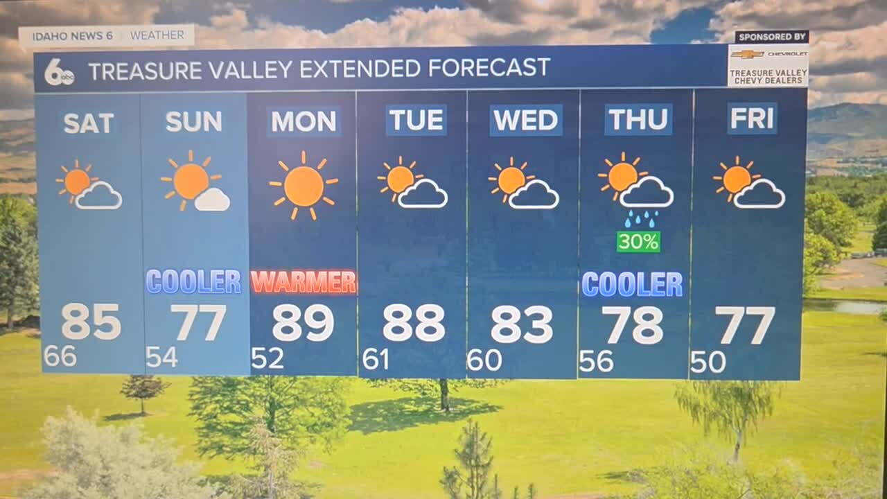
Sunday will be one of the most comfortable days in weeks, with sunny skies and a high near 78 degrees. Temperatures will run about 10 degrees below normal, putting lower elevations in the upper 70s. Sunday night will be dry and cool, with many locations dropping into the upper 40s or colder, signaling the first real taste of fall-like conditions.
Early Next Week: Brief Warmup Before Active Pattern Returns
Monday will bring a rebound to near seasonal averages with sunny skies and a high near 89 degrees. However, the active pattern will quickly return. Increased shower and thunderstorm chances will develop in south-central Idaho Monday, with a 20 percent chance of afternoon showers Tuesday as another shortwave trough moves through. Enhanced storm potential will shift from south-central Idaho over higher terrain in central and southwestern Idaho as well as eastern Oregon Tuesday.
Late Week: Significant Cooldown and Unsettled Conditions
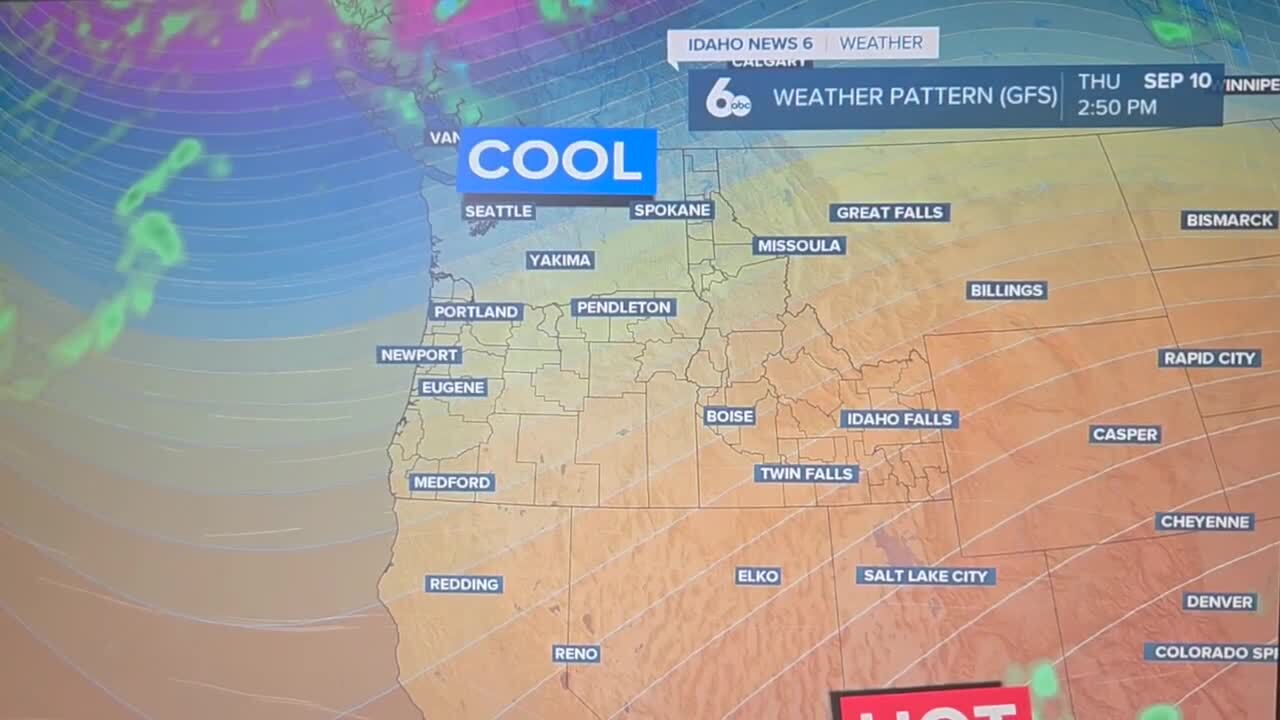
A strong closed low-pressure system will move along the trough axis and stall over the Oregon coast Wednesday through Friday, bringing temperatures 10 degrees below normal and unsettled, gusty conditions. The strong pressure gradient aloft is likely to mix down to the surface ahead of the low, leading to widespread afternoon gusts Tuesday through the extended period. Shower chances of 20 to 30 percent will persist Wednesday through Friday, with the exact placement of storms still uncertain.
Central Idaho Mountains
The central Idaho mountains will see the most active weather through the extended period. Tonight's thunderstorm threat will extend into the Boise Mountains, with gusty outflow winds the primary concern. Shower and thunderstorm chances will continue Saturday before drying out Sunday. The mountains will then see enhanced storm potential Tuesday through the end of the week as the strong coastal low approaches. Anyone planning mountain trips next week should monitor conditions closely and be prepared for rapidly changing weather.
Tonight
A slight chance of showers and thunderstorms. Patchy smoke between 1am and 4am. Mostly cloudy, with a low around 65. East southeast wind 7 to 15 mph, with gusts as high as 30 mph. Chance of precipitation is 20%.
Saturday
A 20 percent chance of showers and thunderstorms after 3pm. Partly sunny, then gradually becoming sunny, with a high near 85. East southeast wind 5 to 8 mph becoming west in the afternoon.
Saturday Night
A 20 percent chance of showers and thunderstorms before 9pm. Mostly cloudy, with a low around 53. West northwest wind around 10 mph, with gusts as high as 23 mph.
Sunday
Sunny, with a high near 78. West northwest wind 5 to 7 mph.
Sunday Night
Mostly clear, with a low around 52. Northwest wind 5 to 7 mph becoming calm in the evening.
Monday
Sunny, with a high near 89.
Monday Night
Mostly clear, with a low around 61.
Tuesday
A 20 percent chance of showers after noon. Mostly sunny, with a high near 89.
Tuesday Night
Partly cloudy, with a low around 59.
Wednesday
Mostly sunny, with a high near 83.
Wednesday Night
A 20 percent chance of showers. Mostly cloudy, with a low around 55.
Thursday
A 30 percent chance of showers. Partly sunny, with a high near 78.
Thursday Night
A 20 percent chance of showers. Partly cloudy, with a low around 50.
Friday
A 20 percent chance of showers. Mostly sunny, with a high near 77.
