


After a brief cooldown today, the heat is about to make a comeback. Temperatures will climb Friday and Saturday quickly as high pressure builds over the region, sending valley highs back near and above 100 degrees. Saturday looks to be the hottest day, with some lower valley locations topping out between 100 and 105 degrees.
Today will stay mostly dry, although a few thunderstorms are possible south of the Idaho border and over parts of central Idaho. Even if storms stay away, gusty outflow winds of up to 40 mph could reach the higher terrain of southwest Idaho this evening.
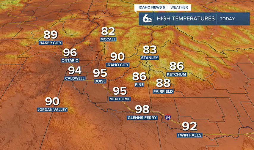
The bigger story is the heat heading into the weekend. Not only will afternoons be hot, but overnight temperatures will stay warm as well, offering little relief. If you have outdoor plans, make sure you stay hydrated and take breaks from the heat.
Looking ahead, a pattern change arrives early next week as monsoon moisture begins moving north into the region. We'll see increasing clouds Sunday and Monday, followed by a growing chance of showers and thunderstorms through the middle of next week. At first, storms may bring mainly gusty winds, but as moisture increases, some storms could produce heavier rainfall by Tuesday and Wednesday.
Even with storm chances returning, temperatures will remain above average through much of next week. Boise's 10-day weather trend has consecutive days of only upper 90s to triple digits!

The bottom line: hot and dry through the weekend, then a better chance for thunderstorms as we head into next week.
Treasure Valley Extended Forecast:

