



BOISE, Idaho — UPDATE - 9:30 p.m. 7/8/2026- The USWFS says that crews have made steady progress today on the Claremont Fire, which has been estimated at 6,530 acres.
"Burnout operations continued along Boise Ridge Road, further strengthening containment efforts and helping prevent the fire from impacting the Robie Creek community," USWFS said in their Wednesday night update.
BCSO has lowered all evacuation zones to Level 1.
Crews are still working to hold and secure containment lines. The estimated time for containment is set for 6 p.m. on July 12.
Fire crews are still working around the unexploded ordnance area, which officials say requires specialized risk management and careful coordination.
An emergency closure remains in effect for BLM-managed public lands, roads, and trails in the Boise Foothills between Bogus Basin Road, Idaho State Highway 21, and Boise Ridge Road.
WATCH: Hear from Boise BLM about the fire outlook and see how helicopters and planes are helping fight it
UPDATE - 9:00 p.m. 7/8/2026 - The Boise County Sheriff's Office released that all evacuation zones have been reduced to Level 1 "Get Ready".
Officials note that even with the evacuation level lowering, Shaw Mountain Road/Rocky Canyon Road and Boise Ridge Road will remain closed to non-residents due to fire crews in the area.
The Red Cross shelter, Eagle Christian Church - Surprise Valley in Boise, will remain on standby until 8 a.m. July 9. Officials say contact information will be posted on the door if the shelter is needed.
BCSO said evacuation statuses will be reevaluated tomorrow evening when temperatures begin to drop.
IDL is mapping the fire at 6,530 acres.
UPDATE - 12:30 p.m. 7/8/2026 - Idaho Fish and Game has closed all gated access points to the Boise River Wildlife Management Area. Access to the area will remain closed until the area closure from the Bureau of Land Management lifts.
UPDATE - 11:30 a.m. 7/8/26 - The Claremont Fire burning in the Boise Foothills has burned 6,509 acres, according to the Idaho Department of Lands. A control date has not been set, but the U.S. Wildland Fire Service anticipated containment by 6:00 p.m. on Sunday, July 12.
UPDATE - 8:00 a.m. 7/8/26- Crews worked through the night and made significant progress on the Claremont Fire, now estimated at 4,800 acres. Officials say a successful burnout operation form Boise Ridge Road to Rocky Canyon Road greatly strengthened containment along that section and they predict they'll reach containment by July 12, 2026 at 6 p.m. Previous evacuation orders are still in place in Boise County as well as closures of BLM land, roads and trails in the Boise Foothills. USWFS says that today's focus is on holding and improving existing containment lines, conducting mop-up operations, and securing areas where the burnout occurred.
WATCH: Live Coverage from the Claremont Fire - July 8, 2026
UPDATE - 8:30 p.m. 7/7/26- The Red Cross is currently working to set up a shelter at Eagle Christian Church - Surprise Valley, located at 4601 S Surprise Way in Boise, for those impacted by the wildfire evacuations. For those that need to get their animals to safety, the Idaho City Rodeo Grounds is open for livestock.
Click here for information about the evacuation shelter.
UPDATE - 8:10 p.m. 7/7/26- The Boise County Sheriff's Office has moved the Rocky Canyon area, RC-06, to a Level 3 evacuation "Go".
Police are asking the public to evacuate towards the highway, not towards Ridge Road.
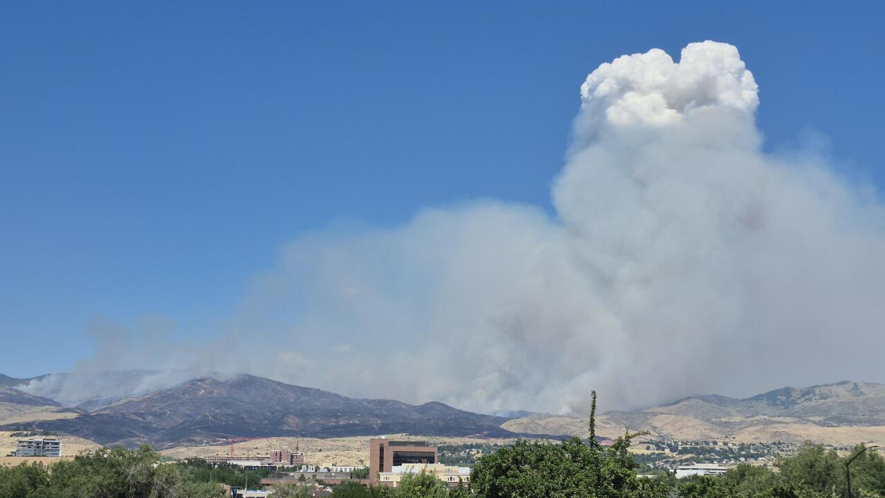
Firefighters battling the Claremont Fire in the Boise Foothills made significant progress overnight after a successful burnout operation strengthened containment lines, but evacuation orders remain in effect as the fire has grown to an estimated 4,800 acres.
UPDATE - 6:30 p.m. 7/7/26 -The Boise County Sheriff's Office has issued a Level 2 "Get Set" evacuation for residents near the Tollgate area.
The evacuation notice is in effect for zones RC-04, RC-02, RC-01.
Click here for a map of the evacuation zones.
UPDATE - 5 p.m. 7/7/26 - The Claremont fire has now burned 4,420 acres, according to the Idaho Department of Lands.
The Boise Fire Department and BLM reminded the public that 8th Street is closed above the Foothills Learning Center to allow for firefighting operations.
UPDATE - 4 p.m. 7/7/26 - A planned burn will take place on Tuesday afternoon or evening near the Claremont Fire. Officials with the U.S. Wildland Fire Service (USWFS) say the planned burn is necessary for firefighter safety, because of an unexploded ordnance in the area. The USWFS says a controlled burn allows crews to contain the fire while also minimizing exposure to hazardous conditions.
The US Army Corps of Engineers is working to identify and clear the unexploded ordnance. Meanwhile, all fire crews are following strict safety protocols.
The planned burn is expected to produce significant smoke. All neighbors should avoid and respect closed areas.
As of 2 p.m. on Tuesday, the Claremont Fire had grown to 3,850 acres in size, according to the Idaho Department of Lands.

UPDATE - 2 p.m. 7/7/26 - The Claremont Fire has grown to more than 3,800 acres, according to the Idaho Department of Lands.
RELATED | Boise firefighters save foothills home threatened by wildfire
UPDATE - 8 a.m. 7/7/26 - The Claremont Fire has been re-estimated to 2,500 acres and while crews are actively working on containment lines, an estimate on when they'll achieve that remains TBD.
According to USWFS Idaho, the fire was active overnight, and continues to burn in the Boise Foothills, near Rocky Canyon, two miles northwest of Boise. No structures are threatened and no evacuations are currently in order, although contingency plans are being developed should the fire escape primary containment lines.
Emergency closures remain in effect for BLM-managed public lands and trails within the Boise Foothills. That includes land. road, and trails between Bogus Basin Road, State Highway 21, and Boise Ridge Road. Those are anticipated to lift July 11 at 11:59 p.m.
PREVIOUS COVERAGE
A grass fire burning in the Boise Foothills has grown significantly Monday afternoon, prompting officials to ask people to leave nearby trail systems and avoid the area.
At around 5:00 p.m., the Boise Fire Department updated on Facebook that the fire is now estimated at 2,000 acres. No structures are currently threatened, and there are no active evacuations at this time. There is no set containment time.
WATCH | See how air resources worked with crews on the ground to suppress the fire
An emergency alert sent by Boise Fire urges people to avoid the Hulls Gulch Trail system, Military Reserve system, and Mountain Cove Road area until further notice.
BLM has also issued a temporary closure of BLM-managed public lands & trails within the Boise foothills. "Specifically, the closure includes BLM-managed lands, roads, and trails (except those maintained by Ada County) between Bogus Basin Road, Idaho State Highway 21, and Boise Ridge Road," the press release said.
This closure is set to be lifted July 11 at 11:59 p.m. The fire agency reiterates that this closure does not affect private land.
FULL PRESS CONFERENCE | Hear from Boise Fire on the fast-growing fire in the Foothills—
Only local traffic is being allowed through on Claremont Drive.
Boise Fire said the fire started near the 1900 block of North Claremont Drive around 1:20 p.m., according to the city's Pulse Point page - an emergency alert system.
Fire officials explain why they haven't issued full evacuations—
Multiple crews are responding, including Brush 9, Brush 14, Brush 15, Brush 16, Engine 1, Engine 5, Engine 6, Engine 8, Engine 9, Ladder 5, Battalion 1 and Water Tender 16.
Boise Fire held a news conference at 4:45 p.m. at the Crestline Trailhead. Officials said updates will continue as more information becomes available.
Boise Fire discusses use of aircraft to fight Foothills fire—
This is a developing story, check back for updates.
