

A weather system remaining off the California coast will bring breezy winds and mountain snow to Idaho through Wednesday, followed by an extended active pattern that could deliver significant precipitation through next Tuesday.
Tonight Through Wednesday: Current System Impacts
Breezy east-southeast winds are expected through this evening, especially over the Treasure and Magic valleys. High clouds from the offshore system will stream northward into the area with increasing cloud cover this afternoon.
A band of precipitation from this system will lift northward from Nevada over the area late this evening and stall out over southeast Oregon and southwest Idaho Wednesday before slowly dissipating. Snow levels will be around 3,500 to 5,000 feet with this system, bringing beneficial snowfall to higher elevation areas.
Thursday: Partial Clearing with Instability
Precipitation will taper off by Thursday with low clouds lingering into the morning hours. Partial clearing is expected Thursday with enough instability and cool air aloft for isolated showers to develop during the afternoon, especially over higher terrain.
Areas of fog are possible before 8 a.m. Thursday, followed by mostly sunny skies and a high near 51 degrees.
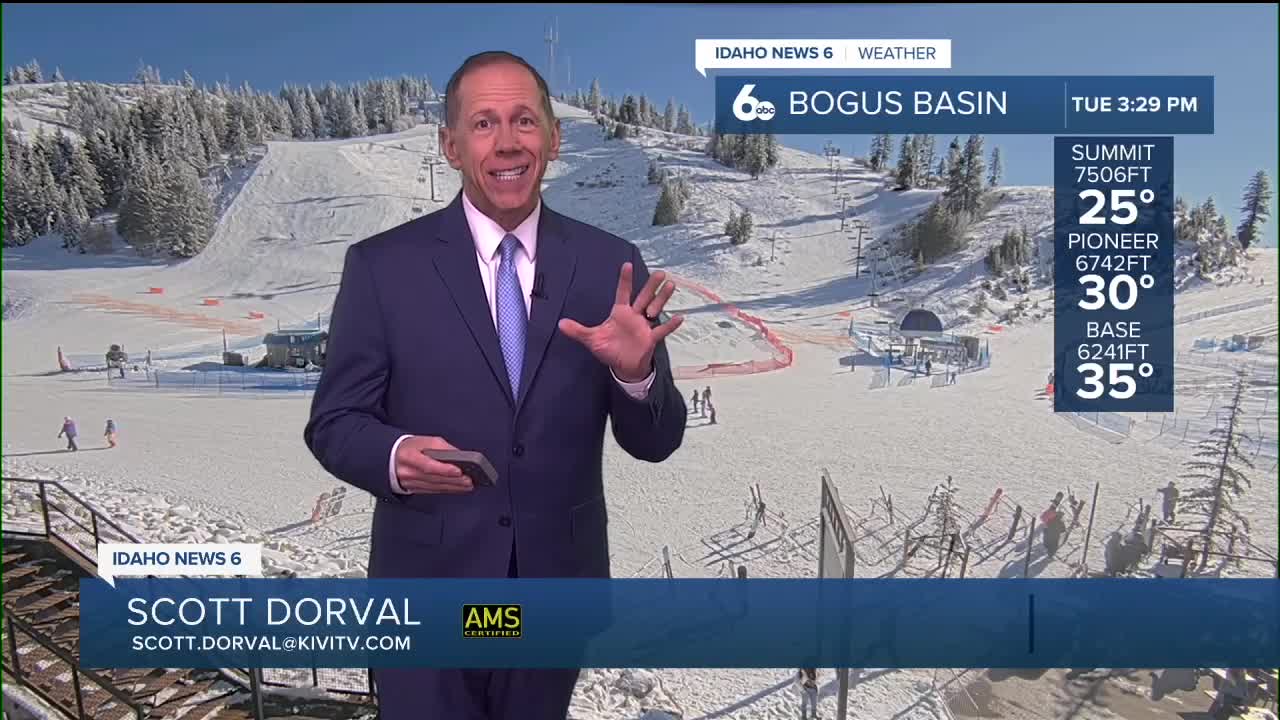
Mountain Snow Conditions for Ski Areas
The current system will provide light to moderate snowfall for ski areas above 3,500 to 5,000 feet. While amounts will be modest with this initial system, the extended active pattern ahead indicates more snow is possible.
Looking ahead to the Saturday through Tuesday period, mountains could see 2 to 8 inches of snow, with the higher amounts dependent on how active the weekend precipitation becomes.
Extended Pattern
Weak ridging overhead Friday will keep temperatures warmer than normal with dry conditions. However, clouds will increase later in the day as a longwave trough moves from the Gulf of Alaska to the west coast.
As this trough moves south and amplifies, it will pick up a large fetch of moisture from the Pacific. Saturday through Sunday will remain cloudy as the trough stalls off the coast, with just enough moisture for a 20 to 30% chance of precipitation across the area.
Hoiday Weekend: Increasing Activity
The southwest flow on the eastern side of the trough will keep temperatures warm through the weekend. Monday, the low will begin moving inland, shifting the region into a more favorable moisture flow and increasing precipitation chances to 30 to 50%, with higher percentages in mountainous terrain.
A secondary low from the Gulf of Alaska will merge into the main system, shifting the position of the core back to the coast and stalling its movement for a wetter Tuesday.
Tuesday: Highest Precipitation Chances
While still seven days out, Tuesday shows a 40 to 70% chance of precipitation across the area. Weather model consensus exists among almost all solutions on the track of the low bringing significant moisture to the region.
With the secondary trough merging into the main low, snow levels will drop to 4,000 to 5,000 feet, even though the general southwest flow keeps temperatures a few degrees above normal.
Daily Forecast:
Tonight
A 20 percent chance of showers after 11pm. Mostly cloudy, with a low around 35. Wind SE 5-9.
Wednesday
A 40 percent chance of showers. Mostly cloudy, with a high near 47. Light wind.
Wednesday Night
Mostly cloudy during the early evening, then becoming partly cloudy, with a low around 34. Light and variable wind.
Thursday
Areas of fog before 8am. Otherwise, mostly sunny & mild, with a high near 51. Light wind.
Thursday Night
Partly cloudy, with a low around 31. Northwest wind around 6 mph becoming calm in the evening.
Friday
Mostly sunny & pleasant, with a high near 52.
Friday Night
Mostly cloudy, with a low around 35.
Saturday
Cloudy, with a high near 53.
Saturday Night
A 20 percent chance of rain after 11pm. Cloudy, with a low around 38.
Sunday
A 30 percent chance of rain, mainly after 11am. Cloudy, with a high near 51.
Sunday Night
A 30 percent chance of rain. Mostly cloudy, with a low around 35.
Monday
A chance of rain and snow. Partly sunny, with a high near 51. Chance of precipitation is 40%.
Monday Night
A chance of rain and snow. Mostly cloudy, with a low around 34. Chance of precipitation is 50%.
Tuesday
A chance of rain and snow. Mostly cloudy, with a high near 50. Chance of precipitation is 40%.