

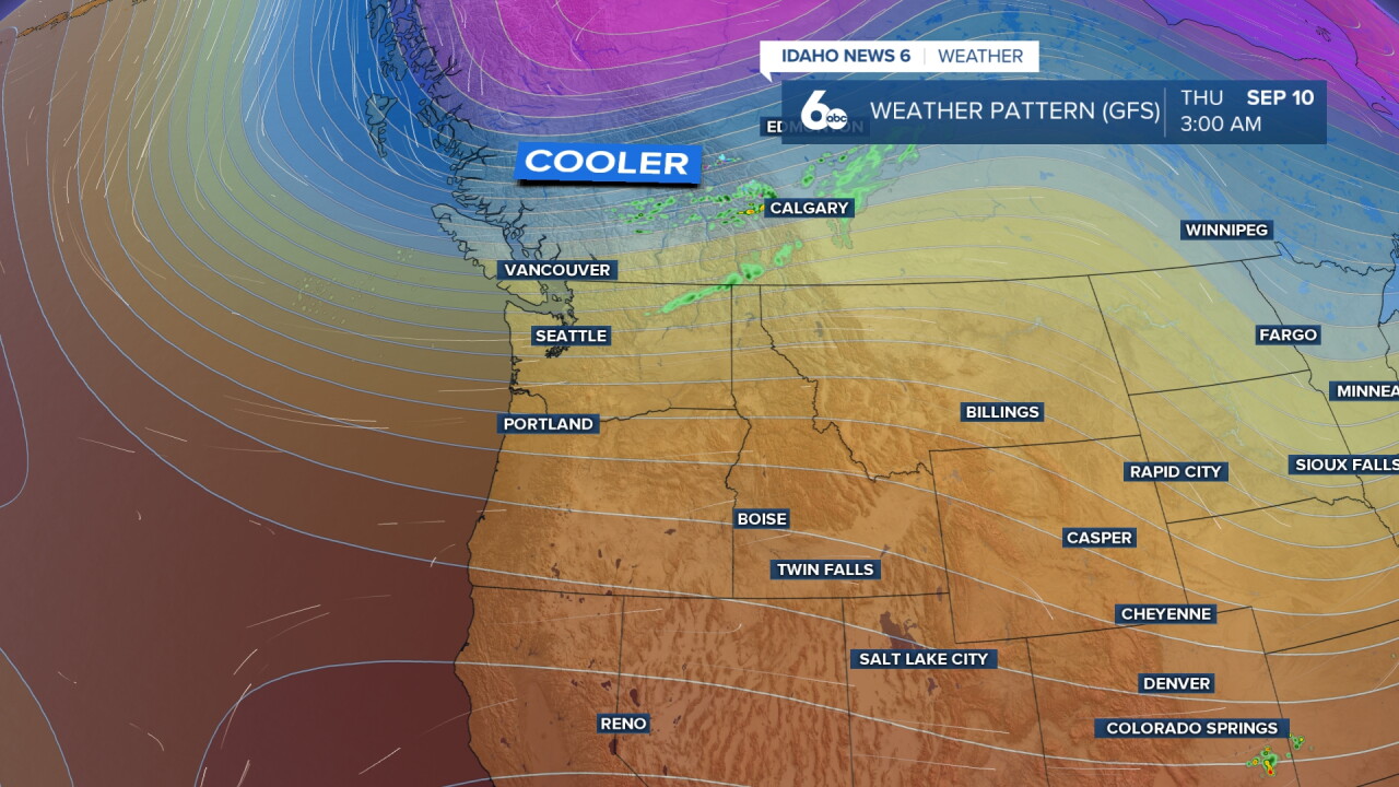


The Treasure Valley and central Idaho mountains are in for a spectacular stretch of early fall weather, with temperatures warming to near-record levels for mid-September by Thursday before a dramatic pattern change delivers a significant cooldown and the best precipitation chances of the week to the central Idaho mountains this weekend.
Spectacular weather warms this week ahead of a weekend cool down in Scott Dorval's video forecast
Warming Trend Builds to 87 Degrees Thursday
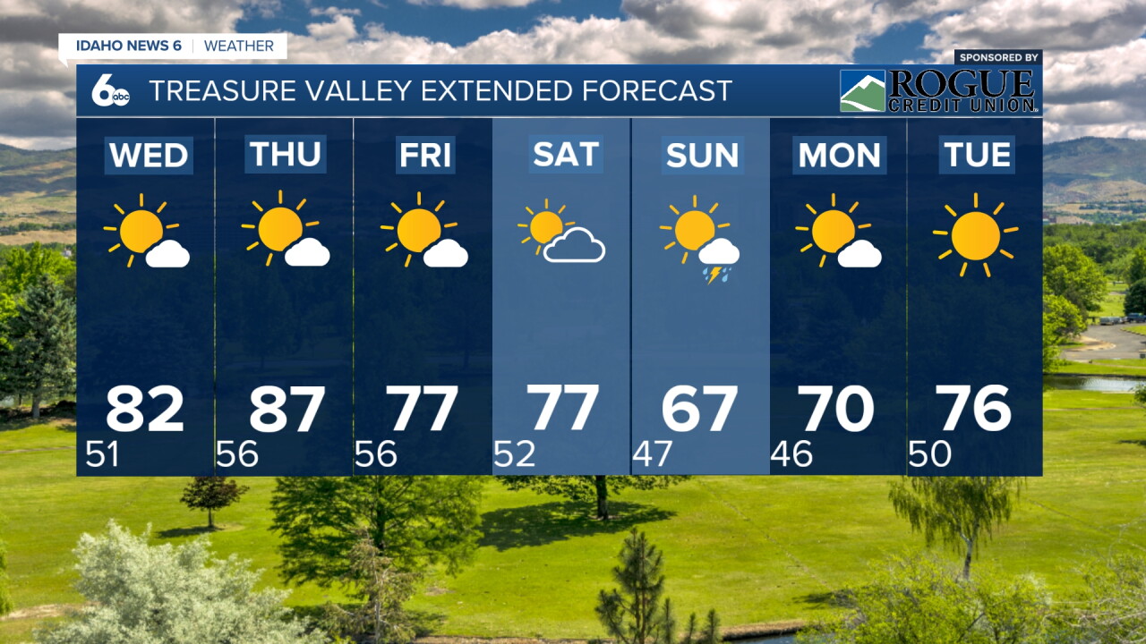
Temperatures will climb steadily through the week, with Wednesday bringing sunny skies and a high near 82 degrees before the warmth peaks Thursday at 87 degrees. For context, Boise's average high for September 10 to 11 is around 82 degrees, meaning Thursday will run about 5 degrees above normal. These are exceptional conditions for mid-September, with light winds and clear skies making for some of the most comfortable outdoor days of the entire year.
McCall and the central Idaho mountains will also see a beautiful warming trend, with temperatures climbing into the low to mid-70s by Thursday. The combination of warm temperatures, clear skies, and the recent significant rainfall that has greened up the landscape and improved trail conditions makes this an outstanding week for mountain recreation.
Check out this band of smoke from earlier today! It may have been from Canadian wildfires as it was not from a local area fire

Recreation Forecast: Make the Most of Wednesday and Thursday
Treasure Valley: Wednesday and Thursday will be among the finest outdoor days of the year. Temperatures in the low 80s to upper 80s with light winds and sunny skies are ideal for hiking in the Boise Foothills, cycling the Greenbelt, or simply enjoying time outdoors. The recent rainfall has settled the dust and improved air quality dramatically, making conditions even more enjoyable.
Central Idaho Mountains: Wednesday and Thursday will be spectacular for hiking, camping, and fall foliage viewing. Trails will be in excellent condition following last week's significant rainfall. The combination of warm temperatures and the moisture from last week's storms will accelerate the fall color change, making this an excellent time to visit areas like the Sawtooth Valley, Payette River corridor, and the mountains around McCall. Overnight lows will be cool and refreshing, perfect for camping.
Friday and Saturday: Still very pleasant with highs near 77 degrees both days. A dry cold front will pass through early Friday, bringing breezy winds but maintaining sunny skies. Saturday will be mostly sunny and warm before conditions change Saturday night.
Dramatic Weekend Cooldown: A Strong Cold Front Saturday Night
The most significant weather change of the week arrives late Saturday as a closed upper low moves inland and over the area. This system will bring gusty winds, showers, and thunderstorms Saturday night before ushering in dramatically cooler conditions Sunday. Temperatures will drop from 77 degrees Saturday to only 67 degrees Sunday, a 10-degree single-day drop that will feel even more dramatic given the warmth earlier in the week.
Sunday will feel decidedly fall-like, with a 20 percent chance of morning showers and a high near 67 degrees. Overnight lows Sunday night will drop to near 47 degrees across the Treasure Valley, the coolest readings since late spring.
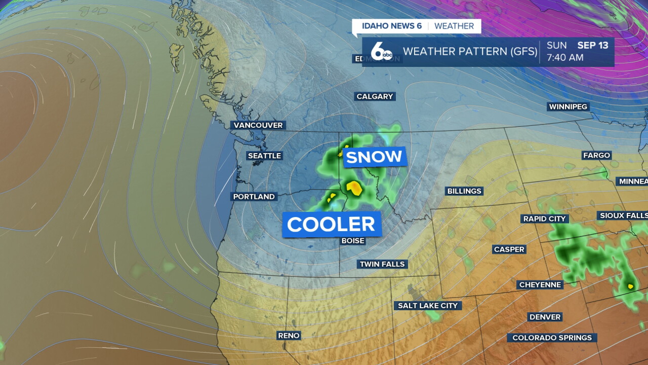
Central Idaho Mountains: Best Precipitation Chances This Weekend
The central Idaho mountains will see the best precipitation chances of the weekend, with showers and thunderstorms most likely Saturday night through Sunday as the closed upper low passes overhead. Mountain hikers and campers heading into the backcountry this weekend should be prepared for changing conditions Saturday evening and have rain gear readily accessible. The precipitation will be most pronounced over high terrain areas, with the Sawtooth Mountains, White Cloud Peaks, and mountains around McCall seeing the highest chances for wetting rains.
This additional moisture will further benefit the fire situation in the mountains, which has already improved dramatically following last week's significant rainfall event.
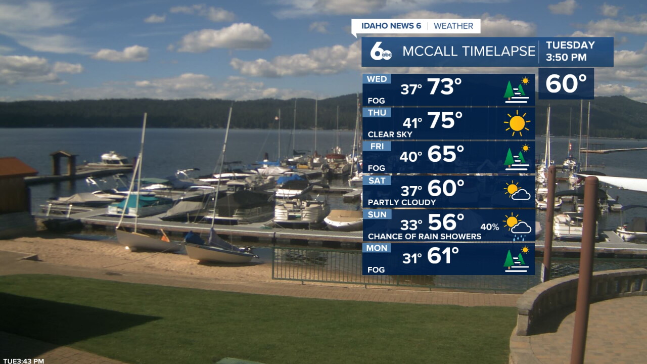
Looking Ahead: Warmer and Drier Early Next Week
A mostly dry longwave trough off the Pacific will keep the area under southwest flow early next week, bringing a return of dry conditions and warmer temperatures. Monday will see sunny skies and a high near 70 degrees before temperatures climb back to 76 degrees Tuesday. This pattern of alternating warm and cool periods is very typical of September in the Treasure Valley and signals the gradual transition toward fall.
Tonight
Clear, with a low around 52. Light wind.
Wednesday
Sunny & warmer, with a high near 82. Light wind.
Wednesday Night
Mostly clear, with a low around 56. Light wind.
Thursday
Sunny & warm, with a high near 87. Light wind.
Thursday Night
Partly cloudy, with a low around 59. Light wind.
Friday
Sunny, with a high near 77.
Friday Night
Mostly clear, with a low around 53.
Saturday
Mostly sunny, with a high near 77.
Saturday Night
A 30 percent chance of showers. Mostly cloudy, with a low around 50.
Sunday
A 20 percent chance of showers before noon. Mostly sunny & much cooler, with a high near 67.
Sunday Night
Mostly clear, with a low around 47.
Monday
Sunny, with a high near 70.
Monday Night
Mostly clear, with a low around 50.
Tuesday
Sunny & pleasant, with a high near 76.
