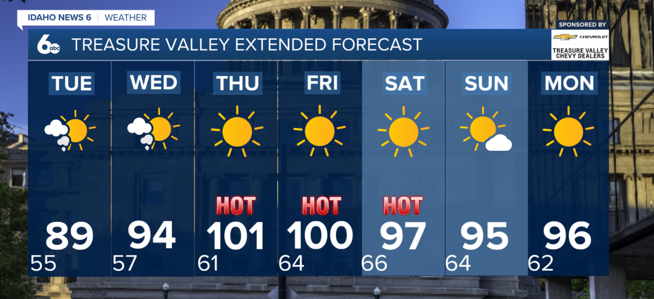
Smoky skies will continue to be one of the biggest weather concerns across southwest Idaho and eastern Oregon this week as wildfire smoke remains trapped over the region. While today brings a brief break from the heat, hazy conditions will persist, and additional smoke is expected to move in later today as winds shift to a more northerly direction.
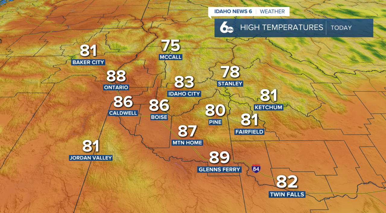
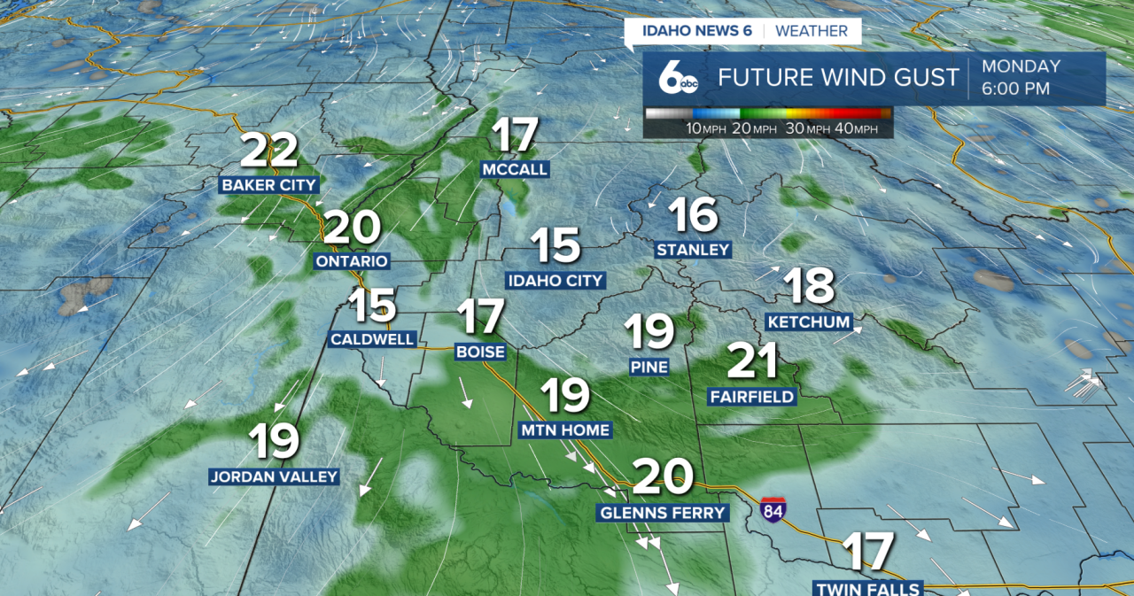
An upper-level disturbance that brought gusty winds overnight will move east through the afternoon, with wind gusts of 20 to 30 mph still possible east of Boise and through the Snake Plain. Those breezy conditions will gradually weaken by Tuesday as high pressure begins to rebuild across the Pacific Northwest and Great Basin.
As the ridge strengthens, temperatures will steadily climb through the middle of the week. After seasonable highs on Monday, lower valley communities will warm into the upper 90s Tuesday before nearing 100 degrees by Wednesday. The hot, dry pattern is expected to continue through at least the end of the workweek, with temperatures running 5 to 10 degrees above average.
Unfortunately, improving weather does not mean improving air quality. Smoke from ongoing wildfires across the Northwest is expected to continue impacting the region, with changing winds transporting additional smoke from large fires in Washington into southwest Idaho beginning Monday evening. Combined with lighter winds, widespread smoky conditions are expected to linger through much of the week.
Looking ahead to the weekend, forecast models suggest a weak upper-level trough could move through the Pacific Northwest. While rain is not expected at this time, the system could bring stronger winds, increasing fire weather concerns while smoky conditions continue across the region.