Early this morning both rain and snow have arrived to Idaho thanks to a wave of low pressure moisture moving into the region.
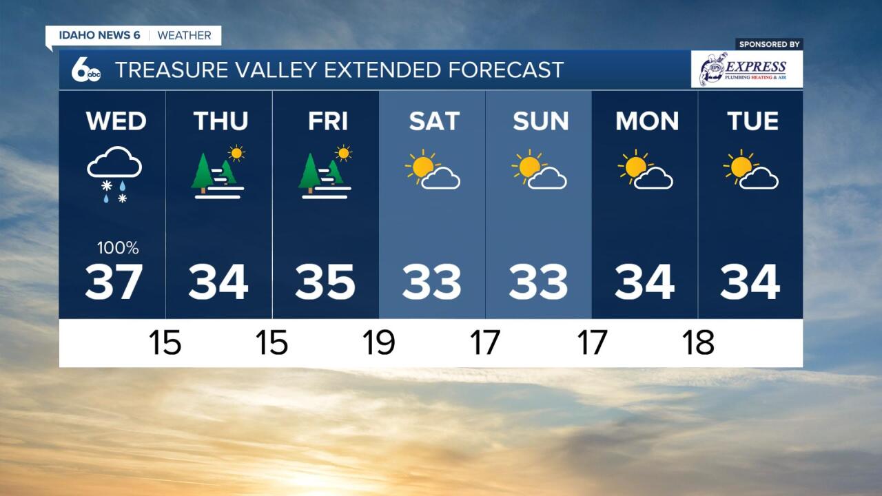
The chance of precipitation in the Treasure Valley is 100% today with the majority of the system clearing out of the area by 6PM tonight. The moisture will come down in the form of both rain and snow, so prepare for both. Temperatures will only be in the 30s today....pretty dang chilly!
Use lots of caution on the roads. It's often the first couple days we get more wintery conditions that are the most dangerous as drivers adjust to slick and slushy conditions.

There are multiple Winter Weather Advisories in effect in the area today. As this wintery weathermaker hits the area it could bring a few inches of snow to our valleys and 4-8+ inches to our mountain areas. These expire at different times today as the system exits the region.
The Winter Storm Warning is in effect for areas of the east central mountains. This is in effect until 11 PM. We'll see blowing snow and reduced visibility in this area with 3-8 inches of snow expected in the valleys below 6500 feet and 6-12 inches of snow expected above 6500 feet.
Here's what our model shows for 24 hour snow accumulation:
Snow accumulation expected in the next 24 hours here in southeast/central Idaho.
— Geneva Zoltek TV (@GenevaZoltek) November 9, 2022
The low pressure system bringing rain and snow to the 'Gem State' will exit the area around 6pm today. #Idaho #Boise #IDwx #TreasureValley #MagicValley pic.twitter.com/Pi48FfsyX3
On the whole, tonight's conditions will be much drier and calmer as a preview for tomorrow's weather. We'll wake up to some fog in some of our valleys including the Treasure Valley.
Temperatures for the remainder of the week will be frigid, only reaching the mid-30s in the Boise area - well below normal.