

Showers steadily move east through southern Idaho on Saturday.
This afternoon there is a small potential for isolated t-storms in eastern Oregon and south of the Treasure Valley near the Nevada border.
In the Treasure Valley, showers start in the early afternoon but expect heavier rain in the region this afternoon starting around 6 PM. Wind speeds could also increase through the afternoon with this activity. This system will ease up almost completely by early Sunday.
In the Magic Valley, showers will be isolated around noon - just a 20% chance of precip - that percentage will increase to 75% around midnight. By 6 AM Sunday, the heavy period of rain will be over, but a slight chance of showers will remain through the day.
In higher elevations, snow will fall with this active system. In central Idaho, we're talking about 6k ft in elevation. At the Nevada border, snow will accumulate even higher - above 7k ft high in elevation.
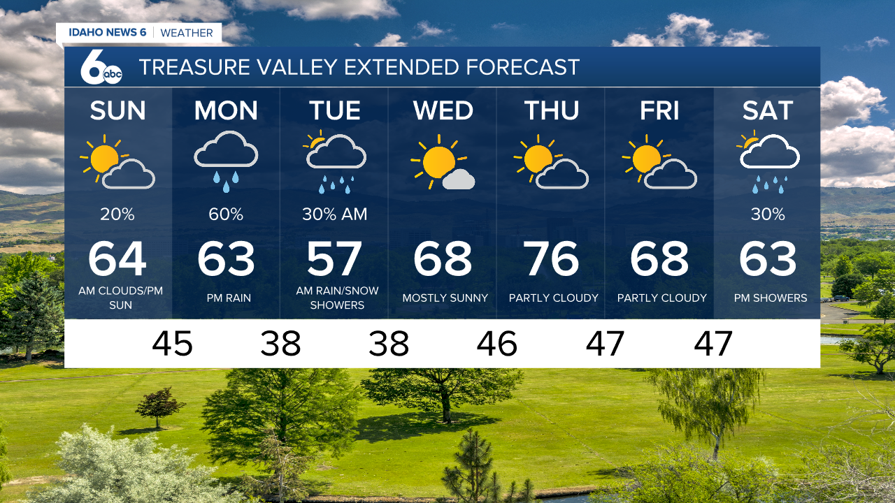
Temperatures will remain below normal through Monday with as this low-pressure activity sweeps through the area in several waves. Mid-50s and low-60s will be our highs over the next several days.