

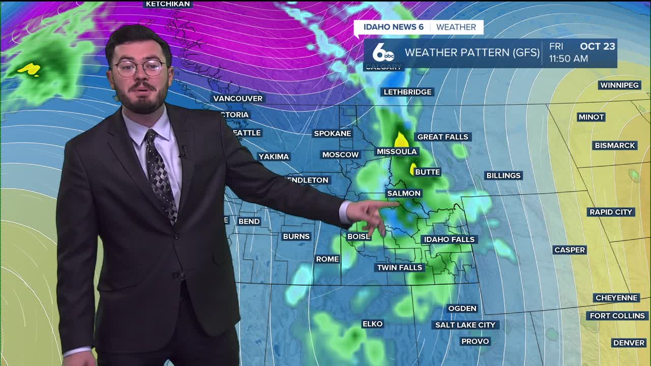


After a dry spell in the gem state, showers and thunderstorms are set to roll in Thursday followed by a major cool down.
Active weather is about to move into Idaho soon.
Rain moving in from the south will bring nearly an inch for some.
Mountainous regions will see the highest chance with areas like Pine and Idaho City getting near or above an inch.
Both valley floor locations are set for at least half an inch.
The Caldwell region is tracking to see lighter showers while eastern and northern Boise are set to see the wettest.
Rain continues into Friday but clears out in the evening where the focus turns from precipitation to how chilly it will become.
Idaho falls out of its comfortable 70s into the 50s as daytime highs for the valley floors. Mountains will see 60s go into 40s, and overnight lows for them fall into the 20s and even teens. The cool down sticks around over Saturday and Sunday with slightly warmer weather going into the work week.
As we change months, our weather outlook is trending towards average temperatures meaning we will stick to the cooler side of the forecast to close out this month. Precipitation outlook will stay average as well for southern Idaho in a first time in awhile dual average look.
Have a great Thursday but stay dry. Showers will shakeup the forecast.
BOISE FORECAST:
Today
Showers likely and possibly a thunderstorm after noon. Sunny during the morning, then mostly cloudy during the afternoon, with a high near 76. Southeast wind 6 to 15 mph, with gusts as high as 29 mph. Chance of precipitation is 70%. New rainfall amounts between a tenth and quarter of an inch, except higher amounts possible in thunderstorms.
Tonight
Showers likely and possibly a thunderstorm, then showers after midnight. Patchy fog between 9pm and 1am. Low around 46. East wind 5 to 13 mph becoming west after midnight. Winds could gust as high as 23 mph. Chance of precipitation is 90%. New precipitation amounts between a quarter and half of an inch possible.
Friday
Showers, mainly before noon. High near 56. Breezy, with a west northwest wind 15 to 20 mph, with gusts as high as 29 mph. Chance of precipitation is 90%. New precipitation amounts between a tenth and quarter of an inch possible.
Friday Night
Mostly clear, with a low around 36. Northwest wind 11 to 16 mph becoming light after midnight. Winds could gust as high as 25 mph.
Saturday
Patchy fog between 8am and 10am. Otherwise, sunny, with a high near 59. Light and variable wind.
Saturday Night
Mostly clear, with a low around 37.
Sunday
Sunny, with a high near 63.
Sunday Night
Partly cloudy, with a low around 40.
Monday
Sunny, with a high near 64.
Monday Night
Partly cloudy, with a low around 40.
Tuesday
Mostly sunny, with a high near 61.
Tuesday Night
Partly cloudy, with a low around 38.
Wednesday
Mostly sunny, with a high near 61.
