Good morning, Idaho!
A strong cold front is moving through the region today, bringing gusty winds and a noticeable drop in temperatures just one day after parts of the Treasure Valley reached the 90s.
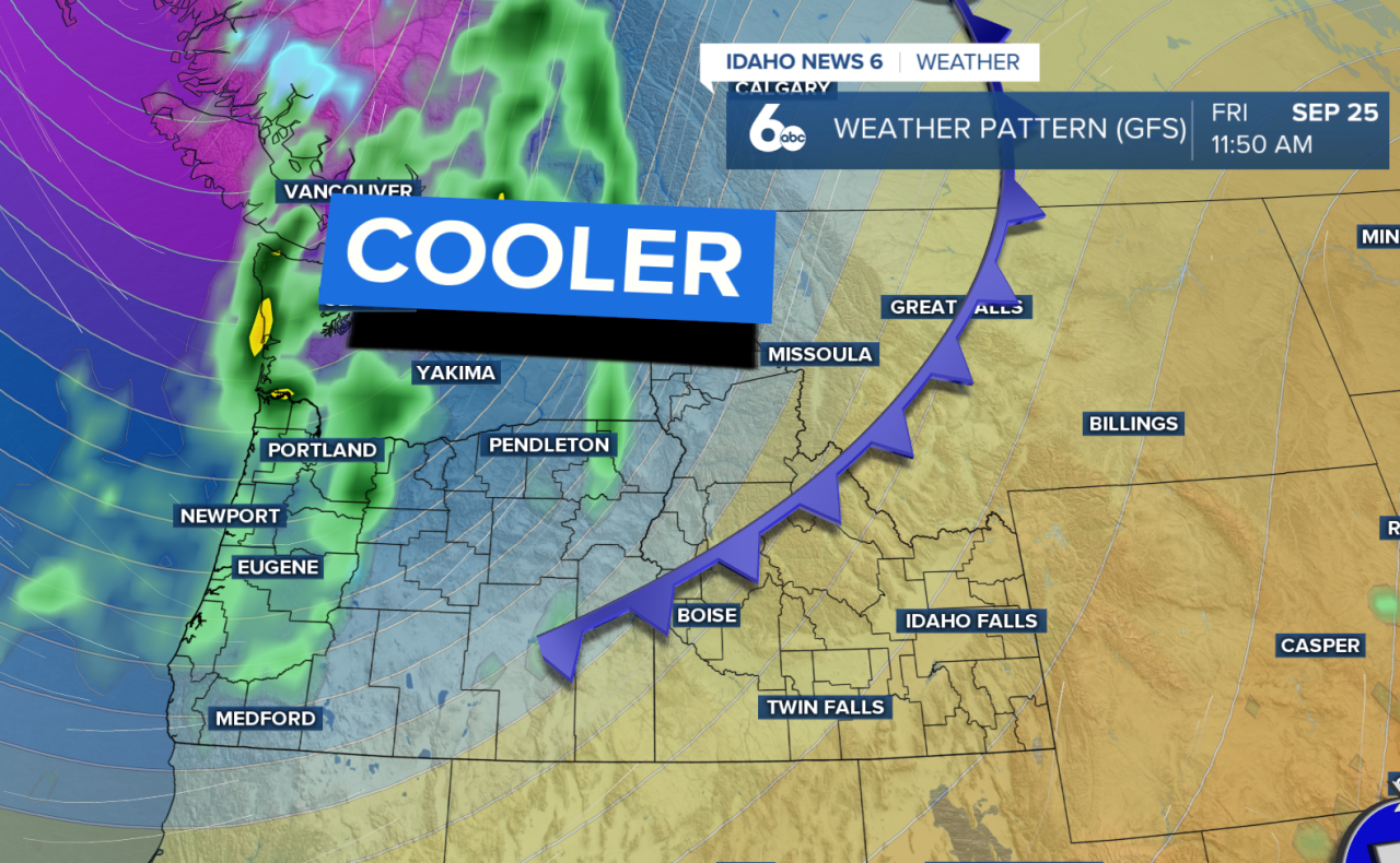
The front will move into eastern Oregon this morning before pushing across southwest and central Idaho this afternoon and evening. Winds will shift to the west and northwest behind the front, with widespread gusts of 25–35 mph. A few areas, including the Upper Treasure Valley and higher terrain, could see gusts near 40 mph.
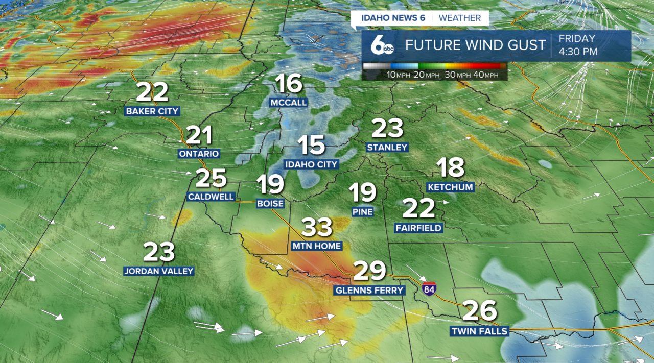
A few showers will also be possible as the front moves through, mainly across northeast Oregon and west-central Idaho. Rain chances remain fairly low, around 10–25%, so most locations will stay dry.
Temperatures will tumble behind the front. Eastern Oregon will see the biggest change today, with highs dropping as much as 15–20 degrees compared to Thursday. Southwest Idaho will cool by around 5–15 degrees today, with another drop expected Saturday.
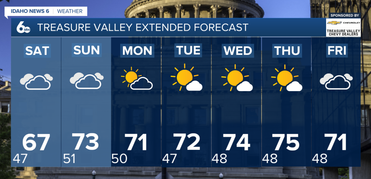
Saturday will be the coolest day of the weekend, with temperatures running around 10 degrees below normal. Winds will ease, but skies will remain mostly cloudy with cool and generally dry conditions.
Another weak system arrives Sunday, bringing a slight chance of showers near the Nevada border and across central Idaho. Otherwise, temperatures will begin to rebound.
Near-normal temperatures return by Monday and should stick around through much of next week. Another cooldown may arrive toward the end of the week, but for now, the forecast remains mostly dry.