

A broad ridge over the Western United States will lead to general warming through the week, with a warm front moving through northern portions of the area bringing scattered precipitation chances and rising temperatures.
Tonight Through Wednesday: Warm Front Arrival
A warm front strengthened by Pacific moisture will move through northern areas tonight and Wednesday, bringing precipitation chances of 70 to 90% in high terrain across northeast Oregon and west-central Idaho. Chances decrease quickly moving south, with only a 20% chance of precipitation in the upper Treasure Valley and Burns area.
The warm front will raise snow levels dramatically from 3,000 to 4,000 feet Wednesday morning to 7,000 to 8,000 feet by evening. Snowfall accumulation in northern areas is expected to be light, with about 0.5 to 2 inches in mountain valleys and 1 to 3 inches on ridges along with Tamarack and Brundage. Bogus Basin will get less than an inch.
Wednesday will see mostly cloudy skies with a 20% chance of rain before 11 a.m. and a high near 51 degrees. Winds will remain calm throughout the period.
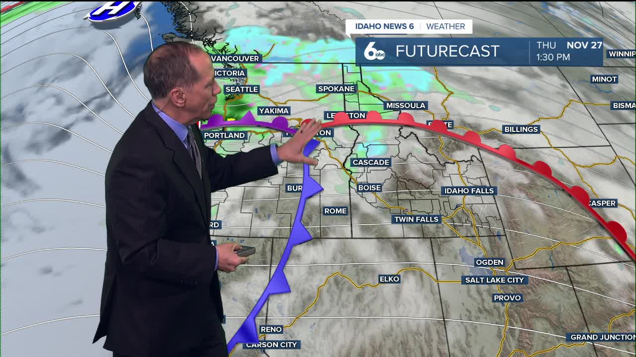
Thursday: Pleasant Conditions Expected
Thanksgiving Thursday will be drier than Wednesday and notably warmer, with temperatures rising 5 to 10 degrees above normal. The holiday will feature mostly sunny skies with a high near 56 degrees and calm winds becoming south-southeast around 5 mph.
Northern areas will still have a 20 to 40% chance of precipitation, but conditions across the Snake Plain should remain favorable for outdoor activities and travel.
The warm frontal inversion does introduce a 20 to 30% chance of fog and stratus formation Wednesday through Thursday, along with brief air stagnation possibilities. This means fog could affect flights at the Boise Airport on Wednesday and Thursday.
Weekend Outlook: Cooler Pattern Returns
A cold front will begin moving through Friday morning, bringing precipitation chances of 30 to 60% in higher elevations and 10 to 30% in lower elevations and valleys. Snow levels Friday will stay around 4,000 to 5,000 feet, gradually lowering to 2,500 to 3,500 feet Saturday.
Another weak disturbance and cold front will pass Saturday afternoon into evening, with precipitation chances returning for higher elevations and snow levels lowering further to 2,000 to 3,000 feet by Sunday.
Extended Forecast: Variable Conditions
A brief high pressure system will impact the area Monday, raising temperatures and bringing clearer skies. However, another shortwave trough will move through midday Tuesday, bringing precipitation chances once again with snow levels at 2,500 to 4,000 feet.
Temperatures will remain near normal through the period, with generally light wind gusts despite multiple cold frontal passages.
Daily Forecast:
Tonight: A chance of rain and snow after 11 p.m. Mostly cloudy, with a low around 36. Calm wind. Chance of precipitation is 30%. Little or no snow accumulation expected.
Wednesday: A 20% chance of rain before 11 a.m. Mostly cloudy, with a high near 51. Calm wind.
Wednesday Night: Mostly cloudy, with a low around 35. Calm wind.
Thursday: Mostly sunny & unseasonably mild, with a high near 56. Light SE breeze
Thursday Night: Partly cloudy, with a low around 34. Light and variable wind.
Friday: A 20% chance of rain before 11 a.m. Partly sunny, with a high near 48.
Friday Night: Partly cloudy & colder, with a low around 30.
Saturday: Partly sunny, with a high near 44.
Saturday Night: Mostly cloudy, with a low around 28.
Sunday: Mostly sunny, with a high near 42.
Sunday Night: Partly cloudy & colder, with a low around 26.
Monday: Mostly sunny, with a high near 44.
Monday Night: Partly cloudy, with a low around 30.
Tuesday: A slight chance of rain and snow. Partly sunny, with a high near 45. Chance of precipitation is 20%.
Stay connected right here for updates to my holiday travel forecast!