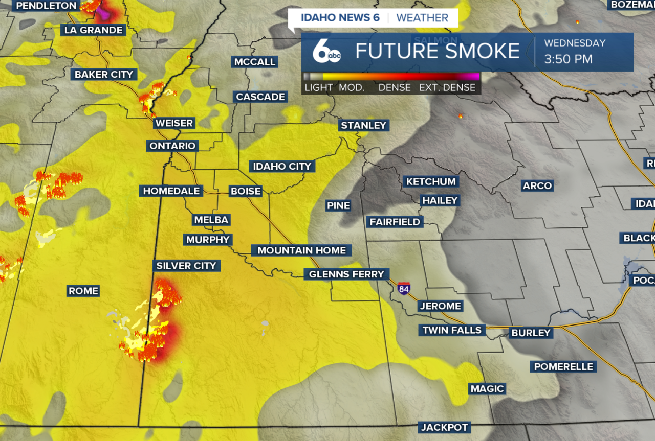
Hot and dry weather isn't going anywhere just yet. Wildfire smoke will remain the biggest weather concern across southwest Idaho and eastern Oregon through the end of the week, keeping skies hazy, reducing visibility, and leading to poor air quality. While temperatures will stay above average, the thick smoke may keep afternoon highs a few degrees cooler than they otherwise would be.

There is a slight chance for a few isolated thunderstorms this afternoon, mainly across the Magic Valley and the southern Idaho highlands. Any storm that develops could produce wind gusts between 40 and 50 mph, even if very little rain reaches the ground.
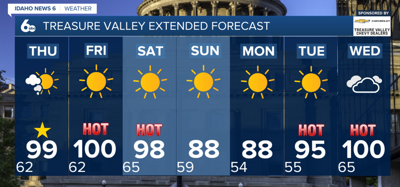
Friday remains hot, dry, and mostly quiet before the hottest day of the week arrives on Saturday. A dry cold front will move through Saturday night into Sunday, bringing stronger winds and very low humidity. That combination will create critical fire weather conditions and increase the risk for rapid wildfire growth.
Wildfire smoke
Many are wondering when the smoke will finally clear. Unfortunately, there isn't a clear answer just yet. The wildfires burning across Oregon continue to produce large amounts of smoke, and the current southwest wind pattern keeps transporting that smoke into southwest Idaho. While the dry cold front this weekend will shift winds more westerly and may help improve air quality somewhat, it won't completely clear the smoke. Without a stronger storm system, widespread rain, or significant containment of the ongoing wildfires, smoke is likely to remain part of the forecast into next week.
Extended Forecast
Behind the front, temperatures will cool by about 5 to 10 degrees on Sunday and Monday. Even with the slight cooldown, conditions will stay dry and breezy, keeping fire danger elevated. Warmer temperatures are expected to return by the middle of next week as high pressure builds back into the western United States.