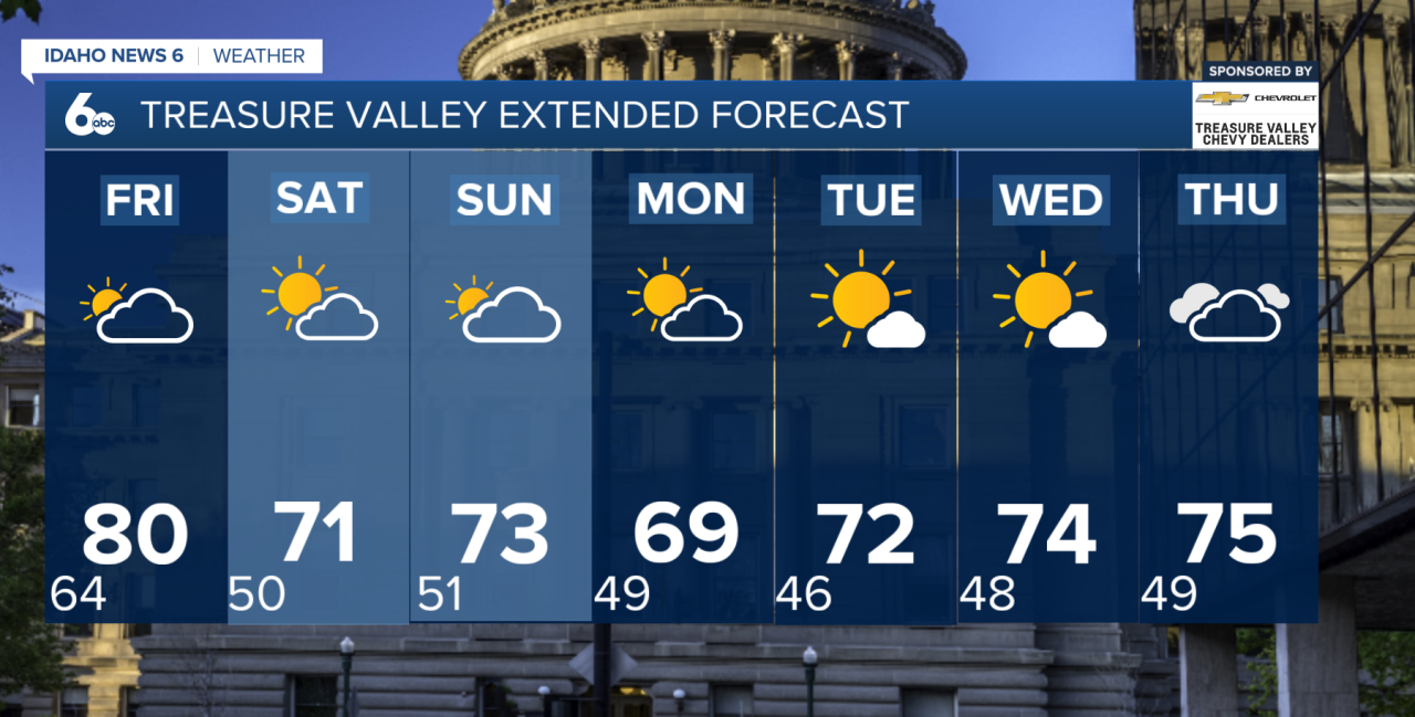
Thursday will be the hottest day of the week before a strong cold front brings a major change heading into the weekend.
Mostly sunny skies are expected today, with highs climbing into the lower 90s across the lower valleys. That puts temperatures around 15 degrees above normal for late September. Mountain valleys will reach the lower 80s, while much of southeast Oregon warms into the mid-80s.
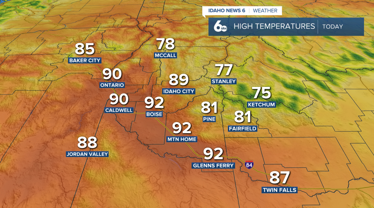
Winds will also increase this afternoon ahead of the approaching cold front. Gusts of 20–30 mph are expected across southeast Oregon and portions of the Snake Plain. The combination of hot temperatures, dry conditions and gusty winds will create elevated fire weather conditions, especially across the high desert.
Friday brings the big change. The cold front will move through southeast Oregon during the morning before crossing southwest Idaho during the afternoon. Winds will become much stronger, with widespread gusts of 25–40 mph possible from the morning through Friday evening.
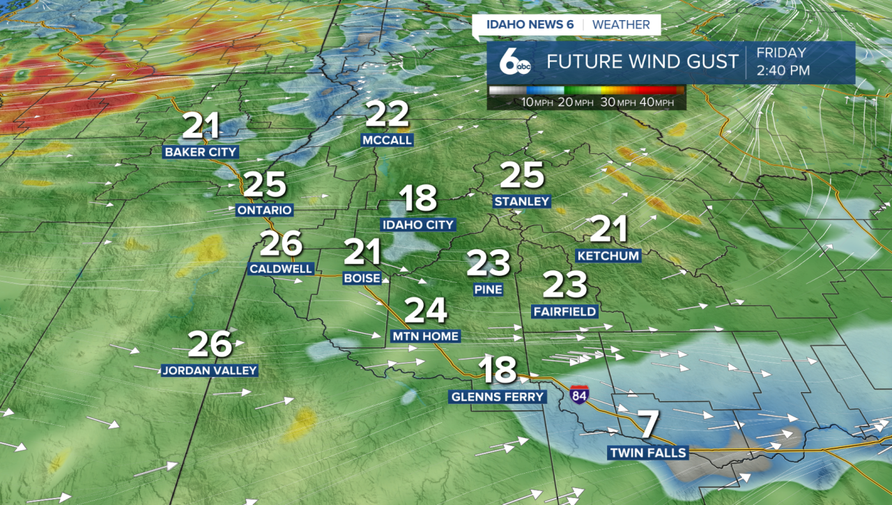
A few showers may develop behind the front, but most of the precipitation will stay north and west of the Treasure Valley. The best chance will be near the Blue Mountains and across portions of Adams, Washington and Valley counties.
Temperatures will tumble behind the front. Most of Idaho will cool by around 10 degrees Friday and another 10 degrees by Saturday. By Saturday, temperatures will go from around 15 degrees above normal today to 5–10 degrees below normal.
Cooler weather sticks around through the weekend. Another weaker cold front arrives late Sunday, bringing another round of breezy conditions and a 15–30% chance of showers, mainly across the higher terrain of southwest Idaho. Drier weather and a gradual warming trend are expected by the middle of next week.