
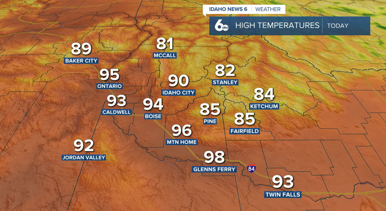
Southern Idaho will see another warm and dry day today as temperatures climb several degrees above normal under sunny skies. Highs across the Treasure Valley and Magic Valley will reach the upper 80s to mid-90s, with light easterly winds developing through the afternoon.
Most locations will stay dry, but a slight chance of thunderstorms exists near the Idaho-Nevada border this afternoon and evening. While any storms are expected to remain south of most populated areas, gusty outflow winds could spread into southern Owyhee and Twin Falls counties.
The warming trend continues Wednesday, with temperatures peaking around 10 degrees above normal before a gradual shift in the weather pattern begins late this week. Thursday will remain warm and mostly dry, although increasing moisture may spark a few showers and thunderstorms across the central Idaho mountains and near the Nevada border.
The biggest forecast story is the significant pattern change expected Friday through the weekend. A strong storm system moving south from the Gulf of Alaska will send a cold front through the region Friday, bringing widespread showers and thunderstorms by the afternoon and evening.
Much cooler and wetter weather is expected this weekend, with temperatures dropping 10 to 20 degrees below normal in some locations. Periods of showers and thunderstorms are expected Saturday and Sunday, and some higher elevations could even see late-season snow above 6,500 to 7,000 feet Saturday night into Sunday morning.
After several weeks of hot and dry weather, the weekend forecast is shaping up to bring a much-needed shot of moisture and a noticeable break from the summer heat.
