


Happy Friday, Idaho! Enjoy the summer-like warmth today because a cool-down is on the way. Temperatures will be hot this afternoon before a cold front brings cooler, breezy conditions for Saturday and Sunday.
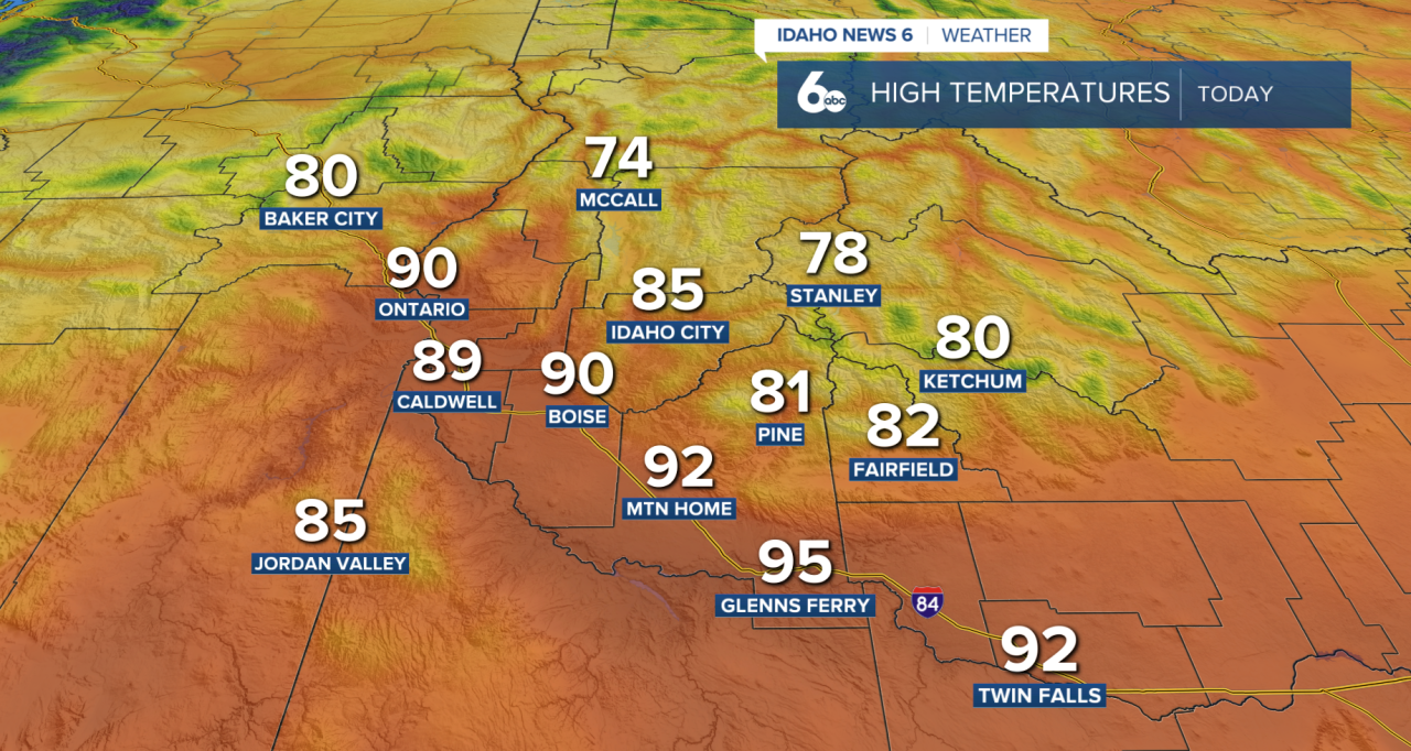
After a hot Friday afternoon, with highs in the upper 80s to lower 90s. A strong cold front will move through the region tonight into Saturday, bringing a noticeable drop in temperatures and increasing winds. While the front will bring more clouds, little to no rainfall is expected with its passage.
The biggest impact on Saturday will be the wind. Gusts could reach 35 to 40 mph across portions of the Snake River Plain southeast of Boise, making for a blustery afternoon and evening. Temperatures will also fall well below Friday's highs as cooler air settles into the area.
The cooler weather continues Sunday with breezy conditions lingering. A few showers will be possible across Valley County and the central Idaho mountains, where snow levels could drop to around 5,500 feet. While significant snow accumulation is not expected, travelers heading through higher elevations may encounter some wet snow showers.
By Monday, another storm system arrives from the Gulf of Alaska, bringing a much wetter pattern to the Northwest. Showers will develop Monday and become more widespread Tuesday and Wednesday. Several rounds of precipitation are possible during this period, and some locations could see meaningful rainfall totals by midweek.

The combination of clouds, showers, and cooler air will keep temperatures below normal through Wednesday. Mountain communities will see chilly mornings, with lows dipping into the 30s, while valley locations wake up to temperatures in the 40s.
A warming and drying trend is expected to begin Thursday as high pressure builds back into the region, setting the stage for more pleasant weather heading into next weekend.
