

Western Idaho is settling into a stable weather pattern as high pressure builds across the region, bringing clear skies to mountain areas while creating conditions for fog and temperature inversions in valleys. The weather will remain dry and calm through the extended forecast period.
Valley fog and inversions developing
High pressure is firmly established along the West Coast and building into the Intermountain West, stabilizing the atmosphere across the region. As skies clear and upper-level winds decrease, cold air will begin pooling in lower valleys tonight.
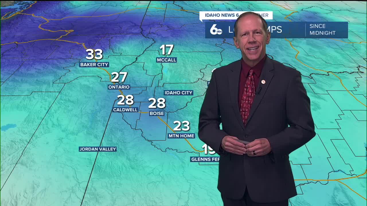
This setup creates ideal conditions for temperature inversions to develop, along with fog and low cloud formation. Valley fog is likely to develop late tonight and persist into Saturday morning, particularly affecting areas like the Magic Valley, Baker Valley, and Long Valley.
The stagnant atmospheric pattern will hold firm through the weekend, creating a stark contrast between valley and mountain conditions.
Mountain sunshine versus valley clouds
While mountain locations will enjoy abundant sunshine and moderating temperatures, valley areas will experience cooler conditions with limited atmospheric mixing. This inversion pattern means daytime highs in affected valleys will struggle to climb, while mid-slopes and ridge tops warm above seasonal averages.
The temperature difference between valleys and nearby higher elevations will be particularly noticeable, with some mountain areas potentially reaching temperatures 10-15 degrees warmer than valley floors.
Extended dry pattern continues
Dry and stagnant conditions will dominate through next week as high pressure remains persistent over the region. The blocking pattern will intensify as the high pressure system moves toward the Gulf of Alaska, continuing inverted and stagnant conditions through next Friday.
Cold pools will continue developing in sheltered valleys, bringing recurring chances of valley fog while keeping temperatures below normal in lower elevations. No precipitation is expected through the forecast period.
I may not be until January 20th before Idaho sees another chance to add to snow in our mountains.
Day-by-day forecast
Friday Night: Mostly clear with a low around 25 degrees. Calm wind.
Saturday: Mostly sunny with a high near 42 degrees. Light wind.
Saturday Night: Mostly cloudy with a low around 25 degrees. Light east wind.
Sunday: Mostly sunny with a high near 43 degrees. Light and variable wind.
Sunday Night: Partly cloudy with a low around 26 degrees. Calm wind.
Monday: Mostly sunny with a high near 43 degrees.
Monday Night: Partly cloudy with a low around 28 degrees.
Tuesday: Mostly sunny & milder with a high near 47 degrees.
Tuesday Night: Partly cloudy with a low around 29 degrees.
Wednesday: Sunny with a high near 47 degrees.
Wednesday Night: Mostly clear with a low around 28 degrees.
Thursday: Sunny with a high near 46 degrees.
Thursday Night: Mostly clear with a low around 27 degrees.
Friday: Sunny with a high near 45 degrees.
Stay connected right here for updates on when we can expect to see a return to snow.