

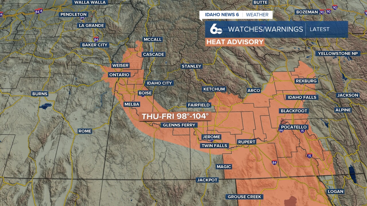


A Heat Advisory is in effect for the Treasure Valley, western Magic Valley, and Upper Weiser River Valley Thursday afternoon through Friday sunset as dangerous heat peaks near 100 degrees both days. A welcome pattern change will then arrive this weekend, bringing cooler temperatures and increasing thunderstorm chances for the mountains.
Sizzling summer heat continues in Scott Dorval's video forecast
Heat Advisory: Dangerous Conditions Thursday and Friday
The Treasure Valley will see highs near 100 degrees both Thursday and Friday under the Heat Advisory. Overnight lows will remain warm in the upper 60s to low 70s, providing only limited relief and increasing the cumulative heat stress on residents. Those most at risk include the elderly, young children, outdoor workers, and anyone without access to air conditioning.
Heat safety reminders:
- Stay hydrated by drinking water frequently, even if you don't feel thirsty
- Limit strenuous outdoor activities to the early morning hours
- Use air conditioning or visit a cooling center during the hottest parts of the day
- Never leave children, elderly individuals, or pets in parked vehicles
- Check on vulnerable neighbors and family members
Pattern Change Arrives Saturday: Cooler Temperatures and Mountain Storms
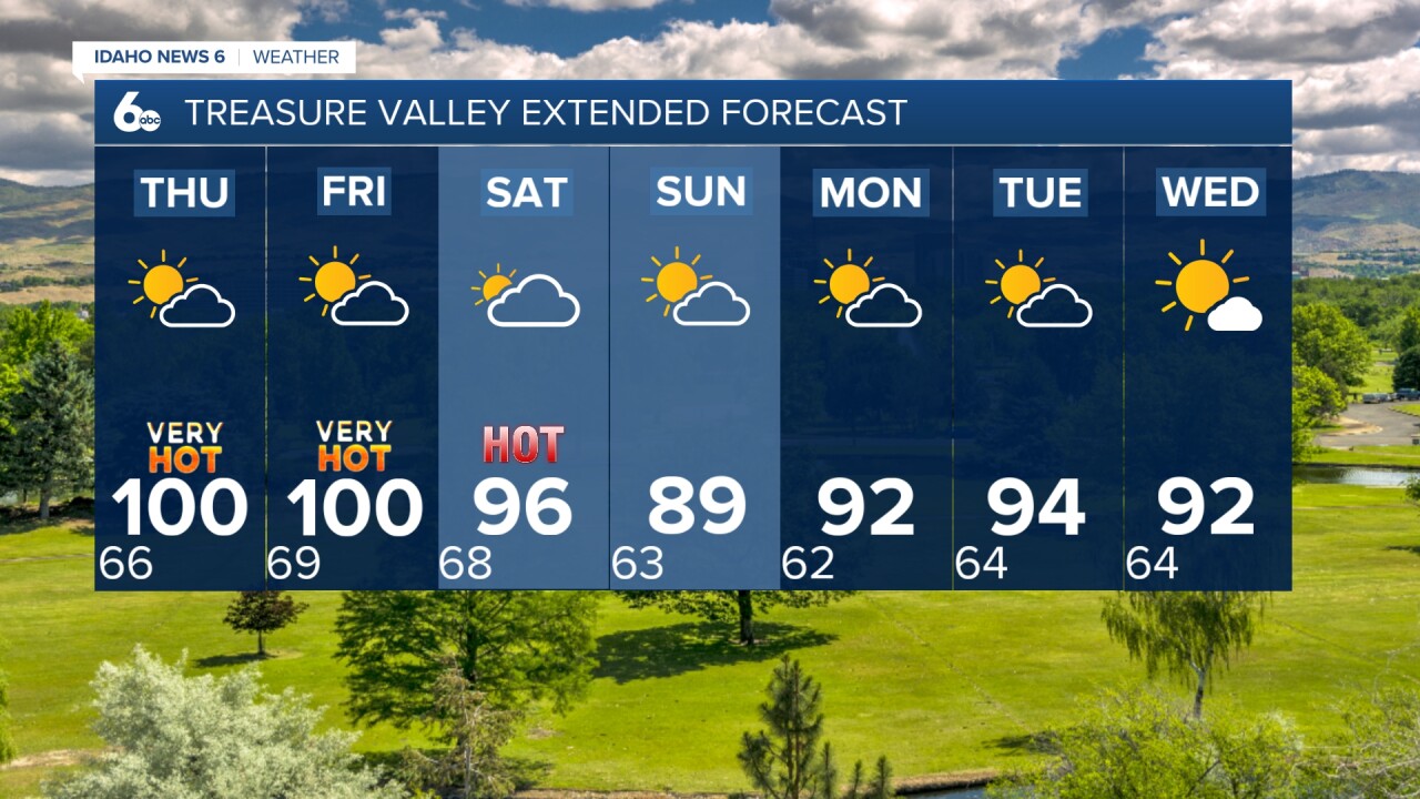
A significant pattern change will arrive Saturday as an upper trough moves across the Pacific Northwest, bringing a cold front and associated strong winds and increased thunderstorm chances. Wind gusts will increase to 20 to 35 mph across the area Saturday, with the strongest winds in southeast Oregon. Temperatures will drop noticeably, with the Treasure Valley falling to 96 degrees Saturday and a much more comfortable 89 degrees Sunday.
Weekend Travel Weather: Central Idaho Mountains
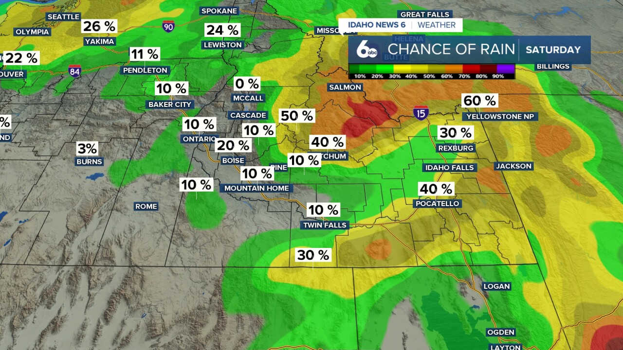
For those heading into the central Idaho mountains this weekend, conditions will be active. A 20 to 50 percent chance of afternoon and evening thunderstorms will develop across west-central and south-central Idaho Saturday, especially over the mountains. Storms could produce lightning, strong gusty winds, and brief heavy rainfall. Mountain communities should be prepared for rapidly changing weather conditions Saturday afternoon and evening.
Sunday will bring near-normal temperatures and a 10 to 20 percent chance of lingering showers and thunderstorms over south-central Idaho mountains. Conditions will be much more manageable than Saturday, but mountain travelers should still monitor conditions closely.
Looking Ahead to Next Week
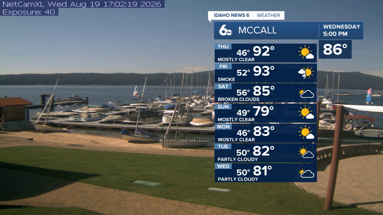
The Four Corners ridge will rebound next week, placing the region under southwest flow and driving temperatures back above normal. Highs will climb from 92 degrees Monday to 94 degrees Tuesday before moderating slightly Wednesday. Latent monsoon moisture circling the ridge will maintain a 10 to 20 percent chance of afternoon showers and thunderstorms over south-central Idaho mountains Sunday through Wednesday.
Tonight
Mostly clear, with a low around 65. Light wind.
Thursday
Sunny and very hot, with a high near 100. Light wind.
Thursday Night
Mostly cloudy, with a low around 68. Light wind.
Friday
Partly sunny and very hot, with a high near 100. Light and variable wind.
Friday Night
Mostly cloudy, with a low around 72. Breezy at times.
Saturday
Partly sunny and hot, with a high near 96. Breezy late in the day
Saturday Night
Partly cloudy, with a low around 64.
Sunday
Sunny & cooler with a breeze, with a high near 89.
Sunday Night
Partly cloudy, with a low around 61.
Monday
Mostly sunny and hot, with a high near 92.
Monday Night
Partly cloudy, with a low around 63.
Tuesday
Mostly sunny and hot, with a high near 94.
Tuesday Night
Partly cloudy, with a low around 64.
Wednesday
Mostly sunny and hot, with a high near 92.
