Good morning, Idaho!
Tuesday will bring a mix of clouds and sunshine across southwest Idaho, with most of the remaining rain showers concentrated in the lower Magic Valley, especially near the Idaho-Nevada border. A few light snow showers are also possible across higher elevations of the Owyhee Mountains and southern Idaho highlands, where snow levels will range from roughly 4,500 to 6,000 feet. Showers should gradually taper off by Tuesday evening as the storm system moves farther east.
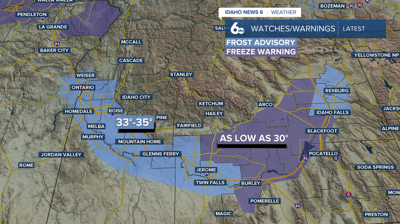
Meanwhile, cold morning temperatures are creating concerns for frost across the Snake River Plain. Frost Advisories remain in effect through late Wednesday morning, with temperatures dropping near freezing in some valley locations. Those with sensitive outdoor plants should take precautions to protect them from the cold.
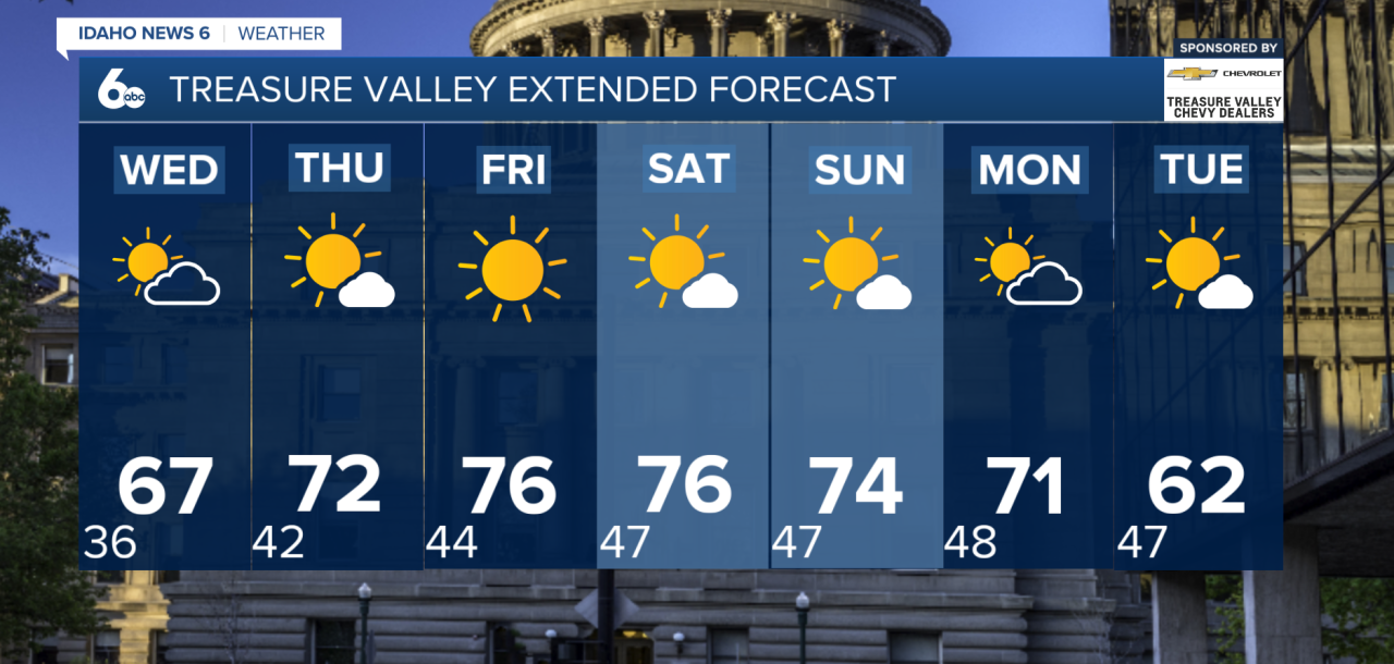
By Wednesday, high pressure will begin taking control of the region, bringing a return to dry weather, more sunshine and gradually warming temperatures. Afternoon highs will climb near or slightly above seasonal averages, especially across the lower Treasure Valley.
The warming trend will become more noticeable Thursday and Friday, with temperatures climbing 5 to 10 degrees above normal. Dry conditions and plenty of sunshine will continue into Saturday, making for a pleasant stretch of fall weather across much of southwest Idaho and eastern Oregon.
A weak cold front is expected to move through the region Sunday, bringing a slight cooldown. However, temperatures will likely remain above average through the beginning of next week. Clear overnight skies could also allow patchy morning fog to develop in some mountain valleys.
Looking farther ahead, another storm system may approach from the Gulf of Alaska late Monday into Tuesday, increasing the chances for rain and mountain precipitation across the region. While confidence is growing that a more unsettled pattern will return, uncertainty remains regarding how widespread and significant the precipitation will be.
For now, the biggest weather concerns are the chilly, frosty mornings Tuesday and Wednesday, followed by a stretch of warmer and drier fall weather heading into the weekend.