

The Treasure Valley faces another frosty night before enjoying ideal Saturday conditions, but Sunday brings the first significant weather change of the weekend with gusty breezes and a brief period of showers.
Frost Advisory Remains in Effect
Tonight will be the coldest of the recent stretch, with a shortwave ridge providing clear skies and efficient cooling. The lower Snake Plain will see temperatures drop into the 33-37 degree range, keeping the Frost Advisory in place through Saturday morning.
As we enter inversion season, an interesting temperature pattern will develop. Mountain areas will tap into warming air aloft, seeing high temperatures rise 2 to 5 degrees from Friday. However, sheltered mountain valleys and lower elevations may actually see temperatures remain unchanged or drop a couple of degrees from Friday's readings.

Saturday: Perfect Fall Day
Saturday offers ideal conditions with sunny skies and highs near 64 degrees. Light south winds will make it comfortable for any outdoor activities, from hiking to yard work to sporting events.
Saturday night will be milder with lows around 46 degrees, meaning no frost concerns for the Treasure Valley.
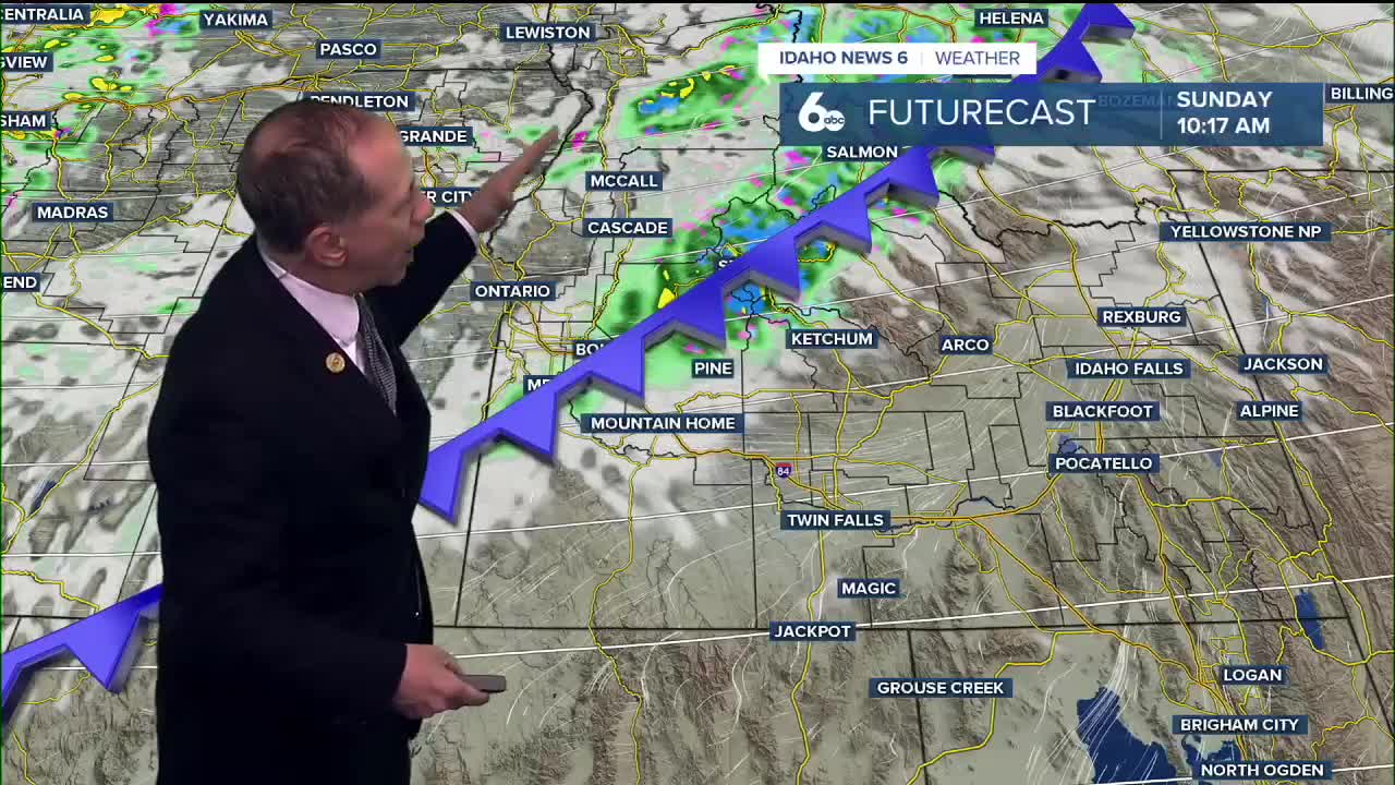
Sunday's Weather Shift
Sunday marks a notable change as a cold front approaches. The day starts partly sunny but conditions will deteriorate with an hour long period of showers developing late morning in Ada County (earlier to the west and later to the east.
The bigger story will be the wind. Southerly winds will pick up ahead of the front, especially across higher terrain where gusts of 20 to 30 mph are expected. The frontal passage Sunday midday brings a wind shift to west-northwest and increases gusts to 30 mph in the Treasure Valley.

Mountain Impacts
The central Idaho mountains will see higher precipitation chances of 60-90% Sunday, with snow levels dropping behind the front. Minor snow accumulations of less than 2 inches are possible above 6,500-7,000 feet.

Next Week Outlook
Monday will be noticeably cooler - about 5 degrees colder than Sunday - with sunny skies and highs near 59 degrees. Frost may return to sheltered spots Monday morning.
The rest of the week looks pleasant with temperatures gradually warming each day under generally stable conditions. Tuesday through Thursday will feature mostly sunny skies with highs climbing from the low 60s back to near 70 degrees by Thursday.
Friday introduces slight uncertainty as an atmospheric river impacts the Pacific Northwest. While most of the moisture will stay west of Idaho, there's a 20% chance of showers and gusty winds are likely Friday afternoon.

Daily Forecast
Tonight: ***FROST ADVISORY*** Mostly clear, with a low around 37 degrees. North wind around 5 mph becoming calm in the evening.
Saturday: Sunny & pleasant, with a high near 64 degrees. Light south wind.
Saturday Night: Mostly clear, with a low around 46 degrees. Calm wind becoming east 5 to 7 mph in the evening.
Sunday: Partly sunny with a 30% chance of late morning showers and a high near 64 degrees. West wind 5 to 10 mph becoming west northwest 12 to 20 mph in the afternoon with some higher gusts possible
Sunday Night: Mostly clear, with a low around 38 degrees and isolated frost. Diminishing wind.

Monday: Sunny with a bit of breeze and cooler temps. High near 59 degrees.
Tuesday: Sunny, with a high near 63 degrees.
Wednesday: Sunny & comfortable, with a high near 64 degrees.
Thursday: Mostly sunny and very pleasant, with a high near 68 degrees.
Friday: A 20% chance of showers later in the day. Partly sunny, with a high near 70 degrees.
Stay connected right here for updates to my extended forecast for next week!