

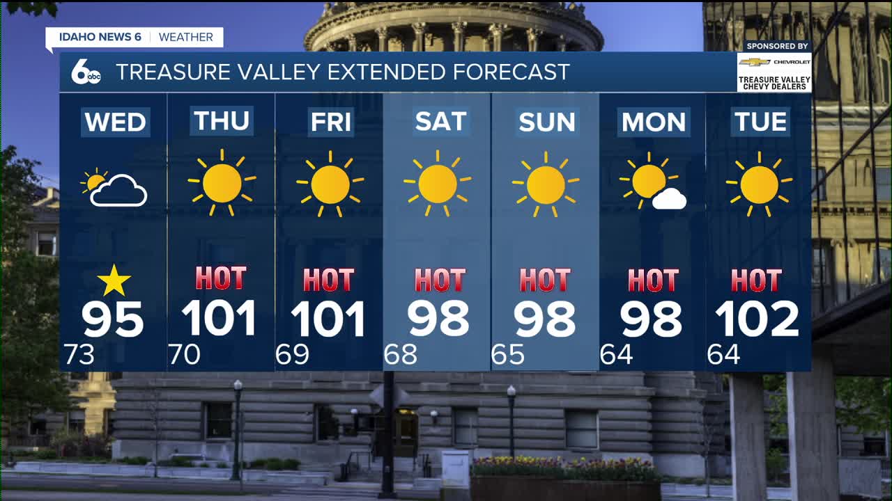


Hot temperatures remain in place across southern Idaho and eastern Oregon today, although a few extra clouds will keep temperatures a couple of degrees cooler than yesterday. Afternoon highs will still climb into the upper 90s to near 100 degrees across the lower valleys, with cooler temperatures in the mountains.

A few light showers are possible this morning, but the better chance for rain develops this afternoon and evening. Isolated to scattered showers and thunderstorms (20-40% chance) are expected mainly over the higher terrain, while valley locations have a much lower chance of seeing a storm. Any stronger storm could produce brief heavy rain, wind gusts up to 45 mph, and frequent lightning.

Air quality will continue to be impacted by wildfire smoke, especially during the morning and overnight hours. While smoke may thin out somewhat during the afternoon as daytime heating helps mix the atmosphere, northwest winds are expected to push more smoke from Oregon wildfires back into the region tonight. Air quality across the Treasure Valley has deteriorated into the unhealthy category, meaning everyone could begin to experience health effects, with sensitive groups at an even greater risk. It's a good idea to limit prolonged outdoor activity, keep windows closed when possible, and consider running an air purifier if you have one.
The greatest chance for storms arrives on Wednesday, especially across the central Idaho mountains, where storm chances increase to 40-80%. The atmosphere will be loaded with moisture, meaning storms will be capable of producing heavy rainfall, increasing the risk for flash flooding, particularly over burn scars and steep terrain, including the Wapiti burn area. Elsewhere, mountain locations have a 20-40% chance of storms, while valley communities remain below a 20% chance. Temperatures will also cool a bit, especially across the mountains.
By Thursday, moisture begins shifting east, allowing storm chances to drop to 10-20%. Valley temperatures climb back to near 100 degrees, with breezy southwest winds developing, especially across southeast Oregon. Smoke may still linger at times, though afternoon mixing should provide temporary improvements.
Looking to the weekend and early next week, expect a return to a hot, dry pattern. Storm chances remain low and mainly confined to the mountains and the Idaho-Nevada border. Afternoon highs stay in the upper 90s to around 100 degrees, with breezy conditions and periods of wildfire smoke continuing to affect air quality through much of the forecast.
Treasure Valley Extended Forecast

