

Valley fog and low clouds are slowly decreasing this afternoon and should be less extensive tonight, while a weak Pacific front approaches with light precipitation chances Thursday.
Tonight Through Friday: Front Weakens, Fog Returns
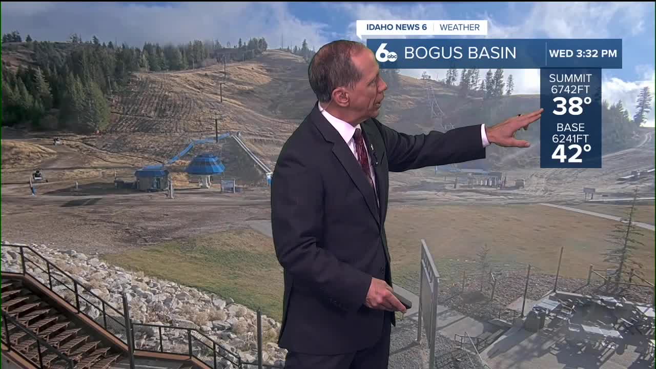
Valley fog and patchy low clouds that have persisted in recent days were slowly decreasing Wednesday afternoon and should be less extensive tonight than previous nights. A North Pacific cold front will move onshore late Wednesday, then weaken as it moves further inland, finally dissipating in eastern Oregon early Thursday morning.
The supporting upper-level trough will split, with the southern end becoming a closed low in California Thursday, while the northern portion continues eastward along the Canadian border. Light rain with the front will only reach as far east as Malheur County before the front dissipates. However, high-resolution weather models show another area of light rain in western Idaho Thursday, with amounts reaching 0.05 inches at most.
Drying conditions are expected Thursday night through Friday night as the closed low moves to southern California and the northern trough moves well east of the area. As the low and trough separate, an upper ridge will develop over the region Friday, gradually causing a temperature inversion in the valleys with more fog and low clouds returning.
High temperatures Thursday and Friday will continue running about 5 degrees above normal. Overnight lows will cool several degrees each night, returning to normal by Friday night. No significant winds are expected.


Extended Outlook: Ridge Dominates Weekend
A high-pressure ridge with weak northwest flow will keep temperatures moderated at 5 to 10 degrees above normal this weekend. Dry weather with partly cloudy skies and light winds is expected during this period.
The main uncertainty in the forecast involves low atmospheric mixing heights of 1,800 to 2,500 feet above ground level, which are borderline favorable for a temperature inversion to develop. Low clouds under an inversion would result in daily high temperatures colder than currently forecast, but the inversion has only a 20% chance of building.
Monday will see temperatures remain warmer than normal, but the region will be clipped by the southern end of a broad trough as it moves across the U.S.-Canadian border. This will bring a 20% to 30% chance of precipitation in high terrain, with snow above 5,000 to 6,000 feet.

The stronger northwest flow behind the trough will bring colder air Tuesday and Wednesday, with temperatures finally dropping to near normal for this time of year.
Daily Forecast
Tonight: Patchy fog between 8 p.m. and 11 p.m. Otherwise, increasing clouds, with a low around 39 degrees. Calm wind.
Thursday: Patchy fog before 11 a.m. A 30% chance of rain, mainly after 11 a.m. Otherwise, mostly cloudy, with a high near 50 degrees. Light wind.
Thursday Night: Patchy fog after 8 p.m. Otherwise, partly cloudy, with a low around 35 degrees. Light wind.
Friday: Areas of fog before 8 a.m. Otherwise, mostly sunny, with a high near 51 degrees. Light NW wind.
Friday Night: Mostly clear, with a low around 34 degrees. Light and variable wind.

Saturday: Mostly sunny, with a high near 52 degrees.
Saturday Night: Partly cloudy, with a low around 32 degrees.
Sunday: Mostly sunny, with a high near 52 degrees.
Sunday Night: Mostly cloudy, with a low around 36 degrees.
Monday: Partly sunny, with a high near 52 degrees.
Monday Night: Partly cloudy, with a low around 29 degrees.
Tuesday: Mostly sunny, with a high near 46 degrees.
Tuesday Night: Partly cloudy, with a low around 26 degrees.
Wednesday: Mostly sunny, with a high near 44 degrees.