

Dry air continues moving into the region this evening as a weak ridge builds over the area, setting the stage for a pleasant Friday before shower chances return this weekend and an active pattern develops into next week.
Mostly clear skies tonight will lead to one more relatively cool night before the warming trend takes hold. Friday will bring dry conditions with temperatures warming several degrees to near seasonal normals under mostly sunny skies, with west to northwest flow keeping just some high clouds streaming overhead.
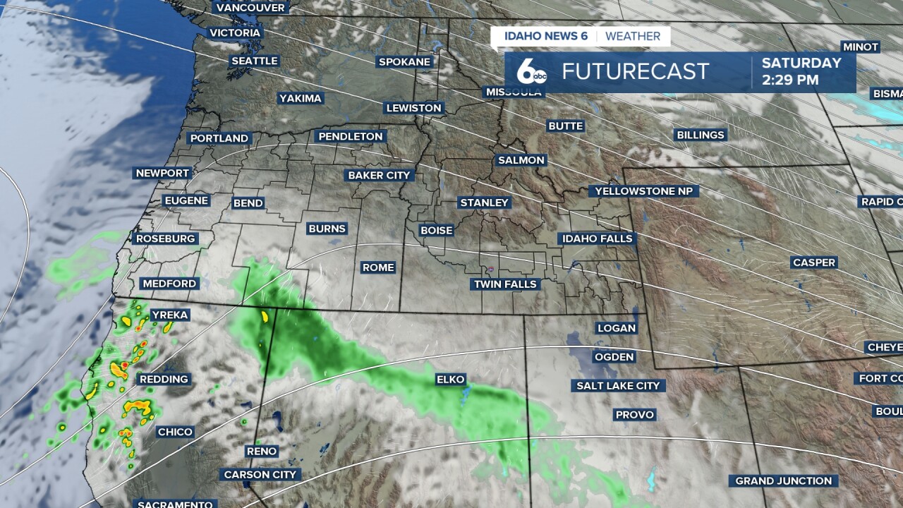
A weak system will approach from the west on Saturday, bringing increasing clouds by the afternoon. This system is expected to track across Oregon and into the Great Basin, bringing a 30 to 50% chance of showers Saturday night. Snow levels will be quite high with this system, ranging from 5,000 feet near Baker City and McCall to around 8,000 feet near the Nevada border, limiting any snow accumulations to the higher mountain peaks. Precipitation chances will taper off late Saturday night as the weak trough moves east.
The upper-level trough will move further inland into the Great Basin Sunday, keeping the region in southwesterly flow aloft with precipitation chances remaining at 30 to 50% through late Monday. The highest precipitation chances and totals for this system will be south of the Snake River Plain toward the Nevada border and across southeast Oregon. Some models indicate precipitation could linger until Tuesday morning depending on the speed of the system.
Brief upper-level ridging will build in Tuesday afternoon, bringing a sunny and warm day with temperatures reaching 61 degrees before another upper-level trough moves into the area early Wednesday. Elevated precipitation chances will return Wednesday with assistance from a weak cold front that brings temperatures back to near normal levels.
Mountain Snow Conditions for Ski Areas
The high snow levels with this weekend's system will limit fresh snowfall to only the highest mountain peaks, with most ski areas seeing rain rather than snow at base elevations. The brief ridging Tuesday will bring warm conditions before the Wednesday system offers another chance for mountain precipitation as temperatures cool with the approaching cold front.
Tonight
Partly cloudy, with a low around 33. Light and variable wind.
Friday
Mostly sunny, with a high near 57. Light and variable wind.
Friday Night
Partly cloudy, with a low around 34. Calm wind.
Saturday
Mostly sunny then increasing clouds, with a high near 59. Calm wind.
Saturday Night
A 30 percent chance of rain, mainly after 11pm. Cloudy, with a low around 40. Calm wind.
Sunday
A 40 percent chance of showers otherwise variable clouds & sun. Quite mild. High near 58.
Sunday Night
A 20 percent chance of rain. Mostly cloudy, with a low around 40.
Monday
A 30 percent chance of rain, mainly before 11am. Mostly cloudy, with a high near 59.
Monday Night
Mostly clear, with a low around 36.
Tuesday
Sunny & unseasonbly mild, with a high near 61.
Tuesday Night
Partly cloudy, with a low around 40.
Wednesday
A 50 percent chance of rain. Mostly cloudy, with a high near 57.
Wednesday Night
A 40 percent chance of rain. Mostly cloudy, with a low around 38.
Thursday
Mostly sunny, with a high near 55.