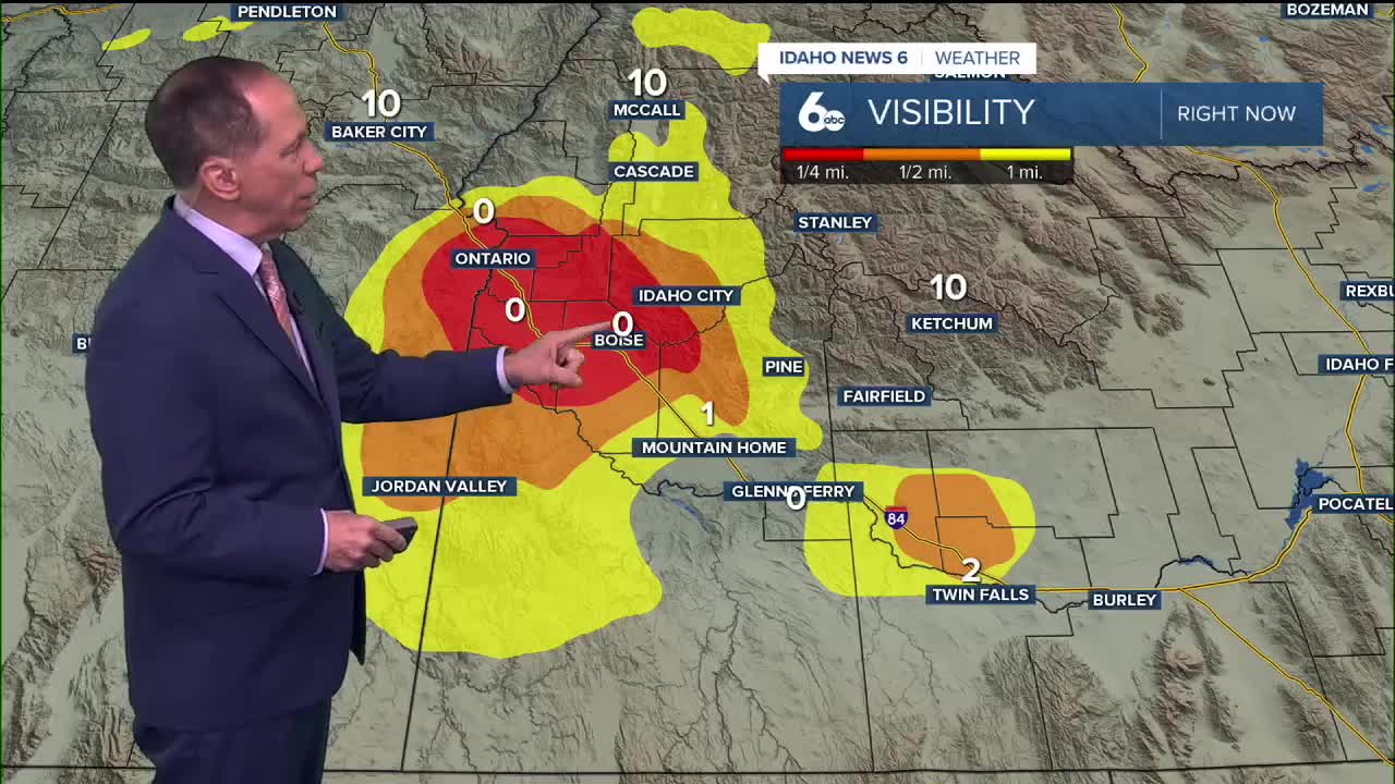


Dense fog and low stratus clouds continue to blanket the Snake Basin as a persistent upper-level ridge maintains stagnant atmospheric conditions across the region.
Fog and stratus clouds across the Snake Basin will persist with little improvement over the next several days. Meanwhile, areas outside the Snake Basin are experiencing mostly sunny skies with milder temperatures. Bogus Basin and other ski resorts have been in the 40s on Thursday.
Temperature impacts from persistent fog
I have lowered temperature predictions for the Snake Basin due to the ongoing fog and stratus cloud cover. However, above the inversion layer, temperatures remain around 10 degrees above normal for this time of year.
The dense fog is not limited to the main valley areas. Mountain valleys, including the Long Valley and Baker Valley, will experience areas of fog developing overnight every night over the next few days.

Extended weather pattern
The upper-level ridge will continue impacting the area into early next week, with the ridge axis shifting west enough to cause more northerly flow aloft. Weather models show the ridging pattern remaining in place at least through Tuesday afternoon, after which the ridge will weaken but still persist.
Relief from the persistent inversion may finally arrive Wednesday into Thursday, when an upper-level shortwave trough moves over the region. While precipitation amounts and trough intensity vary substantially across different weather models, forecasters agree this system should provide some relief against the current inversion pattern.
Snow chances return to higher elevations with this system, with approximately 30% probability on Thursday.

Daily forecast breakdown
Thursday Night: Areas of dense fog with otherwise mostly cloudy skies. Low around 26 degrees with calm winds.
Friday: Areas of dense fog continuing with otherwise partly sunny conditions. High near 35 degrees with south-southeast winds around 5 mph becoming calm in the afternoon.
Friday night: Patchy dense fog with mostly cloudy skies. Low around 26 degrees with calm winds.
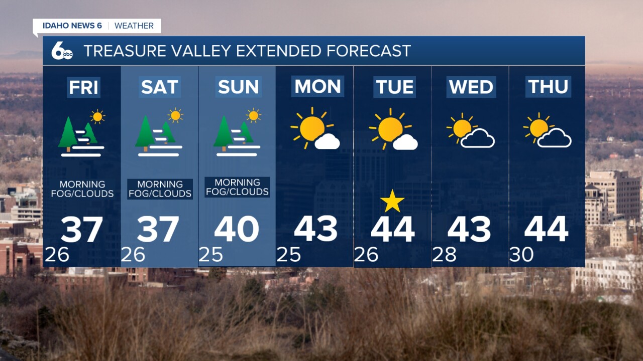
Weekend outlook: Dense fog areas continue Saturday and Sunday with partly sunny to mostly cloudy conditions. Highs near 36 degrees Saturday, climbing to 40 degrees Sunday.
Monday: Areas of dense fog before 11 a.m., then mostly sunny with a high near 43 degrees.
Next week: Conditions begin improving Tuesday with sunny skies and highs near 44 degrees. The pattern change arrives Wednesday into Thursday with mostly sunny to partly sunny conditions and continued highs around 44 degrees.