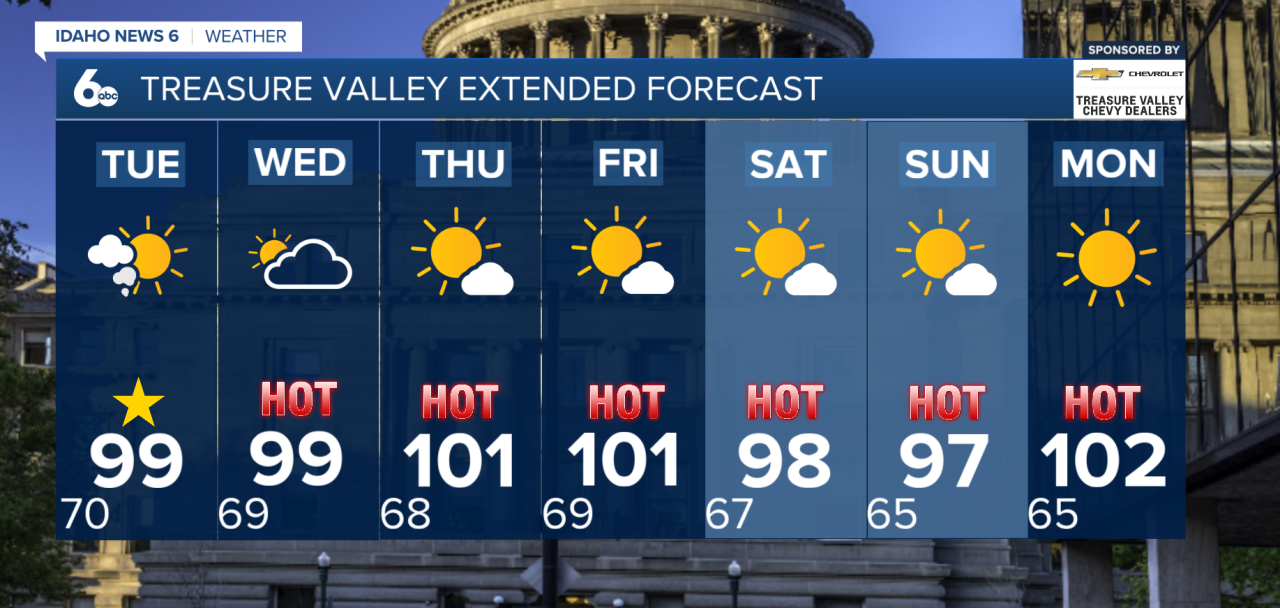
Good morning, everyone! Prepare for a hot and smoky start to the week.
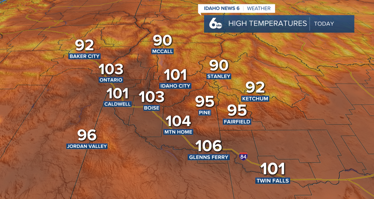
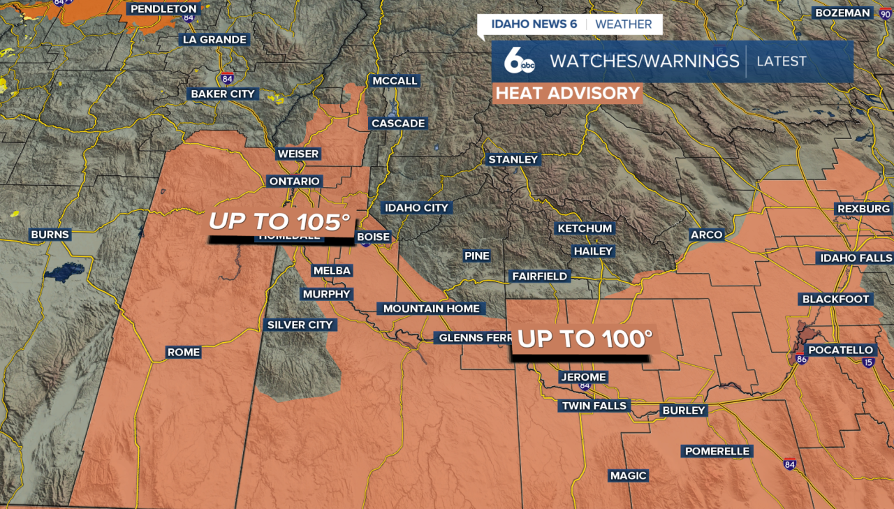
A Heat Advisory remains in effect today for parts of the Snake Plain and high desert as the hottest temperatures of the week settle into southern Idaho. Afternoon highs will climb into the upper 90s to around 105 degrees, while overnight lows will only fall into the upper 60s and low 70s, offering little relief from the heat.
Due to dangerous heat, a Heat Advisory is in effect from 12 PM to 9 PM today. The advisory has also expanded into portions of eastern Idaho. Limit time outdoors during the hottest part of the day, avoid strenuous activities if possible, stay hydrated, and check on vulnerable family members, neighbors, and pets.
Smoke from wildfires in Oregon will continue to impact air quality at times this week. While conditions may improve slightly during the afternoon, smoke is expected to become more widespread again during the evening and overnight hours. Overall, hazy skies and periods of dense smoke are likely to continue, especially later in the day. To check the latest air quality, click here
As the day progresses, monsoonal moisture will begin moving northward into the area. Expect increasing clouds with isolated to scattered showers and thunderstorms developing this afternoon and evening, mainly near the Idaho/Nevada border. Any storm could produce wind gusts up to 40 mph, along with brief heavy rain and lightning.
Storm chances continue to increase Tuesday, especially across the mountains, before becoming more widespread on Wednesday. Wednesday will bring the greatest chance for heavy rainfall as deeper moisture moves into the region. Slow-moving thunderstorms could produce locally heavy rain, creating a risk of flash flooding, especially near burn scars, slot canyons, and steep terrain.
Temperatures cool only slightly Tuesday and Wednesday but will remain well above average, with highs still in the 90s. Looking ahead, there is little relief from the heat. Highs will stay in the upper 90s through the weekend and into next week. Make sure to stay hydrated, limit strenuous outdoor activities during the hottest part of the day, and never leave children or pets inside parked vehicles.
What You Need to Do
- Stay hydrated and avoid strenuous outdoor activities during the hottest part of the afternoon.
- Never leave children or pets inside parked vehicles.
- Have multiple ways to receive weather alerts if you'll be outdoors, hiking, or camping this week.
- If thunderstorms develop, head indoors immediately. Heavy rain can quickly lead to flooding near burn scars and in low-lying areas.
Treasure Valley Extended Forecast