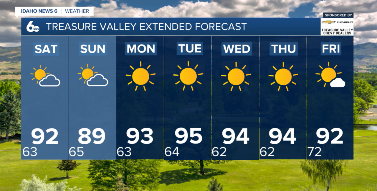


We have made it to the weekend with a number of events happening across Idaho that are outdoors and chances of thunderstorms are expected to move in.
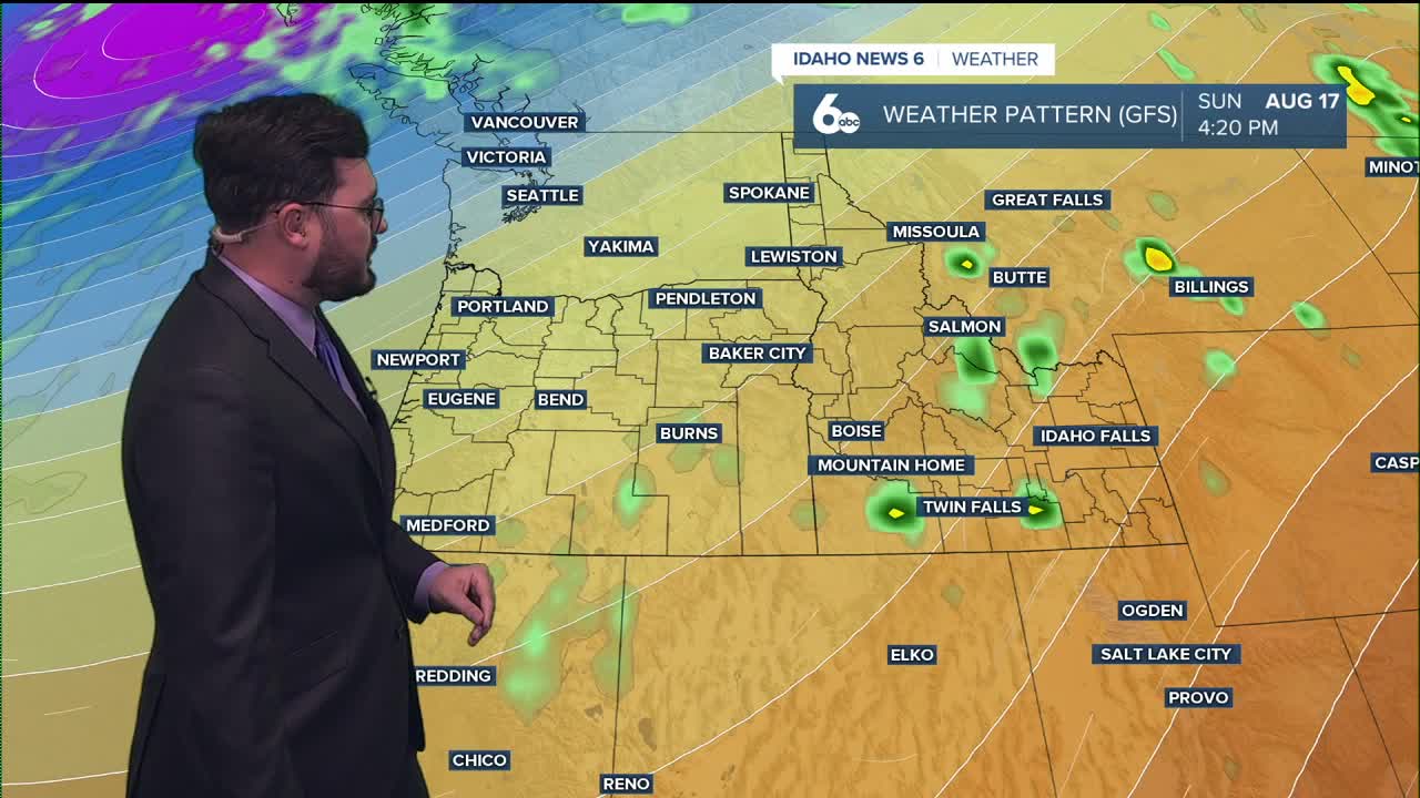
Saturday night is seeing some late afternoon activity moving in. First going over Ontario and then moving into the Boise area. Chances are sitting at only 20% but we will keep an eye out for it.
Sunday nigh will see more scattered activity and not much is developing over the Treasure Valley. again just a 20% chance but still enough to keep watch.
Temperatures consistently sit in the low 90's through Sunday with a climb going into the work week. Tuesday is looking at mid to upper 90's as the high in Boise which means there is a shot at triple digits for surrounding area.
Enjoy the nice weekend ahead!