


As of 10:30 p.m. moderate rain is impacting Boise and Eagle after hail up to 1" in diameter roared across the area. Thunderstorms with frequent lighting continue to impact Glenns Ferry and the Wood River Valley. The lightning threat will diminish overnight but several rounds of showers will push through southwest Idaho. Click here for the latest radar.

An approaching cold front will continue to trigger widespread showers & storms from eastern Oregon through southwest and central Idaho through Wednesday night and even into Thursday.

Showers and storms will continue through Wednesday night with heavy downpours at times.
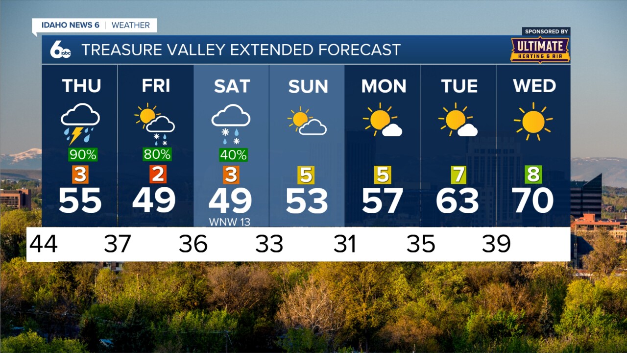
As we head into Thursday, the front will stall leaving periods of heavy rainfall in the area. Thunderstorms are also still likely. Models are predicting up to an inch of rain in the Treasure Valley through Thursday night. Be careful on your commutes in the next couple of days as heavy rain will cause isolated slowdowns on the interstate.

As we head into the weekend the wet and rainy weather pattern will last through Saturday morning with snow showers even possible in the valley. Drier conditions return Saturday afternoon and Sunday with temperatures remaining below average through Tuesday.
Stay up to date here and on my Facebook Page for updates to my forecast for potential severe weather.