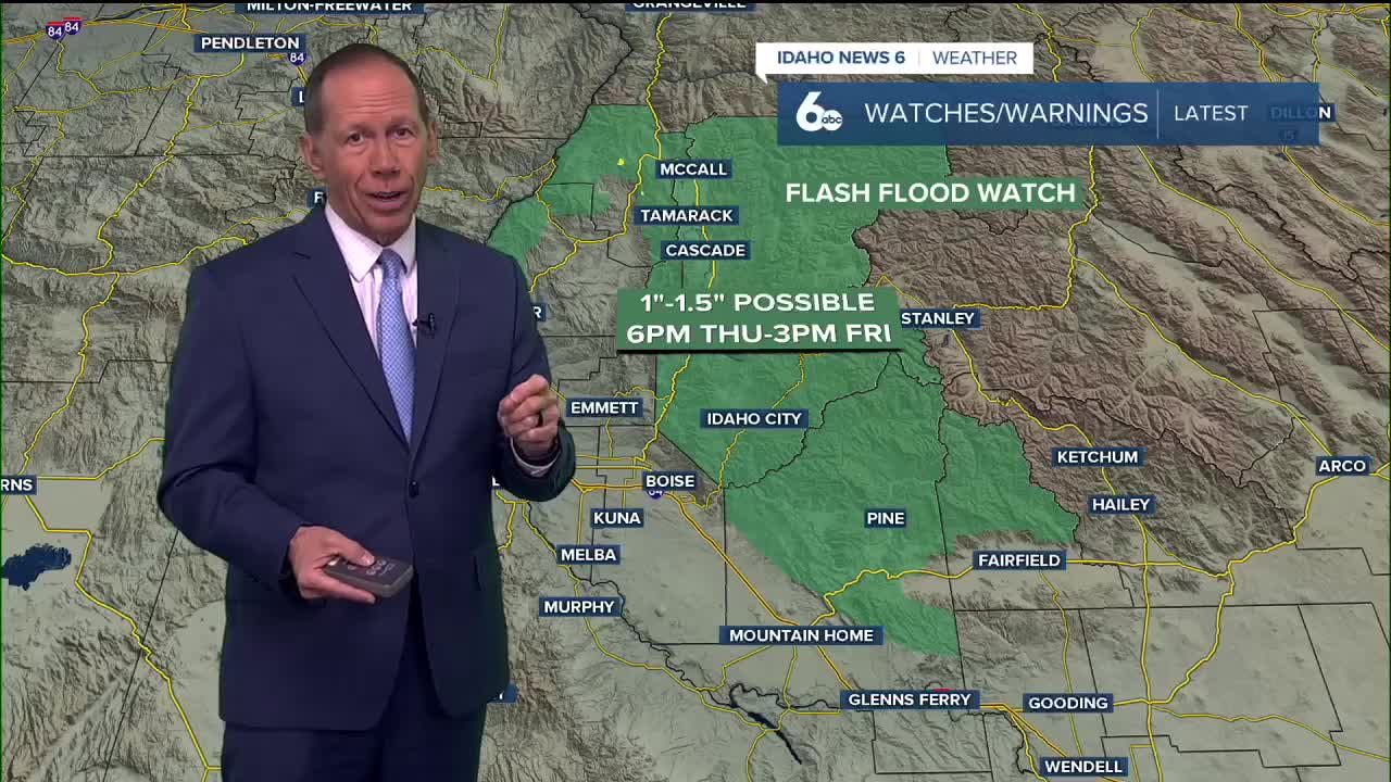


After a partly cloudy, breezy and seasonable Wednesday, we can expect more of the same on Thursday as an upper-level low begins to slide east, pushing a front into the region. That front will stall for a time, setting up a narrow band of heavier rain. The corridor most favored stretches from near the Oregon–Idaho–Nevada border up through Mountain Home into the Boise Mountains along with parts of the central mountains south and east of McCall.

In this zone, some spots could pick up 1"-1.5" of rain, while others just outside the band see much less — a small shift in the front’s position could make a big difference- this is what we will continue to watch for.
The Boise area could experience heavier rain after midnight on Thursday night into early Friday morning, followed by showers tapering off before midday, and breezy afternoon conditions with chilly temperatures.
Friday brings the low farther east, with showers tapering off from west to east. Behind the front, cooler air settles in with highs only in the mid-60s in the valleys and mid-50s in the mountains — about 5 to 10 degrees below average. Gusty northwest winds kick in Friday into Saturday, especially along the I-84 corridor, where 25–35 mph gusts are possible.
Sunday stays cool, but the breeze will settle down. As we head into early next week, conditions trend drier with a gradual warm-up back toward seasonal norms.
Check out where the Flash Flood Watch has been issued in my latest video forecast
Wednesday Night
Partly cloudy, with a low around 55. Diminishing wind.
Thursday
Partly sunny with a chance of showers, with thunderstorms also possible after noon., with a high near 71. Light wind. Chance of precipitation is 30%.
Thursday Night
Mostly cloudy with some heavier rain developing from Meridian east and a low around 52. Light wind. Chance of precipitation is 70%. New precipitation amounts between a quarter and half of an inch are possible.
Friday
Showers likely, especially in the morning, with thunderstorms also possible after noon. Areas of fog before noon. Otherwise, mostly cloudy & unseasonably chilly, with a high near 62. Light morning wind will increase from the NW to 10-20mph with higher gusts possible as sunshine increases. Chance of precipitation is 60%. New rainfall amounts between a tenth and quarter of an inch, except higher amounts possible in thunderstorms.
Friday Night
A chance of showers and thunderstorms before midnight, then a slight chance of showers. Partly cloudy, with a low around 46. Gusty NW wind still possible. Chance of precipitation is 30%.

Saturday
Mostly sunny, breezy & continued cool, with a high near 64.
Saturday Night
Mostly clear, with a low around 42.
Sunday
Mostly sunny with lighter wind, with a high near 63.
Sunday Night
Mostly clear, with a low around 42.
Monday
Sunny, with a high near 65.
Tuesday
Sunny, with a high near 68.
Wednesday
Sunny, with a high near 69.
Keep checking back right here for updates on where this next storm will hit the hardest.