



After last weekend's dramatic cold front and cooldown, the Treasure Valley is in for a stunning stretch of early fall weather this week, with sunny skies, light winds, and temperatures climbing back to near normal by Wednesday. The weekend ahead looks equally impressive, making this one of the finest stretches of September weather in recent memory.
Pleasant weather gives way to mountain showers by Thursday in Scott Dorval's video forecast
Tuesday and Wednesday: Near-Perfect Fall Conditions
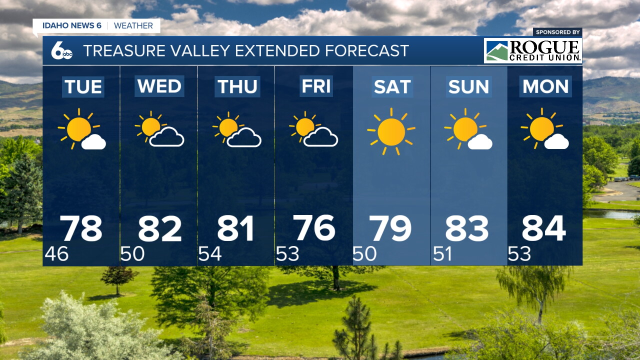
Tuesday will bring sunny skies and a high near 78 degrees, running just slightly below the normal high of around 82 degrees for mid-September in Boise. Wednesday will be even better, with sunny skies and a high near 82 degrees, right at seasonal normals. Light winds both days will make conditions feel absolutely ideal for outdoor activities.
The timing could not be more fitting. The official start of astronomical fall, the autumnal equinox, arrives on Tuesday, September 22 at 8:29 p.m. MDT. While that date is still a week away, the Treasure Valley is already experiencing the kind of crisp, clear, and comfortable weather that defines the best of the fall season. Boise's average high for mid-September is around 82 degrees, and the combination of sunny skies, light winds, and comfortable temperatures this week will make for some of the finest outdoor conditions of the entire year.
Patchy Frost in Mountain Valleys Tonight
Cold temperatures tonight will bring patchy frost to sheltered mountain valleys, with lows dropping to around 5 degrees below seasonal averages. Gardeners and agricultural interests in mountain communities like McCall and the Sawtooth Valley should take precautions to protect sensitive vegetation tonight.

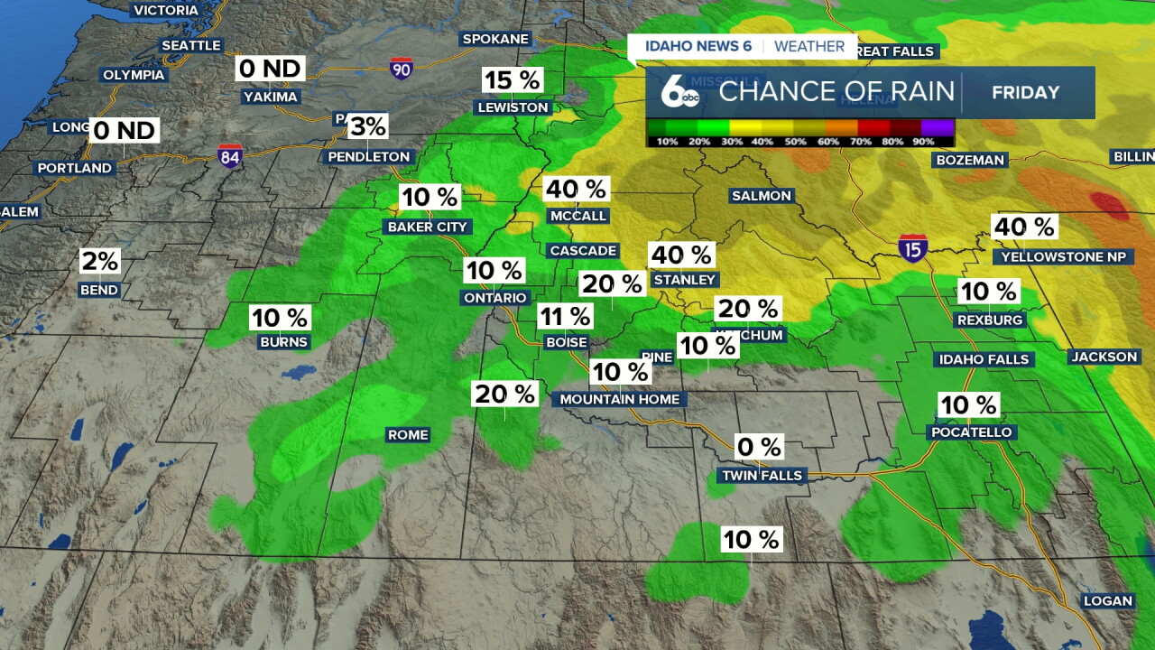
Midweek Shower Chances: Thursday and Friday
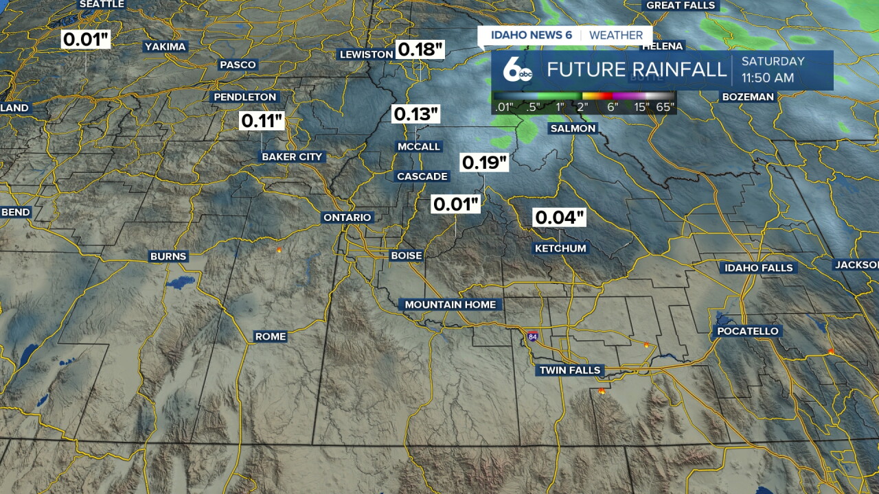
A cut-off low pressure system forming over western Oregon will bring increasing cloud cover and precipitation chances to the region Thursday and Friday. The west-central Idaho mountains will see the highest precipitation chances at 50 to 70 percent, while the Treasure Valley will see a slight chance of showers Thursday afternoon and a 20 percent chance Friday morning. These will not be significant rain events for the valley, and conditions will clear quickly heading into the weekend.
Weekend Recreation Forecast: Outstanding Conditions
The weekend ahead looks spectacular for outdoor activities across the Treasure Valley and central Idaho mountains. After the midweek shower chances clear out, an upper-level ridge will build into the Northwest, bringing a clearing and warming trend.
Saturday: Sunny skies and a high near 79 degrees with mostly clear skies overnight. Outstanding conditions for any outdoor activity.
Sunday: Sunny skies and a high near 83 degrees. One of the warmest and most beautiful days of the entire fall season.
This weekend's weather will be exceptional for popular fall events and outdoor activities in the Treasure Valley and surrounding areas:
- Outdoor festivals and events: Saturday and Sunday will be picture-perfect for any outdoor gathering, festival, or community event. Sunny skies, temperatures in the upper 70s to low 80s, and light winds create ideal conditions.
- Hiking and trail running: The Boise Foothills, Table Rock, and Camel's Back Park will be spectacular under sunny skies with comfortable temperatures. The recent rainfall has settled the dust and improved trail conditions dramatically.
- Cycling: The Greenbelt and surrounding bike paths will be in excellent condition with ideal temperatures for long rides.
- Golf: Conditions will be near perfect Saturday through Monday with sunny skies and temperatures in the upper 70s to low 80s.
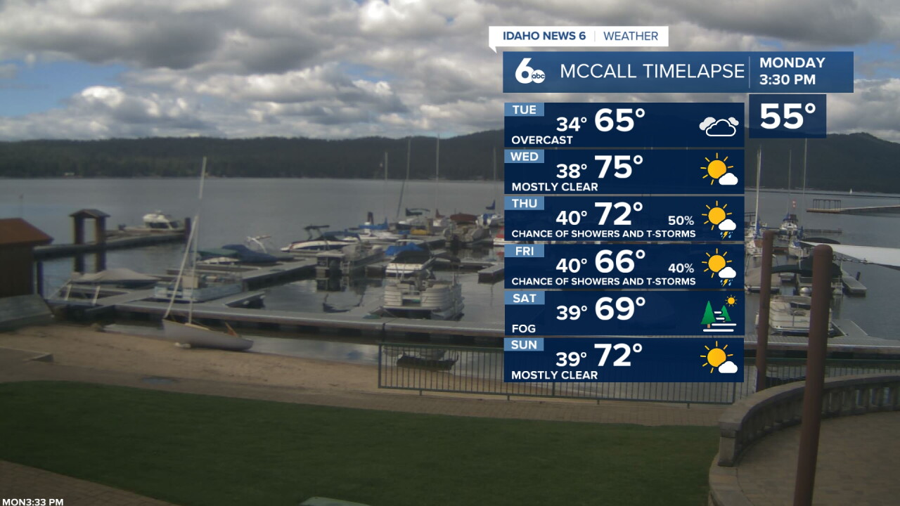
- Fall foliage viewing in the central Idaho mountains: The combination of last week's cold front and the recent significant rainfall has accelerated the fall color change in the mountains. This weekend will be an outstanding time to visit the Sawtooth Valley, Payette River corridor, and the mountains around McCall for early fall foliage viewing. Temperatures in the mountains will be comfortable in the mid to upper 60s Saturday and climbing to the low 70s Sunday and Monday.
Looking Ahead: Another Unsettled Pattern Possible
Models are split on the forecast starting next week, but a return to another unsettled pattern looks to return after the warm and dry weekend. Residents should enjoy the exceptional weather this week and weekend while it lasts.
Tonight
Mostly clear & chilly, with a low around 47. Diminishing breeze.
Tuesday
Sunny & pleasant with some afternoon clouds increasing, with a high near 78. Light wind.
Tuesday Night
Partly cloudy, with a low around 51. Light wind.
Wednesday
Sunny & seasonably warm, with a high near 82. Light wind.
Wednesday Night
A 20 percent chance of showers after midnight. Partly cloudy, with a low around 57. Light wind.
Thursday
Mostly sunny with a slight chance of showers, with thunderstorms also possible after noon and a high near 81. Chance of precipitation is 20%.
Thursday Night
A 20 percent chance of showers after midnight. Partly cloudy, with a low around 54.
Friday
Mostly sunny with a 20 percent chance of showers before noon and a high near 76.
Friday Night
Mostly clear, with a low around 51.
Saturday
Sunny & pleasant, with a high near 79.
Saturday Night
Mostly clear, with a low around 52.
Sunday
Sunny & warmer, with a high near 83.
Sunday Night
Mostly clear, with a low around 53.
Monday
Sunny, with a high near 84.
