Counties of southern Idaho are under a Severe Thunderstorm Watch through 8PM this evening. Expect active weather that includes stronger t-cells with hail and severe gusts up to 50-75 mph. This likelihood is particularly high across southcentral Idaho and includes the western Magic Valley.
A Severe Thunderstorm Watch has been issued for Boise, Elmore, Camas, Gooding, Jerome, and Twin Falls counties until 8 PM MDT this evening. Threats include hail up to quarter size, gusts up to 75 mph, and frequent lightning possible. #IDwx https://t.co/s2a4TxfyKv
— NWS Boise (@NWSBoise) September 21, 2022
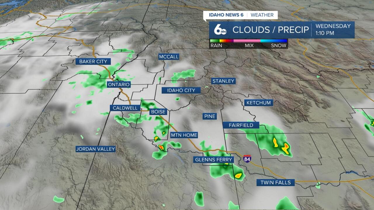
Overnight and through tomorrow morning this closed-low system will continue to drop rain through the central mountains of Idaho. This region could continue to see the threat of thunderstorms throughout the day and strong rains.
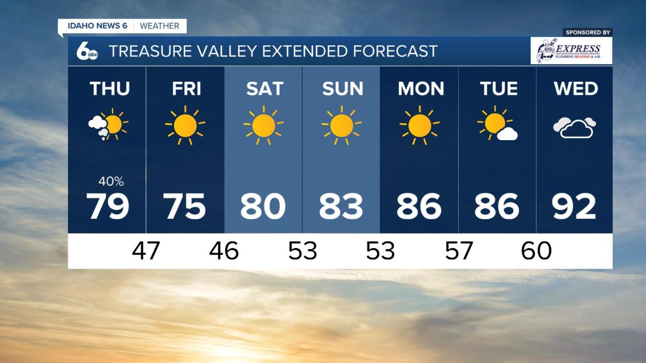
Conditions are set to become calmer in southern Idaho despite a chance of rain tomorrow morning in the Treasure Valley. By the evening the system will clear up leaving behind nice conditions for Friday and the weekend.