

Idaho is experiencing an active weather pattern this week with multiple storm systems bringing rain to valleys and snow to higher elevations, along with strong winds that prompted a Wind Advisory for parts of the region.
Light showers will continue tonight across southeast Oregon, with the Snake Plain potentially seeing some light precipitation. However, the main focus of rainfall will remain in Oregon, where up to 0.20 inches is possible, while southwest Idaho expects less than 0.10 inches.
The most significant weather arrives Wednesday as a stronger upper-level system moves across the Pacific Northwest. Strong gusty winds will be the primary concern, especially across southeast Oregon and higher terrain of southwest Idaho.
Daily Forecast
Tuesday Night: Mostly cloudy & mild, with a low around 50 degrees. Wind SE 5-10.
Wednesday: Mild with showers likely after midday with a high near 63 degrees. SE wind 10-18 mph with gusts to 25 mph. Chance of precipitation is 60%.
Wednesday Night: Showers likely with a low around 44 degrees. Wind SE 10-15. Chance of precipitation is 70%.
Thursday: Partly sunny with a 50% chance of showers before Noon with a high near 58 degrees. Light wind.
Thursday Night: Showers likely, mainly after 11 p.m. with a low around 44 degrees. Chance of precipitation is 70%.
Friday: Partly sunny with showers likely, mainly before 11 a.m. and a high near 56 degrees. Chance of precipitation is 70%.
Friday Night: Partly cloudy, with a low around 33 degrees.
Saturday: Mostly sunny, with a high near 53 degrees.
Saturday Night: Partly cloudy, with a low around 35 degrees.
Sunday: Mostly sunny & comfortable, with a high near 58 degrees.
Monday: Partly sunny, with a high near 59 degrees.
Tuesday: Mostly sunny, with a high near 58 degrees.

Mountain Snow Expected
Wednesday's system will primarily be an orographic event, with mountains seeing widespread precipitation develop by afternoon and continuing through the evening. Snow levels will start between 7,000 to 8,000 feet, lowering to 6,000 to 7,000 feet Thursday morning.
Snow accumulation will be limited to elevations above 6,500 feet, where 1 to 3 inches is expected with up to 6 inches across higher peaks. Precipitation shadowing will largely limit rainfall across the Treasure Valley until late Wednesday.
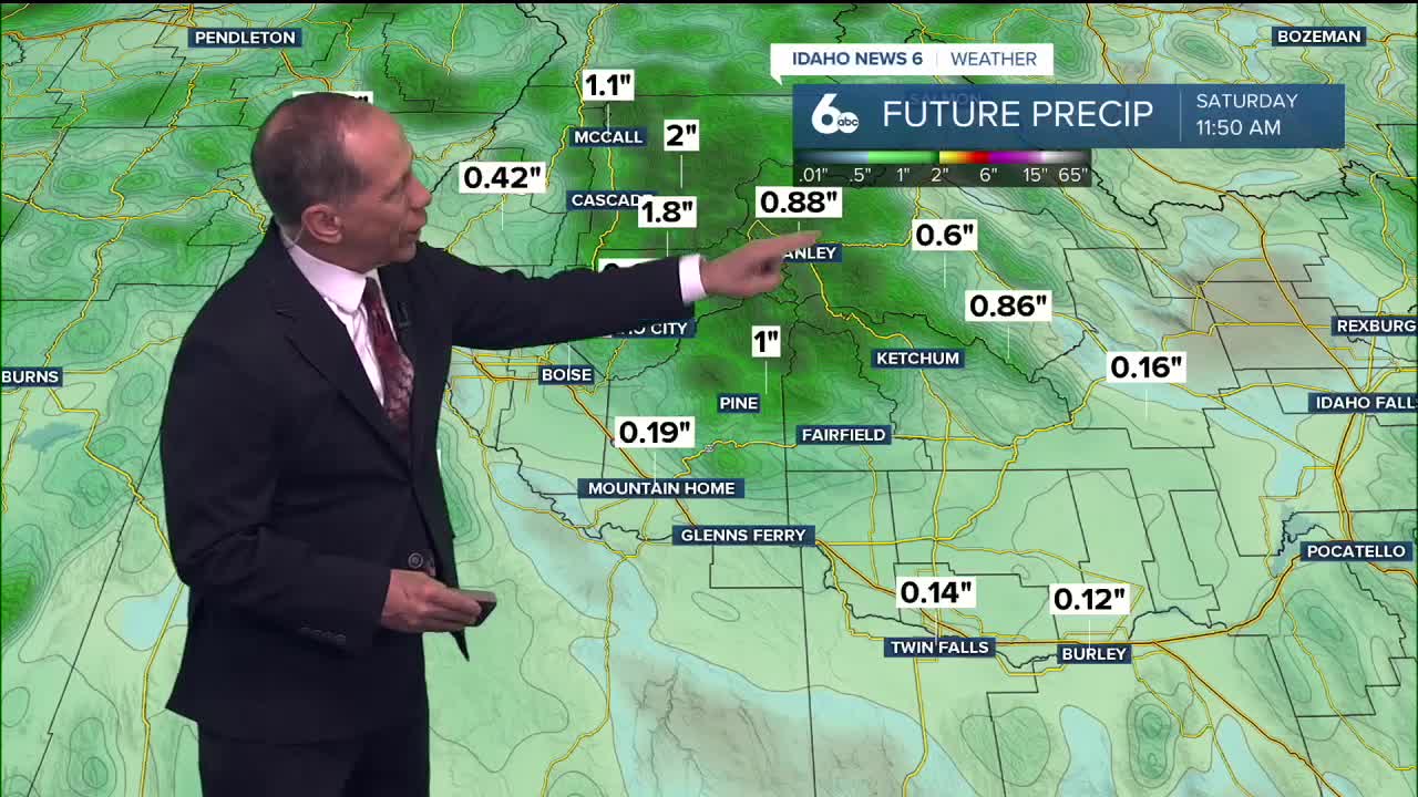
Mountain areas will see the most significant precipitation, with rainfall totals ranging from 0.25 to 0.50 inches in mountain valleys and up to 0.75 inches across higher peaks Wednesday.
Weekend Mountain Snow
Friday brings another round of mountain precipitation as a weak trough moves over the region. Snow levels will drop to 5,000 to 6,000 feet, bringing snow to populated mountain areas Friday evening. McCall could see a dusting of snow, while Banner Summit may receive up to 2 inches.

Extended Outlook
High pressure builds into the region late Saturday, bringing mostly sunny skies and temperatures climbing 5 to 10 degrees above normal Monday and Tuesday. The pleasant weather pattern will continue through Tuesday with mostly sunny conditions expected.

Stay connected right here for updates to my weekend forecast!