


A trough of low pressure crossed the area on Monday bringing scattered showers & some thunderstorms. Behind that trough we are experiencing a spectacular day with comfortably warm temperatures, bright sunshine, and a breeze.
You can expect this sunshine to continue Wednesday with temperatures warming a bit into the upper 70s. Wind will be lighter.

The hottest day of the week will be Thursday with our highs reaching the mid-80s along with lots of sunshine and not that much wind.

Another cooler push of air will affect northern Idaho Friday night bringing a drop in temperature and breezy conditions again for our area on Friday and Saturday. Right now I am expecting temperatures to cool to the low to mid-70s for both Saturday and Sunday with lots of sunshine continuing.

There is a good chance of a cooler trough of low pressure to drop our temperatures back to near or below normal by mid next week.
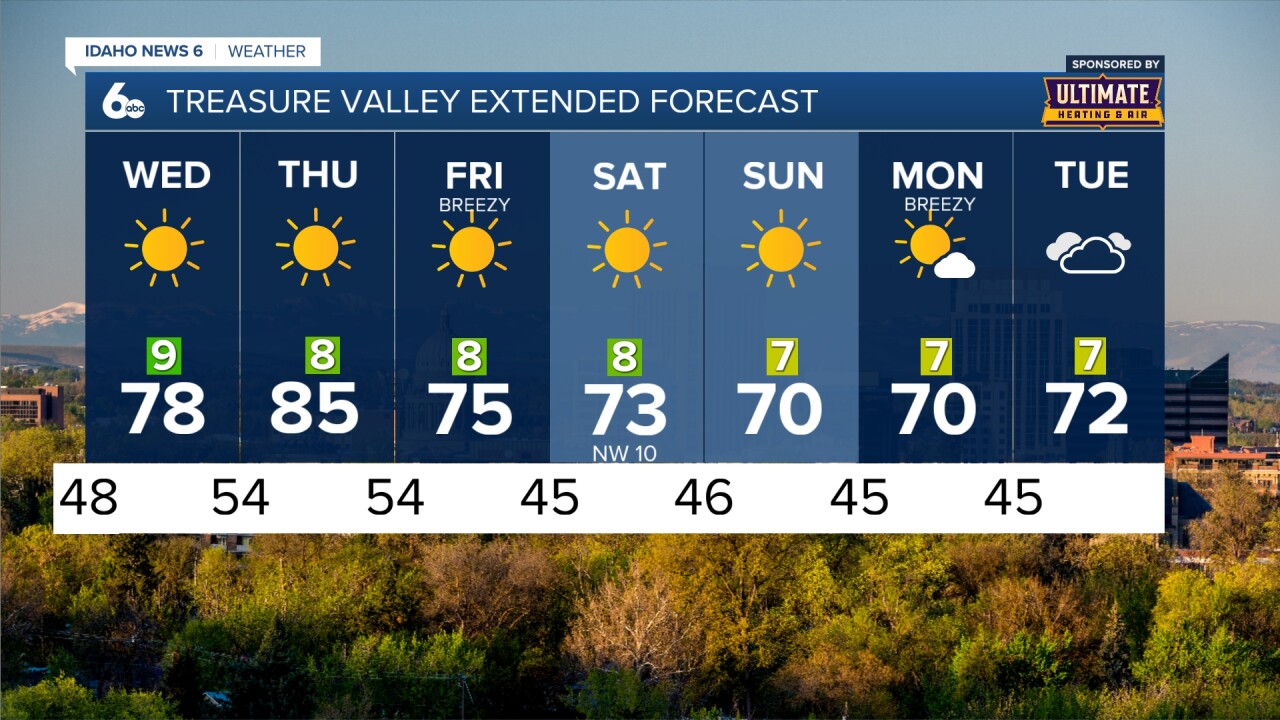
Computer models are still showing some uncertainty into the weekend so stay connected to my forecasts for updates on what we can expect this weekend!