

On Nov. 13, the National Oceanic and Atmospheric Administration (NOAA) issued a La Niña Advisory. That advisory states there is a 51% chance of La Niña conditions lasting until February of 2026.
Starting in September, La Niña conditions emerged out of "neutral" conditions that lasted through the summer months.
When it comes to snowfall outlooks for the 2025/2026 Winter Season, the presence of La Niña may foreshadow some promising precipitation & temperature trends for southern and central Idaho, which is welcome news for skiers, snowboarders, and water managers alike.
But what exactly is La Niña, and what does it mean for winters in Idaho?
What is La Niña?
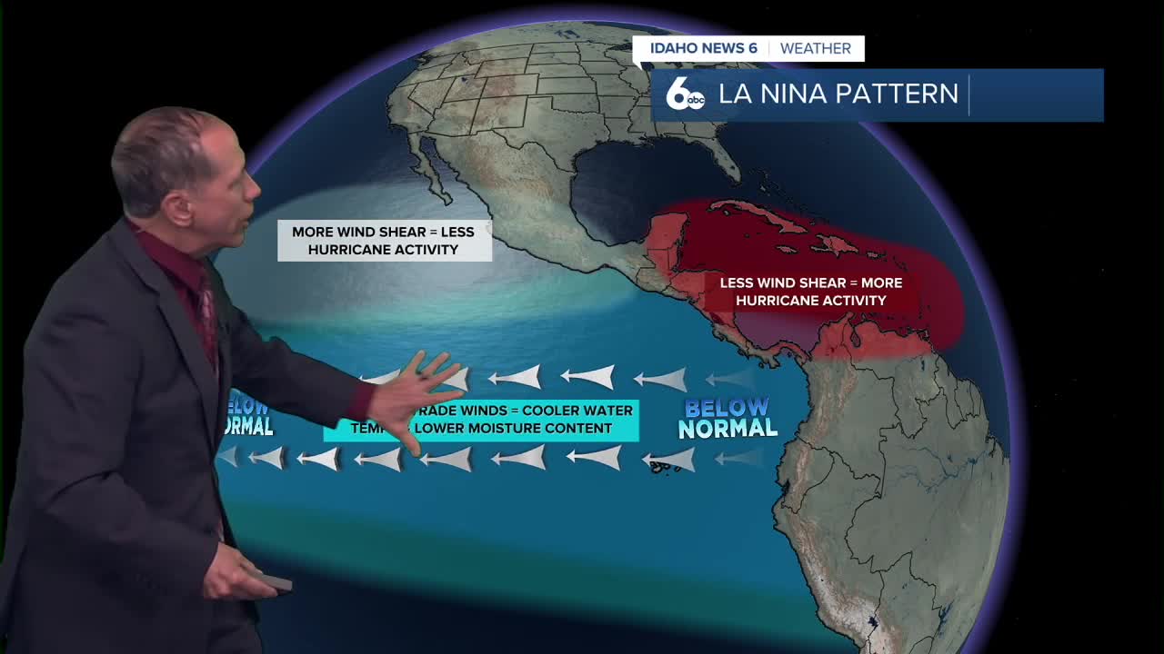
According to NOAA, "La Niña is characterized by unusually cold ocean temperatures in the Equatorial Pacific, compared to El Niño, which is characterized by unusually warm ocean temperatures in the Equatorial Pacific."
Periodically, NOAA measures surface ocean temperatures using a combination of infrared satellite technology, buoys, and ships to get accurate readings throughout the Pacific Ocean, specifically around the equator.
During El Niño years, temperatures are at least .9°F above the average for the equatorial Pacific Ocean. In addition to the average temp increase, the "warm pool" that exists in the waters near Indonesia often extends all the way to North America.
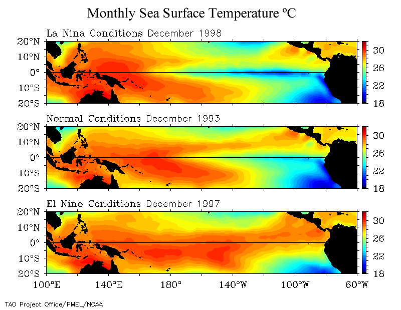
Conversely, during La Niña years, temperatures are .7°F below the average temperature for the equatorial Pacific Ocean as the "cool pool" in the waters off the coast of North America extends west towards the middle of the equatorial Pacific Ocean.
Furthermore, in a La Niña year, the presence of cold water tends to push the jet stream further north, which can bring colder conditions and potent storm systems to the northern half of the hemisphere.
La Niña-like patterns favor Idaho
Although a formal, strong La Niña may not officially develop this winter, some meteorologists acknowledge that there could be times during the season when the weather patterns act similarly to those of a strong La Niña year.
This observation is particularly relevant for Idaho, as even weak or transient La Niña-like conditions have a well-documented historical impact on our region's winter weather patterns, which include a trend towards colder-than-average temperatures and above-average precipitation.
Historical benefits of a weak La Niña
Even subtle La Niña influences tend to create favorable conditions for Idaho's snowpack.
Slight shifts towards colder and wetter climate patterns, no matter how small, offer significantly better chances at accumulating substantial snowpacks across the mountains of the Gem State.

This is especially true for northern and central Idaho mountains, including the Salmon, Boise, and Payette River basins, with southern Idaho basins also typically benefiting.
What's more, the prevailing colder trend can often lead to an earlier onset of significant snowfall in autumn and early winter, giving the snowpack more time to build.
What this means for southern and central Idaho
Combining forecasts from meteorologists with climatological understanding of La Niña-like patterns, southern and central Idaho can anticipate several positive developments.
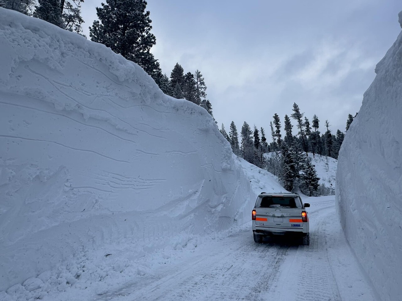
For starters, there's a strong likelihood of a snowier-than-normal winter, with particular emphasis on the central mountains that are vital for the region's water supply.
And while parts of the West may see warmth, including places like California, Arizona, and New Mexico, Idaho's high elevations are well-positioned to receive adequate cold temperatures for precipitation to fall as snow rather than rain.
The NOAA seasonal climate forecast also hints at possible Arctic air masses across North America in late January and early February, which could bring notably frigid periods that help preserve and build the snowpack in the southern and central mountains.
Benefits for recreation and water supply
This outlook brings encouraging news for multiple sectors across Idaho, including skiers, snowboarders, water managers, and the agricultural industry.
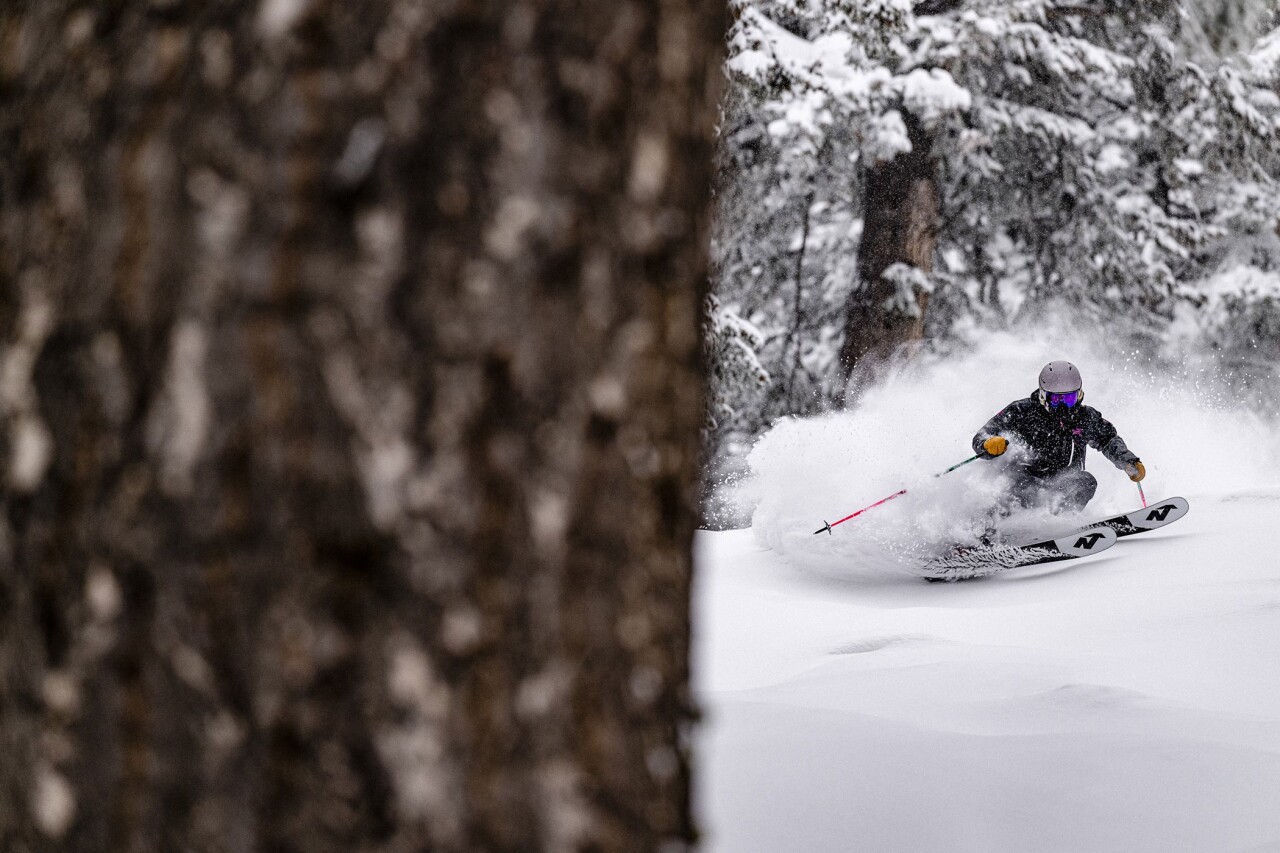
Ski resorts can anticipate potentially strong early-season conditions and sustained snow coverage throughout the winter.

Water managers may see improved reservoir levels and spring runoff that could help address ongoing drought concerns.
Outdoor recreation enthusiasts can look forward to extended seasons for snowmobiling, cross-country skiing, and other winter activities.
The combination of early-season momentum, sustained cold, and La Niña-like influences creates an optimistic scenario for Idaho's 2025-26 winter snowpack - welcome news after recent years of variable snow conditions.
Early-season momentum builds in December
In December, some storms will reach the Northwest and northern Rockies, helping to build snowpack in the Cascades, Rockies and parts of the northern Sierra, according to some meteorological forecasts.


This is crucial information, indicating a good and potentially early start to snow accumulation in central and southern Idaho mountains. December storms could provide the foundation for what may become a robust snowpack season.
Late winter resilience expected
While a broader pattern of warm Pacific waters is expected to bring dryness to California and the Southwest, Idaho is specifically highlighted as an exception to this warmth in the Rockies during late winter.


This suggests our region might avoid the worst of the mid-to-late winter drying trend expected further south, potentially sustaining snowpack longer into the spring months when water managers need it most.
While La Niña makes no promises of an epic winter, the climate trend favors above-average precipitation with below-average temperatures for Idaho through at least February.