This weekend, when it rains it pours.
An atmospheric river brings intense precipitation to the region this weekend and could result in rising water levels for streams and creeks. It could also create conditions for flooding in urban areas.

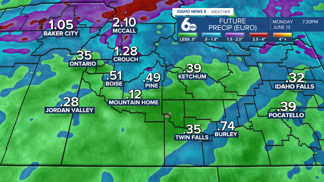
As of Friday mid-day, the system is impacting northern Idaho, dropping temperatures and bringing precipitation. Throughout the weekend, this system will move south bringing rounds of heavy precipitation and thunderstorms to the rest of the state.
Right now, a National Weather Service Flood Watch is in effect for areas of northern Idaho and western Montana. These are the areas most likely to see heavy downfall of rain throughout the weekend.
Areas in central Idaho and southern Idaho are also at risk to these conditions, especially on Saturday and Sunday when rounds of precipitation from this Pacific low-pressure storm move southeast through the state.
Risk Awareness:
If you are out in the mountains recreating when a heavy rainfall occurs, avoid any streams or creeks, move to higher ground, and be cautious of any mudslides that could result around water. Do not cross any swelling areas of water.
If you are in an urban area, do not wade or drive into any flooded area because they are often deeper than it appears and a fast-moving undercurrent could sweep you under.

When any moisture-heavy system hits southern Idaho, areas with poor drainage can fill up quickly with water. That’s a concern for smaller creeks and streams in low-lying areas. Runoff from the rain combines with the already running snowmelt and causes sharp rises of water - posing a threat due to the rapid change in conditions.
Canals close to residential areas could also see quickly rising waters with sudden downpours. Irrigation managers monitor these situations to control canal water, but stormwater can still spill over banks and run into roadways and other urban areas.
"There's been years where we shut off the canal and a canal was going down and we got enough rain where this one was overtopping in lots of spots downstream. So, it can happen," Nampa & Meridian Irrigation District Water Superintendent Greg Curtis said of flash flooding.
Curtis said the irrigation districts in Idaho watch changing weather conditions to prevent these conditions.
“That is something we watch very closely is when we have flash flood alerts or severe thunderstorms. We're watching it to see where it's gonna end up," Curtis said.
Future precipitation models show accumulations quickly rise from from Saturday to Monday in central and southern Idaho.