

Good morning, Idaho! If you ski, snowboard, or love the snow, you're gonna love the forecast ahead.
An active weather pattern continues across the region as several disturbances move through, bringing multiple cold fronts, periods of mountain snow, and breezy conditions through midweek. The Winter Weather Advisory has now been extended to include Idaho City and Pine and will remain in effect through 11 pm Wednesday.

The first cold front arrives this afternoon, bringing rain to the valleys and snow to the mountains. Snow levels will sit around 4,000–5,000 feet, allowing snow to fall in mountain valleys. By Wednesday night, the Long Valley of Idaho will see between 5 and 10 inches of snow, with 10 to 20 inches above 6,000 feet. Mountain valleys in the Boise Mountain zone will receive 3 to 7 inches, with 12 to 18 inches above 6,000 feet.
A stronger push of colder air moves in Wednesday night into Thursday morning as the primary storm system passes through. Snow levels will drop to 3,000–4,000 feet, allowing another round of mountain snow. This system will be drier overall, so totals are lighter, with 1 to 3 inches possible in mountain valleys. Snow levels may briefly fall to valley floors early Thursday, bringing a slight chance for snow showers in the Snake River Valley. Any accumulation there should be minimal due to limited moisture.
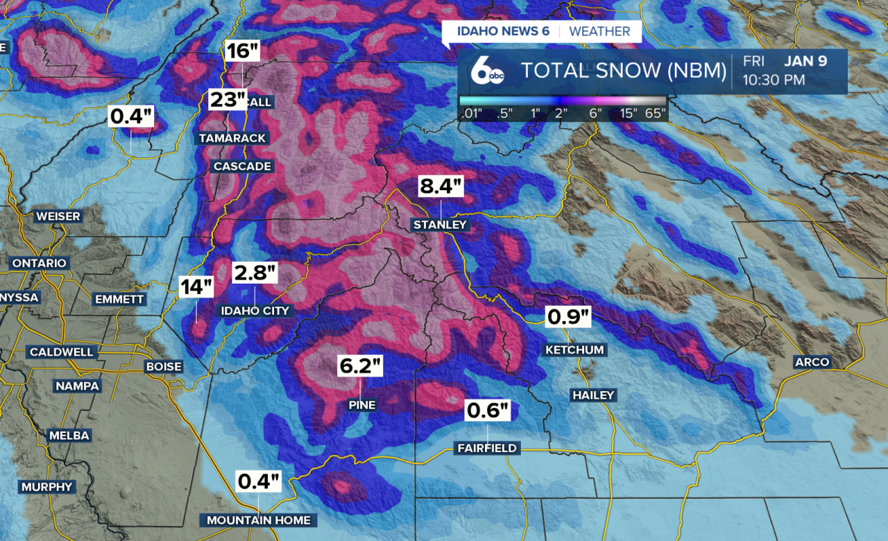
The best chance for measurable valley snow along the Snake River Plain will be near Twin Falls and along the Idaho–Nevada border, where 0.5"-2" of snow is possible by Thursday afternoon.
A few leftover snow showers may linger in the central mountains early Friday, but conditions turn dry by midday as a strong ridge of high pressure builds over the Pacific Northwest. This ridge is expected to set up an inversion pattern, keeping valley temperatures cooler while the mountains gradually warm. Valley highs will remain in the lower 40s, while mountain temperatures trend warmer beginning Saturday.
Dry weather and sunshine return this week and look to continue into next week.

