

An active weather system is moving across eastern Oregon and southwest Idaho, bringing gusty winds, periods of rain, and mountain snow through the weekend and into next week. Get out a good raincoat!
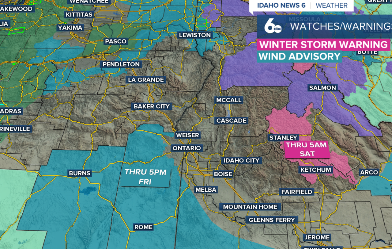
This morning, a slow-moving cold front stretches across Oregon while a long plume of Pacific moisture feeds into the system. Ahead of the front, much of southeast Oregon and southwest Idaho remain on the warmer side of the storm. That setup is producing strong winds, especially across southern Harney and Malheur Counties and areas south of the Snake Basin in Idaho. A Wind Advisory is in effect through early this evening, and temperatures today will run 15 to 20 degrees warmer than average.
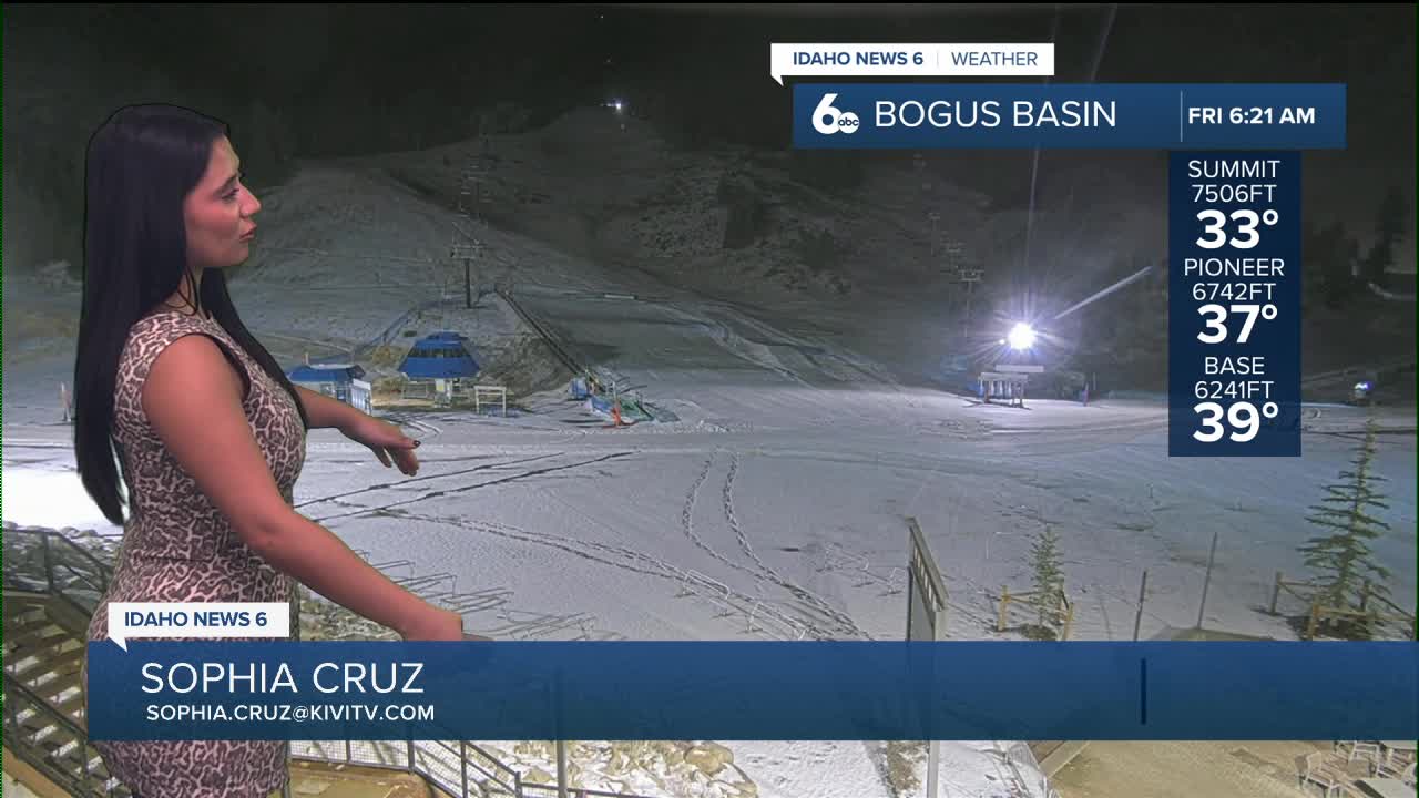
Rain will be most widespread across the Boise Mountains and west-central Idaho through the afternoon. Snow will be limited to the highest elevations, mainly above 7,000 feet, until colder air arrives later today. As the cold front pushes through, snow levels will quickly drop toward valley floors, but precipitation will be ending at the same time—keeping accumulations light or nonexistent in lower elevations. A brief rain-snow mix is possible as the front passes, along with a slight chance for a thunderstorm.
Lingering snow showers may continue early Saturday across parts of southern Owyhee County and the southern Magic Valley, while most of the region dries out during the day. Another system moves in late Saturday night, bringing widespread precipitation early Sunday. Regardless, if you have outdoor plans, Saturday afternoon will be the best window to get them done, as it looks to be the driest part of the weekend.
By Sunday morning, snow levels will vary across the region. Lower snow levels near 3,500 feet are expected in parts of Baker County and near the Weiser Basin, while areas farther south and east—including much of the Snake Basin—will stay warmer with snow levels closer to 7,000 to 8,000 feet. Some locations may start as snow before changing over to rain. The mountains once again stand the best chance for moderate snowfall above 7,000 feet.

Looking ahead to next week, a mild but active pattern continues. An atmospheric river remains aimed at the region early in the week, bringing several rounds of mountain precipitation. From Monday through Wednesday, the central Idaho mountains could receive 1 to 2 inches of liquid, translating to 10 to 20 inches of snow at higher elevations. Snow levels will be lower to the northwest and higher across the Snake Basin.


Stay up to date right here: @SophiaCruzWX