

Update (10:41 a.m.)
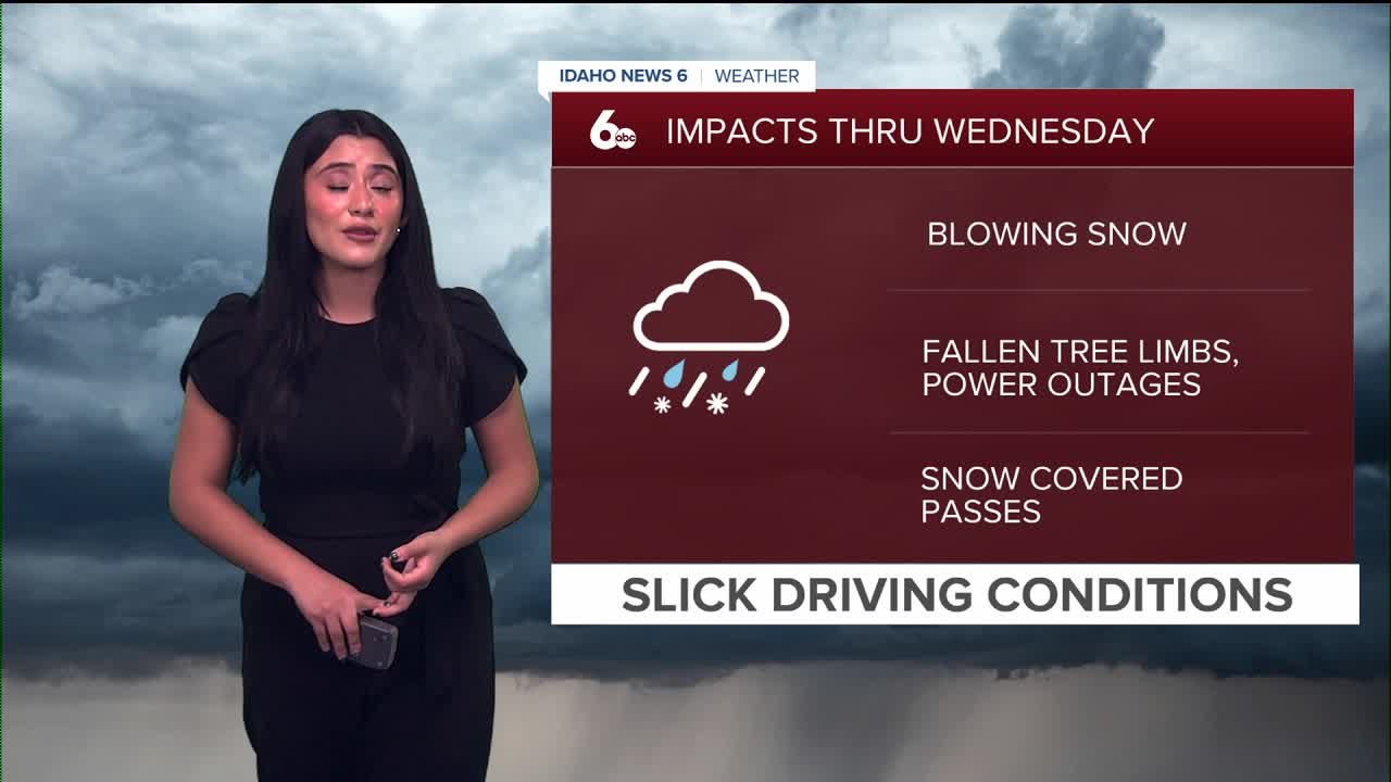
A strong cold front swept through the region early this morning, producing damaging wind gusts up to 63 mph. The powerful system has led to scattered power outages, with reports from Valley County, Idaho City, and parts of the Upper Treasure Valley.
Check current outages: Idaho Power Outage Map
As the system moved through, gusty winds developed alongside periods of rain in the valleys and a rain-snow mix in the mountains. Snow levels remained very high early on—around 7,000 to 8,000 feet—allowing Sun Valley to pick up about 6 inches of snow, while other resorts such as Brundage and Tamarack saw mostly rain.

Winds continue to be the primary concern as the front tracks east through Idaho. A High Wind Warning will remain in effect for the Magic Valley, with a Wind Advisory for the Treasure Valley and a Winter Storm Watch in place for the east-central and west-central mountains. Travel may be difficult at times, especially in mountain areas where blowing snow will reduce visibility.
RELATED | Two children critically injured after high winds downed trees in Twin Falls
Another round of precipitation arrives Thursday morning. Snow will fall early before changing to rain in most valleys as warmer air moves in. Higher elevations—especially above 6,500 feet—could pick up 6 to 10 inches of snow by Friday morning, while lower elevations, including the Treasure Valley, are more likely to see rain or a rain-snow mix with little to no accumulation.

Friday stays unsettled in the mountains with gusty winds and additional snow at higher elevations, while valley locations remain mostly dry. Snow levels gradually drop late Friday, allowing colder air to settle into mountain valleys.
Over the weekend, temperatures cool slightly, and conditions briefly dry out Saturday before another chance of rain and mountain snow returns Sunday into early next week.
Snow levels may fluctuate during this period, especially in higher terrain, before a stronger system arrives midweek and brings more widespread changes.
Stay up to date right here @SophiaCruzWX
