


Good morning, everyone! It's a new week, make it a great one.
After a hot weekend across southwest Idaho, today brings a brief cool down in temperatures as a dry cold front moves through the region this morning. Even with the slight cooldown, temperatures will still remain above average for this time of year. Breezy northwest winds are expected to develop this afternoon across the Snake Plain, making it feel a bit more like the weekend, when it was intensely hot. Skies will stay mostly sunny and dry as high pressure quickly rebuilds over the western United States.

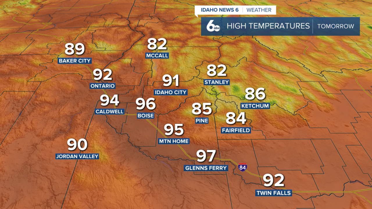
The bigger weather story arrives Tuesday as a strong ridge of high pressure strengthens. This setup will allow temperatures to rapidly climb, bringing some of the hottest weather of the year so far to the Treasure Valley and surrounding lower elevations. Afternoon highs are expected to surge into the low to mid 90s, while some of the warmest valley locations could approach the upper 90s. Several cities, including Boise, may come close to daily record highs. The combination of strong sunshine, dry air, and light winds will create ideal conditions for rapid warming through the afternoon and evening.
Tuesday records
- Boise: 94° 1993
- Baker City: 88° 1993
- McCall: 84° 1993
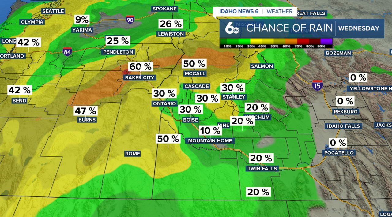
That summer-like heat won't last long. By Wednesday, a Pacific upper-level low will begin pushing inland, breaking down the ridge and bringing a pattern change to the Northwest. Clouds will gradually increase through Tuesday, scattered showers and thunderstorms will develop on Wednesday afternoon and evening. Current guidance shows a 40-60% chance of showers across much of southwest Idaho and southeast Oregon, along with a 20-30% chance for thunderstorms. Some storms could produce gusty winds, brief heavy rain, and small hail.
The arrival timing and exact track of the system still carries some uncertainty, but cooler weather will begin settling into the region starting Wednesday. Temperatures will continue trending downward into Thursday and Friday. Forecast models are still struggling with exactly where the upper trough will track later this week. Some model solutions push the system farther south across northern Nevada into southwest Idaho, which would lead to significantly cooler and wetter conditions locally. If that scenario develops, portions of southeast Oregon and southwest Idaho could pick up between a quarter inch and three quarters of an inch of rainfall.
Looking ahead to the weekend and early next week, temperatures are expected to fall to around 5 to 10 degrees below average. Snow levels in the mountains could also lower to around 5,000 to 6,500 feet, bringing a much different feel compared to the near-record heat expected Tuesday. Most of the lingering shower activity by Sunday and Monday should remain north of a line from Baker City, Oregon to McCall, Idaho.
Extended Forecast
