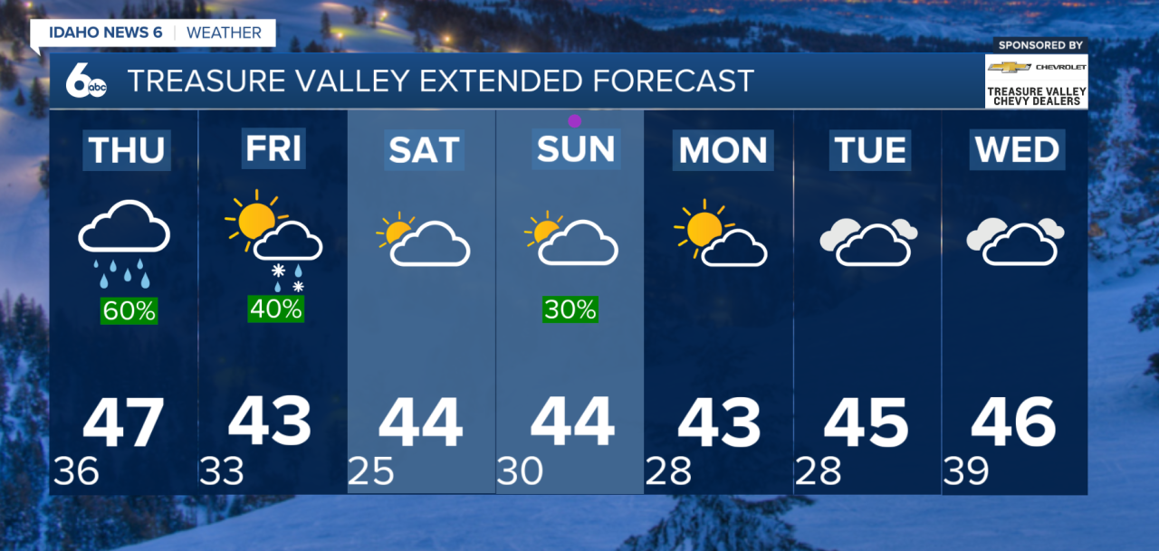
Happy Hump Day, Idaho! Another round of active weather is moving into southwest Idaho and southeast Oregon, bringing valley rain, mountain snow, gusty winds and the possibility of snow reaching valley floors by Friday morning.
Today: Snowy Roads in Oregon, Rain Arrives in Idaho
A Pacific storm system will bring widespread precipitation to the region Wednesday.
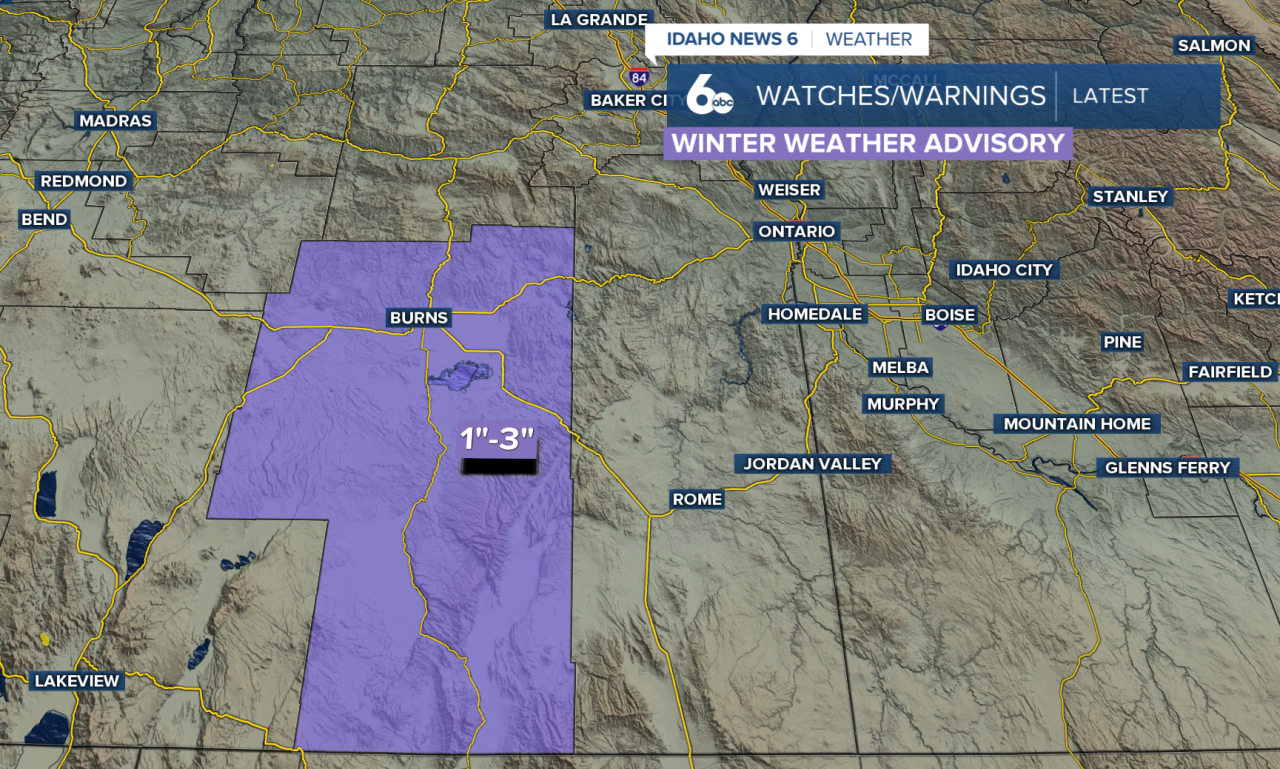
Southeast Oregon will see the first impacts, with snow developing early Wednesday morning. Lower elevations could pick up as much as 2 inches, while mountain passes and higher terrain could receive 2–5 inches.
A Winter Weather Advisory is in effect for northern Harney County until 4 p.m. Wednesday, with hazardous travel possible along portions of Highways 20 and 26 north and west of Vale.
Precipitation will spread into southwest Idaho later Wednesday, bringing rain to the valleys and snow to the mountains. Winds will also increase, with gusts of 30–40 mph possible in exposed areas and higher elevations.
Thursday: Rain Continues, Snow Levels Rise
Periods of rain and mountain snow will continue Thursday as the storm moves across the region.
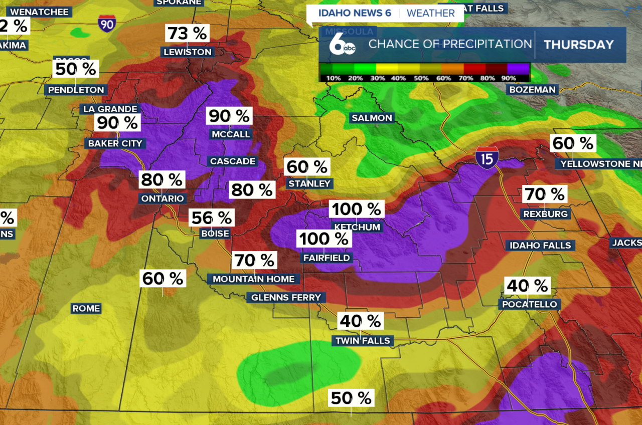
Slightly warmer air will push snow levels up to 4,000–5,500 feet across much of southwest Idaho. That means most lower valleys, including the Treasure Valley and Snake River Plain, will primarily see rain throughout the day.
Friday: Snow Could Reach Valley Floors
Colder air will move into the region late Thursday night into Friday, dropping snow levels back to valley floors.
A rain-snow mix or light snow accumulation will be possible in lower valleys Friday morning into early afternoon. A light dusting is possible across valley floors.
By Friday evening, higher elevations of eastern Oregon and west-central Idaho could receive 3–8 inches of snowfall, with up to 10 inches possible on the highest peaks.
Precipitation should gradually taper off Friday afternoon and evening.
Weekend and Beyond: Cool and Unsettled
Saturday will bring a brief break from the wet weather before another Pacific storm approaches Sunday.
Rain and snow chances return Sunday, with precipitation chances below 30% in the valleys and up to 50% in the mountains.
Another short break is expected Monday into early Tuesday before the next system potentially brings widespread precipitation Wednesday.
Temperatures will remain near or slightly below normal across southwest Idaho, while southeast Oregon could run 5–10 degrees below average.