A wet and windy Friday is underway across southwest Idaho and eastern Oregon as a cold front pushes through the region this morning. Widespread rain showers will continue through the morning before gradually tapering off from west to east this afternoon.
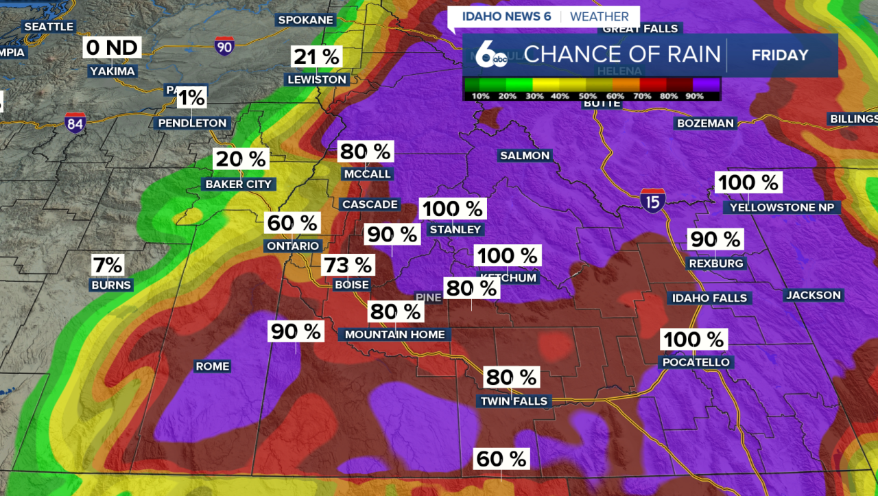
There's a slight chance of thunderstorms early this morning, with brief heavy rainfall being the main concern. Drive with caution, and give yourself extra time for your morning commute.
A Flash Flood Watch also remains in effect this morning for recent burn scars in the Boise Mountains. Surrounding neighboors be prapred for debris flow, or impacts to highway 21 from flash flooding.
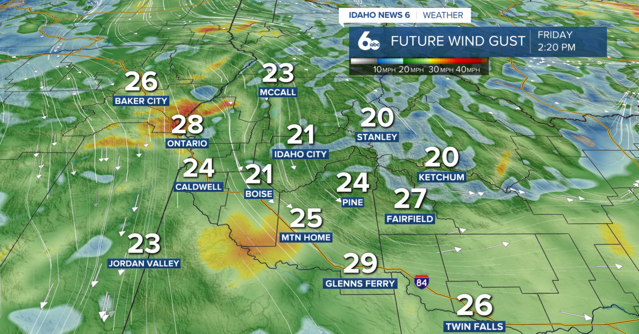
Winds will be another big weather story today. Widespread gusts of 30–40 mph are expected this morning, with locally stronger gusts of 45–55 mph possible in portions of Baker and Malheur counties, particularly along I-84 through Baker Valley. Winds will gradually weaken this afternoon, although gusts of 20–35 mph will remain possible.
Temperatures will also take a noticeable tumble, with afternoon highs generally reaching the 50s across lower elevations. Snow levels will drop behind the cold front, but only minor accumulations are expected across the highest mountain peaks.
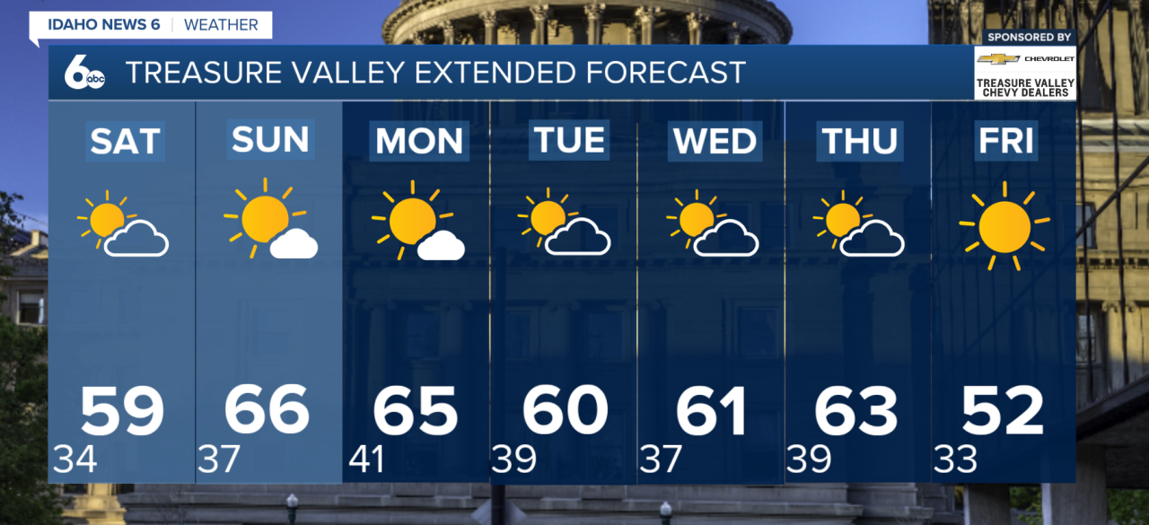
A Cool and Dry Weekend
After Friday's storm system moves out, high pressure will bring drier conditions and clearing skies for the weekend.
Saturday and Sunday will feature cool fall temperatures, with the potential for frost in the morning. Heads up, gardeners: be prepared to cover any sensitive vegetation. While lingering breezes may limit frost development Saturday morning, calmer winds Sunday morning could increase the frost risk across lower elevations.
Next Week
The dry weather won't last long. Another Pacific storm system is expected to approach the region late Monday, bringing increasing chances for rain and mountain snow.
Precipitation chances will increase Monday afternoon and peak overnight into Tuesday. Valley County has a 55–65% chance of precipitation, while other areas north of the Snake River Plain have a 30–50% chance.
Snow levels could fall to around 6,500 feet, with accumulating snow possible across higher mountain elevations.
Looking ahead, a cool and unsettled weather pattern is expected to continue through much of next week.