

Today through Friday
High pressure will continue to build over the region through Friday, keeping skies mostly clear and temperatures gradually warming. Daytime highs are expected to climb several degrees above normal by Friday. Clouds will begin to increase on Friday afternoon and evening as a cold front from the Gulf of Alaska approaches the Pacific Northwest.
Atmospheric River Event
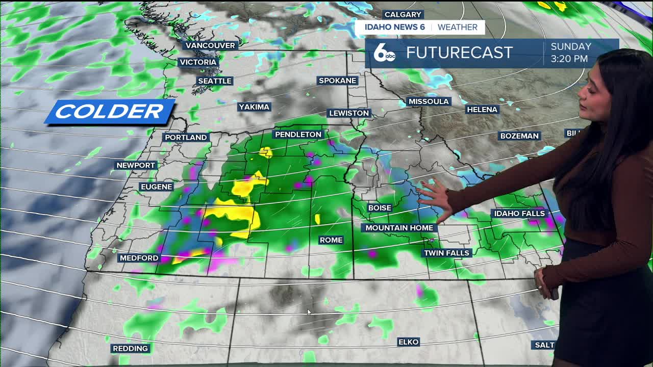
An atmospheric river event will bring a plume of moisture across the Pacific Northwest. Do not wash the car! Rain will first develop across eastern Oregon Friday evening, spreading into southwest Idaho around midnight. By Saturday morning, most of the area, except for Twin Falls County, will be seeing steady rainfall. The cold front will push east across the region on Saturday, bringing noticeably cooler air and breezy conditions. Snow levels will remain generally above 6000 feet during this period, allowing for rain in lower valleys and accumulating snow in higher elevations. The West Central and Boise Mountains can expect between 1 and 4 inches of snow, with McCall possibly picking up 3" by early Sunday.

Higher elevations around 7,000 feet could see snowfall accumulations between 8 and 12 inches through Sunday, leading to winter driving conditions and impacts over mountain passes.
Behind the front, colder and showery weather will linger through Sunday as the upper trough slowly moves east. Snow levels will lower to near 4000 feet in northern areas and around 5000 feet farther south. Rain and snow showers will continue through much of Sunday before tapering overnight.
Next week
The beginning of next week is expected to remain cool and unsettled under a moist westerly flow. Scattered showers and areas of morning fog are possible on Monday and Tuesday, with gradual improvement expected by midweek.
Stay up to date right here https://www.instagram.com/sophiacruzwx/
Today
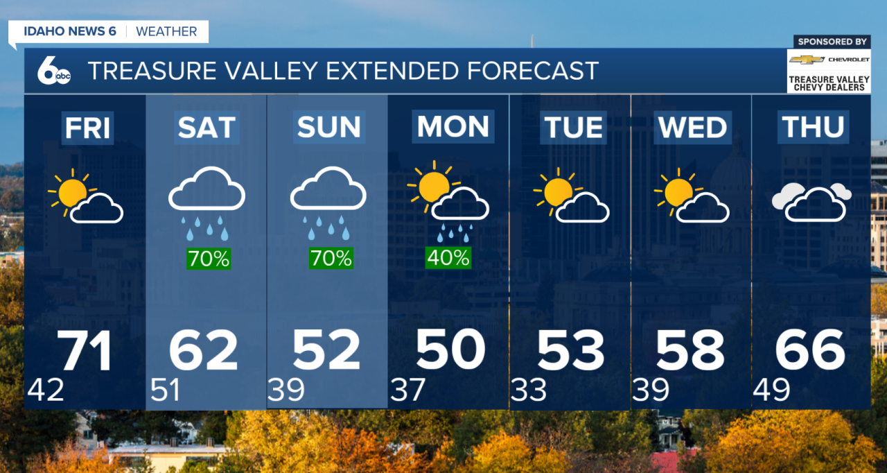
Sunny, with a high near 64. Light west northwest wind increasing to 5 to 10 mph in the morning.
Friday
Mostly sunny, with a high near 70. East southeast wind 8 to 15 mph, with gusts as high as 24 mph.
Friday Night
Mostly cloudy, with a low around 48. Southeast wind 9 to 13 mph, with gusts as high as 25 mph.
Saturday
Showers likely, mainly after noon. Cloudy, with a high near 62. Southeast wind 10 to 15 mph. Chance of precipitation is 60%.
Saturday Night
Showers likely and possibly a thunderstorm. Mostly cloudy, with a low around 38. Chance of precipitation is 60%.
Sunday
A 50% chance of showers. Partly sunny, with a high near 52.
Sunday Night
A 50% chance of showers. Mostly cloudy, with a low around 35.
Monday
A 50% chance of showers. Partly sunny, with a high near 51.
Monday Night
A 20% chance of showers before midnight. Partly cloudy, with a low around 32.
Tuesday
Mostly sunny, with a high near 53.
Tuesday Night
Partly cloudy, with a low around 35.
Wednesday
Mostly sunny, with a high near 59.