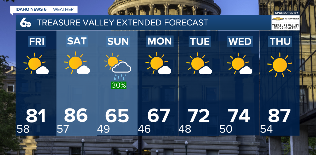
Mostly sunny skies and warmer temperatures today before a series of cold fronts bring big changes heading into the weekend.
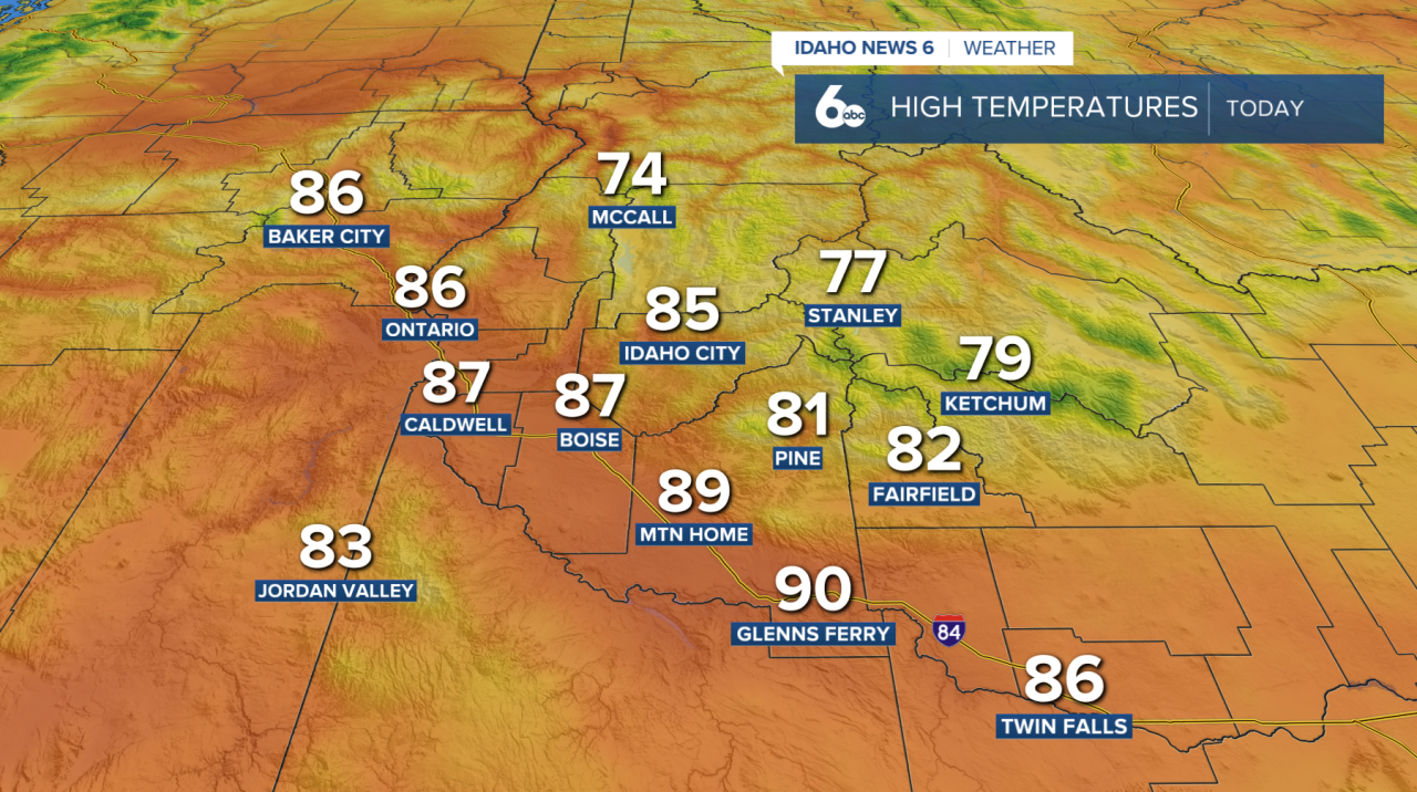
Today will be the warmest day of the workweek, with mostly sunny skies across the region. Clouds will increase in some areas later in the day as the first cold front approaches.
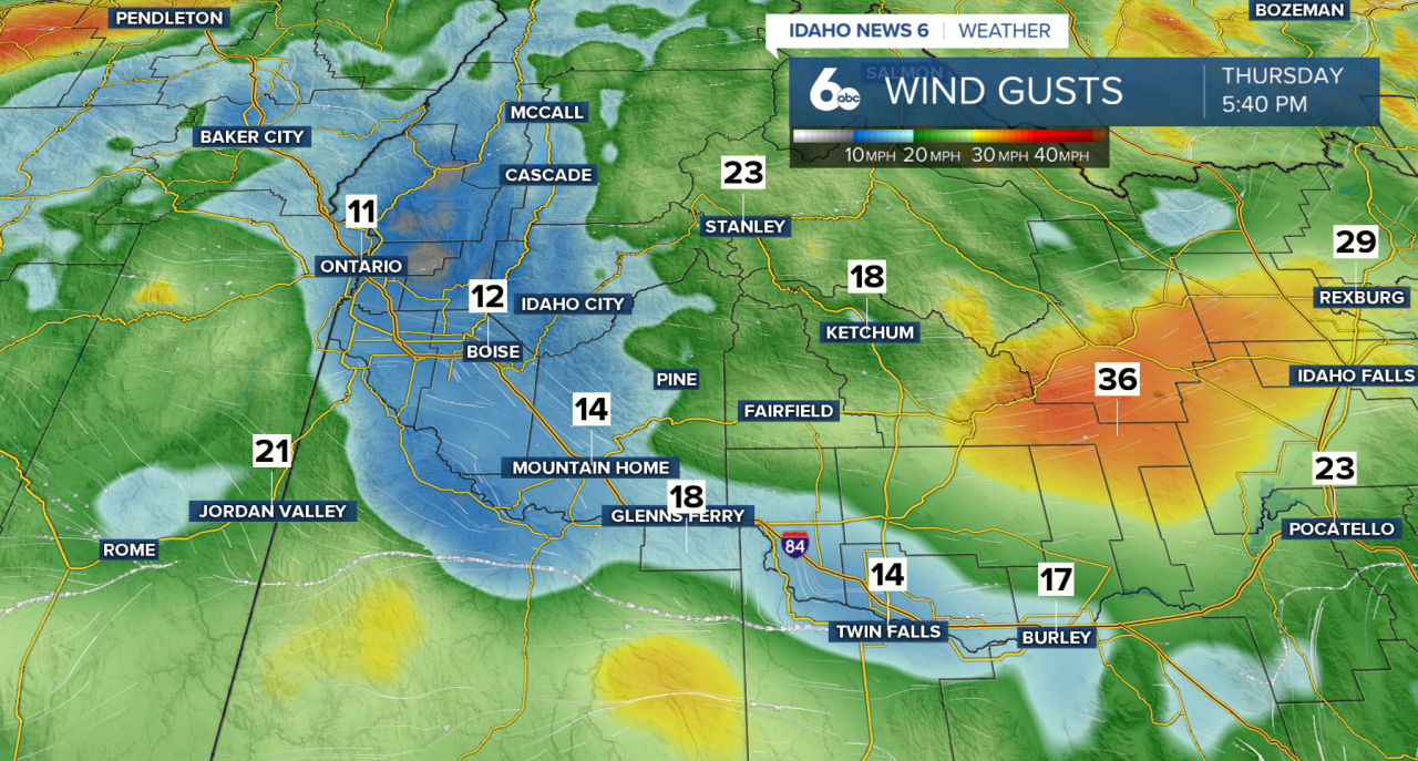
Winds will also pick up, especially across southern areas, where gusty west winds are expected late this afternoon and evening.
Behind the front, Friday will turn breezy and slightly cooler, with temperatures dropping about 5 to 10 degrees in some areas. The cooldown will be brief, though, as temperatures climb again Saturday ahead of a much stronger system.
Saturday afternoon starts warmer, but conditions will become increasingly windy as a stronger cold front approaches. If you're heading to the Boise State game with kickoff at 4 PM, expect winds to pick up through the afternoon. The latest forecast has slowed the arrival of the front, which could keep much of the afternoon warmer and drier. However, the strongest winds are expected later Saturday into Saturday evening, with gusts of 40 to 50 mph possible across southern areas.
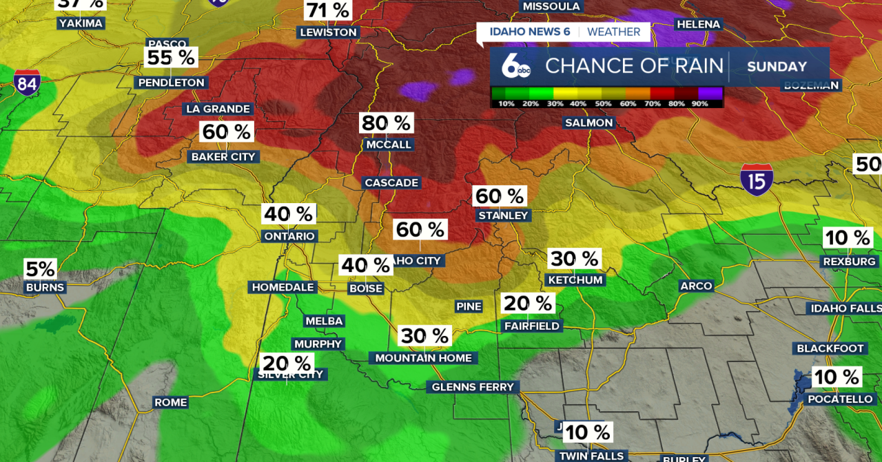
Widespread showers and scattered thunderstorms will develop across northern portions of the region Saturday night, with locally heavy rainfall possible. Southwest Idaho will see the strongest winds Saturday evening, with those winds shifting into south-central Idaho later Saturday night.
Sunday will be much cooler and windy. Showers are expected to continue throughout the day across northern areas, while southern areas gradually dry out and clear. Sunday night will turn colder, with some fog possible in northern valleys into Monday morning.
By Monday, sunshine returns and temperatures begin warming. The extended forecast looks mainly dry, with a warming trend continuing through much of next week.